Blog Article
June 14, 2026 Severe Weather Recap: Tornadoes & Flooding
A complete meteorological recap of the June 14, 2026 severe weather event, including Rust Belt tornadoes, Ozark flash flooding, and a 90 mph Texas wind gust.
Y'all, yesterday was a heavy one. We saw a single storm complex produce simultaneous life-threatening flash flooding in the Ozarks and tornado rescue operations in the Rust Belt. That is a rare and difficult combination for forecasters and first responders alike.
Here is a look back at how June 14 unfolded, what the data confirmed, and what we can learn from it.
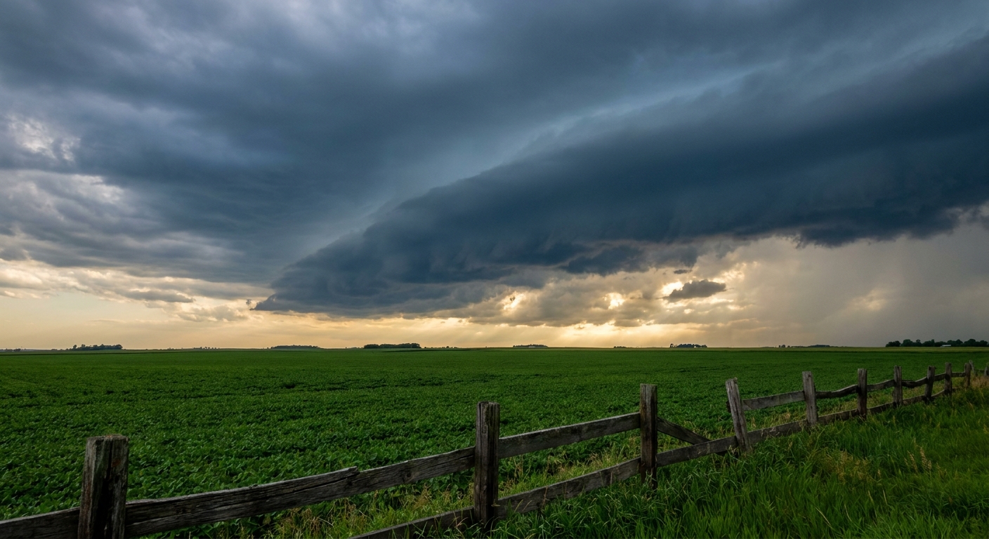
How the Day Evolved
The event started early in the Southern Plains with a significant wind threat. An automated station in Amarillo, Texas, measured a rare 90 mph wind gust during the initial phase of the storm.
As the morning progressed, the system moved into southwest Missouri and southeast Kansas. The threat transitioned from wind to a critical hydrological event. Springfield, Missouri, experienced life-threatening flash flooding with rainfall rates hitting 4 inches per hour. Tragically, this led to a confirmed fatal water rescue involving a submerged vehicle on Highway CC in Greene County.
By late afternoon, the atmosphere over the Great Lakes and Mid-Atlantic destabilized. The system underwent a major intensification and evolved into a tornadic squall line.
We saw a confirmed tornado in Ashtabula, Ohio, which resulted in structural damage and resident rescues. Over in western Pennsylvania, 911 call centers reported a tornado on the ground near Steves Lane in Worthville. We also received confirmed reports of tornado damage in Ambridge, Pennsylvania, where trees and an above-ground pool were damaged, as well as reports near Salem and New Waterford, Ohio.
The day finally wound down with a 71 mph wind gust measured at Langley Air Force Base in Virginia, alongside late-night urban flooding down in Brownwood, Texas.
Ground Truth vs. Forecast
We spent a lot of time in our previous outlook talking about the upcoming tropical deluge in Texas and the severe reload expected in the Midwest later this week. While the broader models caught the eastward progression of yesterday's system, the sheer intensity of the afternoon squall line was a stark reminder of how fast things can change.
The transition from a heavy rain threat in the morning into a tornadic line across northeast Ohio and western Pennsylvania escalated rapidly. The baseline forecasts highlighted the risk, but the density of the tornado reports in the Rust Belt over-performed what many of the early morning models suggested.
The Meteorology Behind the Mess
This event is a textbook example of how a mesoscale convective system evolves over a 24-hour period. What starts as a cluster of thunderstorms can develop a massive pool of rain-cooled air underneath it. That cold pool pushes forward, generating intense straight-line winds like we saw in Amarillo.
As that line continues eastward and interacts with different airmasses or local boundaries, the leading edge can spin up localized tornadoes. It is a highly dynamic process, and it explains why a single system can cause 90 mph winds in the morning and tornadoes in the afternoon.
Looking Ahead
Now we have to focus on what is right in front of us.
The Weather Prediction Center has a Moderate Risk for excessive rainfall up for the entire Texas Gulf Coast today and tomorrow. We have an incredible amount of deep tropical moisture moving in, and precipitation water values are rising to record territory.
On top of that, the Storm Prediction Center has an Enhanced Risk for severe thunderstorms on Wednesday across the Mid-Mississippi Valley into Indiana. We are looking at an all-hazards threat, including damaging winds, large hail, and tornadoes.
Bottom Line
Yesterday proved that water remains one of the most dangerous elements in any storm. The fatal flooding in Missouri is a heartbreaking reminder to never drive across flooded roadways.
If you live along the Texas coast, you need to prepare for significant rainfall over the next 48 hours. If you live in the Midwest, especially near the Mid-Mississippi Valley, make sure your weather radio has fresh batteries before Wednesday afternoon. Have a plan, know your safe space, and keep an eye on the sky.