Blog Article
June 28, 2026 Weather Recap: Tornado and Flooding
June 28, 2026 recap: a brief tornado damaged homes near North Fort Myers, FL, while catastrophic flash flooding hit Kentucky, Virginia, and Pennsylvania.

June 28, 2026 Recap: A Brief Tornado in Fort Myers, but Water Was the Real Story
Alright y'all, when you hear the word "tornado," your mind goes straight to the open Plains. But the one confirmed tornado in yesterday's reports touched down in southwest Florida, not Tornado Alley. An emergency manager near North Fort Myers reported a quick spin-up just before 5:15 PM Eastern that did real damage to two mobile homes.
Here's the thing though. The headline weather story of June 28 wasn't wind. It was water. And in one tragic case out West, it was fire.
The North Fort Myers tornado
Let's start with what we can confirm. At 21:14 UTC (5:14 PM Eastern), an emergency manager reported a tornado about 1 mile west-southwest of North Fort Myers, Florida (LSR ID: iem_lsr:202606290015-KTBW). Here's what the report said:
- Two mobile homes had roof damage.
- Video showed lofted, circulating debris, which supports a very brief touchdown.
- About two-thirds of a roof was lifted off one home, and a porch roof was pulled off another.
- The time was estimated from radar.
- The reporting estimate listed it as a brief, low-end tornado with winds around 65 mph.
I want to be careful here. That intensity figure came from the initial spotter report, not a finished NWS damage survey. Surveys take days to complete. So we'll call this what it was: a brief tornado near North Fort Myers that damaged two homes. No injuries were noted in the report.
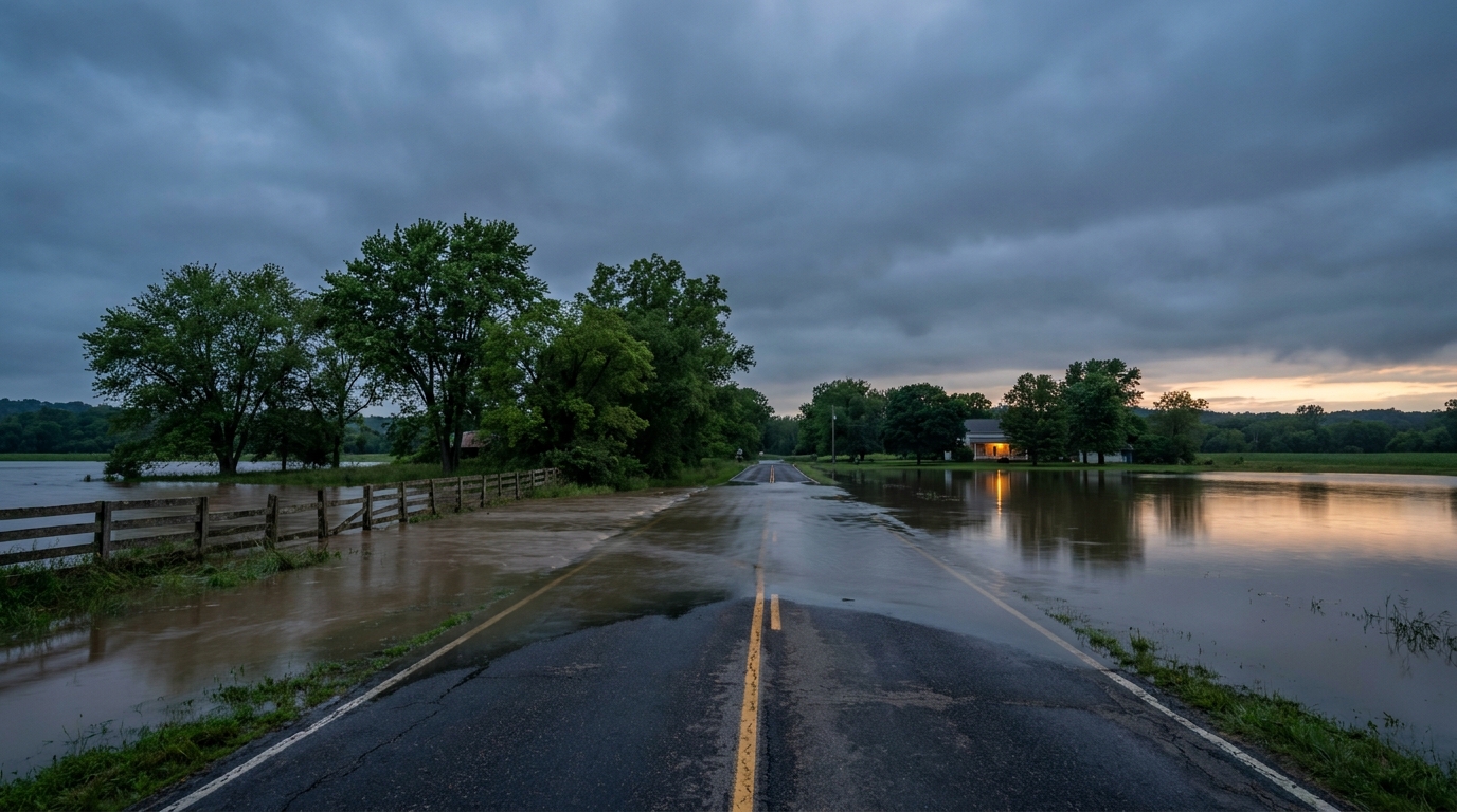
The bigger picture: flooding in Kentucky
Now for the part that affected the most people. South-central Kentucky took the worst of it. Spotter reports came in of up to 11 inches of rain, and a Flash Flood Warning was extended that contained a Flash Flood Emergency. That's the strongest flood-related wording the National Weather Service issues.
Clinton County and the city of Albany declared a state of emergency. There were evacuations, water rescues, and widespread flooding. In Louisville, an active search and water rescue operation was underway for an unaccounted-for person near Broad Run Parkway.
And it wasn't just Kentucky. Severe flash flooding hit the Richmond, Virginia, and Philadelphia, Pennsylvania, metro areas too. Submerged vehicles, water rescues, and road closures across all three regions.
The Western fire tragedy
We also have to mention the most somber news of the day. Three firefighter fatalities were confirmed along the Colorado-Utah border, tied to the 93,600-acre Cottonwood Fire in Utah. Our hearts go out to those families and crews.
A few rare things worth flagging
June 28 had some genuine oddities:
- Summer snow. High-elevation stations in western Montana and eastern Idaho measured 8 to 9 inches of snow. In late June. That's a real rarity.
- A scorching surface reading in Texas. Slaton, Texas, recorded an unseasonable 110 degrees with damaging winds, consistent with a heat-burst-type event.
- Big hail up north. A destructive Severe Thunderstorm Warning was issued for McLean County, North Dakota, forecasting 3.00-inch hail.
- Plains wind damage. Near Baltic, South Dakota, the public and a storm chaser reported a dairy farm with significant outbuilding damage and a destroyed silo. Across the Carolinas, multiple reports of downed trees and power lines came in through the afternoon.
How the forecast held up
Our Monday morning post was focused on the pattern going forward, with the active severe threat pegged for the northern Plains and Upper Midwest under a Slight Risk. That part lines up with what the Storm Prediction Center carried and with the wind and hail reports we saw around the Dakotas.
Where I'll be honest: we framed Kentucky as "finally getting a break." The reports from June 28 show the flooding was still very much ongoing and serious, with that Flash Flood Emergency and a state of emergency in Clinton County. The hydrological hazard didn't ease as cleanly as the headline suggested. When you've had multiple days of heavy rain stacking up, the ground stays loaded and it doesn't take much to push rivers and creeks over. That's the lesson here, and it's worth owning.
What's coming next
The pattern hasn't reset. A few things to watch:
- More northern Plains storms. SPC has a Slight Risk again, focused on the northern Plains into the Upper Midwest, with large hail and damaging wind the main concerns and a low-end tornado chance.
- More flooding potential. WPC has a Slight Risk for excessive rainfall over North Dakota, with wrap-around moisture along the Canadian border. West Texas keeps a dryline-driven flooding concern going.
- Dangerous heat building. The bigger headline for the days ahead is a significant, dangerous, and potentially record-breaking heat wave for the Central and Eastern U.S. heading into next week. Heat index values over 100 to 105 degrees are on the table, and warm nights will limit overnight relief.
- The tropics are quiet, mostly. There's one low-end disturbance offshore the Southeast coast with a 10 percent chance of development through 7 days. Low odds, but worth a glance.
Bottom Line
June 28 was a reminder that the most dangerous weather isn't always the loudest. The one confirmed tornado near North Fort Myers damaged two homes and grabbed attention, but flooding is what put lives at risk across Kentucky, Virginia, and Pennsylvania, and a wildfire out West cost three firefighters their lives. If you live in flood-prone terrain after days of rain, take the warnings seriously, because saturated ground turns ordinary downpours into emergencies. And keep an eye on that heat building for next week. That'll be the next big story.