Blog Article
July 04, 2026 Severe Weather Recap: Iowa Floods & Wind
July 04, 2026 recap: 13.5 inches of rain flooded Polk City, IA, 90 mph gusts hit Oklahoma, tornadoes reported in Iowa, plus a G3 geomagnetic storm.
July 04, 2026 Recap: A Foot of Rain in Iowa, 90 MPH Gusts in Oklahoma, and a G3 Storm Overhead
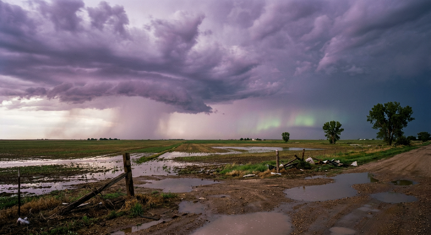
Y'all, when a town measures 13.5 inches of rain in a single day, that's the headline. Polk City, Iowa did exactly that on the Fourth of July, and it turned streets into rivers and set off life-threatening flash flooding across central Iowa. That's more rain in one day than a lot of places see in three months.
But the rain was only part of the story. This was a day where the atmosphere stayed busy from morning to midnight, and it stretched from the Plains clear to the Northeast Corridor. Let's walk through how it all came together.
How the Day Unfolded
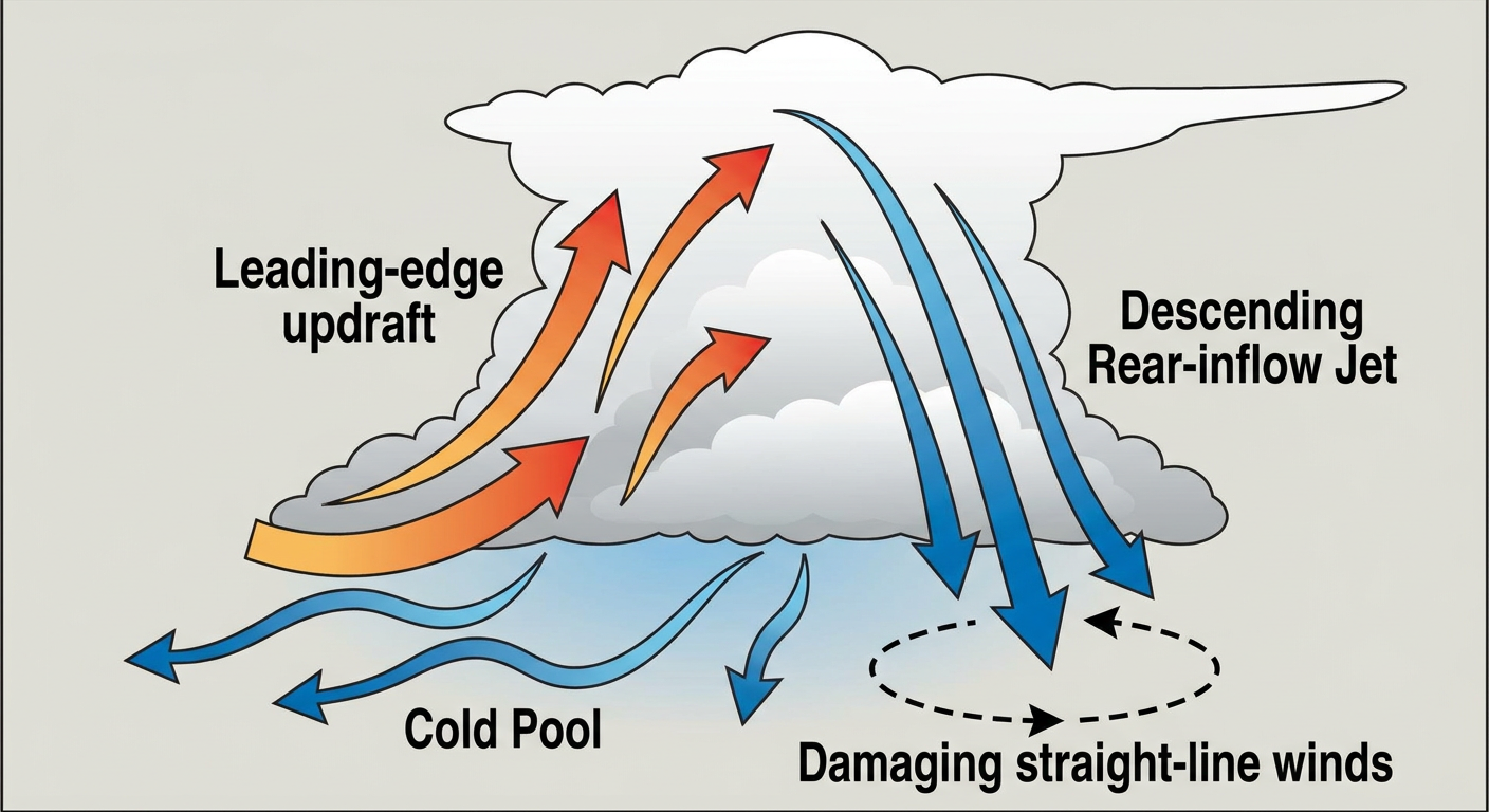
Things got moving early. By mid-morning, storms were already firing, and by afternoon those cells organized into linear segments and bow echoes. That's the setup that produces long stretches of damaging wind instead of one isolated cell.
Here's the timeline that the reports lay out:
- Morning (Florida coast): Broadcast media caught multiple waterspouts spinning up off the Gulf coast near Sanibel, Grove City, and Pass-a-Grille. These were the classic warm-season, low-topped variety.
- Late morning (northwest Iowa): A tornado was reported 2 ESE of Everly, Iowa around 11:11 AM Central, with video showing it move across a pond and come onshore.
- Early afternoon (northwest Iowa): A second tornado touched down 3 SE of Greenville, Iowa. A sheriff's deputy witnessed the brief touchdown.
- Afternoon and evening (the Plains): Garfield County, Oklahoma measured a 90 mph wind gust alongside 2.5-inch hail. Kit Carson County, Colorado logged an 80 mph gust.
- Evening (Colorado): A trained spotter reported a brief landspout 6 NNE of Otis, Colorado, with photos.
- Late evening (Northeast Corridor): The line reached the coast. An 87 mph gust hit the Potomac River along the Virginia/Maryland line and capsized multiple boats. Trees came down across Long Island and Connecticut, including reports near Orient, NY and New Fairfield, CT.
The overall trend through the day was a worsening one. Wind threats climbed from garden-variety 60 mph gusts into destructive 80 to 90 mph events, and the hydrological threat shifted from flash flooding into broader areal flooding and river rises.
The Tornado Reports, Kept Honest
Two tornadoes were reported in northwest Iowa, both handled by the Sioux Falls (FSD) office. One near Everly came with public video, and one near Greenville was confirmed visually by law enforcement. There's no EF-rating on either one yet, and there shouldn't be. NWS damage surveys take days to complete, so anybody handing you a rating today is guessing. When those surveys come in, we'll pass them along.
The Florida waterspouts and the Colorado landspout round out the rotation reports, but those are a different animal from the supercell tornadoes folks usually worry about. Waterspouts over open water and brief landspouts are common in summer and rarely reach land with much punch.
Space Weather Got In On It Too
Here's something you don't see every Fourth of July. A G3 (Strong) geomagnetic storm was observed with the K-index reaching 7.33, and an X1.3 solar flare produced R3 (Strong) radio blackout conditions. Concurrent strong geomagnetic and strong radio blackout events are a genuine rarity. If you were anywhere with clear, dark skies at the right latitude, the aurora may have put on a show.
How the Forecast Held Up
This is where we grade our own homework. Yesterday's blog led with the flash flood threat from Kansas to Ohio and called out the Iowa soaking. That verified. Polk City's 13.5 inches was exactly the kind of total that setup can produce, and the Weather Prediction Center's Moderate Risk was there for a reason.
The blog also flagged the 87 mph Potomac gust and the boat capsizes, and it pointed at the Mid-Atlantic wind threat with 60-plus mph gusts and the possibility of hen-egg hail. The destructive winds did materialize, from Oklahoma's 90 mph gust and 2.5-inch hail to the wind damage that swept into the Northeast that evening. The big-ticket items in the forecast lined up with what the reports actually showed.
What's Coming Next
The pattern isn't done. For today, July 5, SPC has a Slight Risk of severe storms across parts of the Mid-Atlantic and North Dakota, with scattered wind damage possible and large hail in play up in North Dakota. WPC is carrying a Moderate Risk for excessive rainfall over the northern Mid-Atlantic, with back-building storms capable of rates over 2 inches an hour across eastern Pennsylvania and New Jersey.
Looking further out, the story shifts to heat. The Extended Forecast Discussion calls for a major to extreme heatwave building across the Southern Tier this week, then spreading into the Southwest and Great Basin. The Climate Prediction Center's Week-2 Hazards Outlook backs that up with a moderate risk of extreme heat for the Great Basin, Desert Southwest, and Southern Plains around July 12-15. If you're in that footprint, start thinking about how you'll handle the heat before it arrives.
Bottom Line
The Fourth of July 2026 was a multi-hazard day that behaved a lot like the forecast said it would. Central Iowa took the worst of it with over a foot of rain and life-threatening flooding, while a long corridor from the Plains to the Northeast dealt with damaging winds and, in Iowa, two reported tornadoes. The forecast caught the headline threats, which is the whole point of a forecast. Now the focus turns from flooding and wind to a stretch of dangerous heat building over the southern half of the country. Keep an eye on that if you live where the ridge is setting up.