Blog Article
July 15, 2026 Severe Weather Recap: TX Tornado & Flooding
Full recap of July 15, 2026: a tornado near San Antonio, catastrophic Hill Country flooding, and overnight wind damage across the Northeast US.
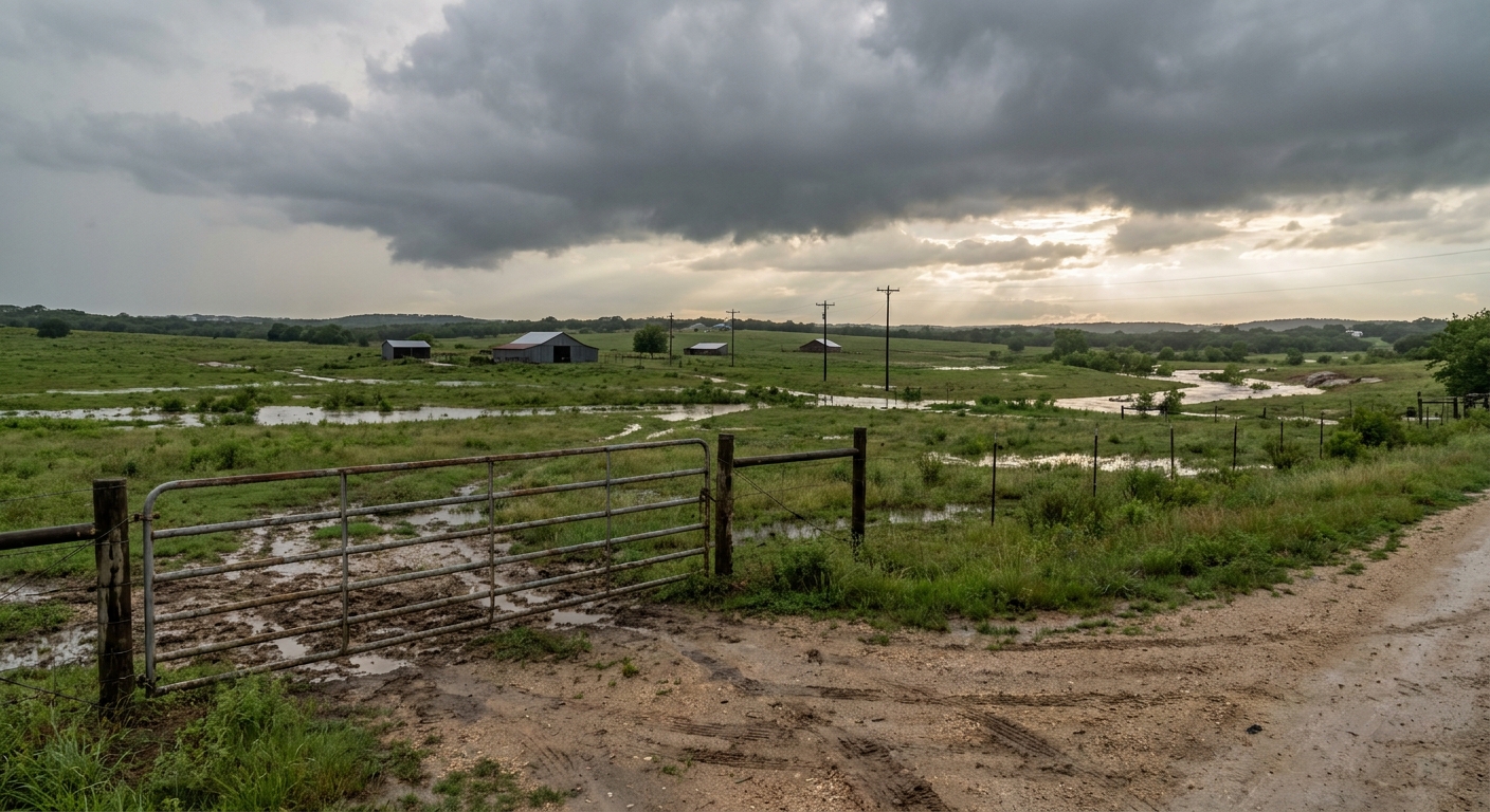
July 15, 2026 Recap: Tornado Near San Antonio, Catastrophic Hill Country Flooding, and a Rough Night in New England
Alright folks, let's talk about yesterday. July 15 packed three separate weather stories into one 24 hour window: a tornado on video crossing a major San Antonio highway, a flash flood emergency that turned deadly serious across the Texas Hill Country, and a round of overnight wind damage that stretched from Vermont to Michigan. Here's how it all played out and what we actually confirmed.
The Headline Moment: A Tornado on Loop 1604
Around 7:50 AM Central time, the public reported a tornado three miles west of Shavano Park, Texas, just outside San Antonio. Video showed the tornado crossing Loop 1604, with power flashes and debris visible on the footage. The National Weather Service office in Austin/San Antonio (EWX) logged the report, with the exact time estimated from radar. No damage survey has come back yet, so we don't have a rating on this one. We'll update if and when NWS releases a survey.
That same afternoon, a waterspout formed over Saint Charles Bay, about 8 miles northeast of Fulton, Texas, right along the coast. Public photos confirmed it. Not a tornado over land, but a good reminder that the same instability driving severe weather inland was working the coastline too.
The Bigger Story: Catastrophic Flash Flooding in the Hill Country
While the tornado made for dramatic video, the flooding is what did the real damage yesterday. Flash Flood Emergencies, the highest level flood warning the NWS issues, went out for Kendall and Medina counties as rain kept falling on ground that had no capacity left to absorb it. This hit south-central Texas hardest, specifically Kendall, Medina, Bexar, Uvalde, and Bandera counties, the same stretch of the Edwards Plateau that had already taken on heavy rain earlier in the week.
This wasn't a one-and-done storm. WPC's own language called it a persistent convective pattern, meaning storm after storm rolled over the same saturated ground through the day and into the evening.
Overnight Wind Damage Up North
While Texas dealt with tornadoes and floods, the Northeast had its own rough stretch overnight and into the evening.
- Half Moon State Park, Vermont: A microburst described as massive damaged several campers (one totaled), two vehicles, and brought down power lines and multiple trees throughout the campground.
- Orwell, Vermont: Trees and power lines down.
- Bellows Falls, Vermont: Trees down along I-91.
- Hillsborough, New Hampshire: Trees and wires down on Deering Center Road, including a tree on a house.
- Greenwich Village, New York City: A tree came down on West 20th Street, confirmed by an emergency manager.
- Bath, Michigan: Tree down, with additional reports of trees and wires down between St. Johns and DeWitt.
None of these reports carry wind speed measurements in the confirmed data, so we're sticking with what's documented: tree and power line damage across a wide swath of the Northeast and Great Lakes.
Forecast Versus Reality
This morning's outlook (published as we were putting together this recap) told us a lot about how accurate yesterday's flood forecasting was. WPC brought back a Moderate Risk of excessive rainfall for the Edwards Plateau and Hill Country for today, specifically because the ground out there is already saturated from what fell Monday through Wednesday, July 15 included. That's forecaster language confirming the flooding was bad enough to leave standing impacts a full day later.
The tornado near Shavano Park wasn't something we were tracking as a headline risk going into July 15. It came out of what was primarily framed as a flood event, and that's a fair miss to own. Flash flooding was the dominant, well-forecast threat. The tornado was a secondary hazard riding along with it, and it caught up with the public reporting system in real time rather than through an advance Tornado Watch narrative in our prior coverage.
What's Coming Next
The pattern isn't finished with Texas. WPC has a High Risk of excessive rainfall up again today across south-central Texas, meaning more of the same ground that flooded yesterday could see additional heavy rain before this eases to a Slight Risk on Friday as the mid-level trough drifts toward the Big Bend.
Further out, SPC has a Slight Risk of severe storms posted for Saturday across the Ohio Valley into the Mid-Atlantic, with a broader Marginal Risk fanning out to New York, Chicago, Charlotte, Nashville, and Detroit. Given what the Northeast just went through overnight on the 15th, that's a region worth watching again this weekend.
On the tropical side, things stay quiet. No named storms are active, and the two Atlantic disturbances NHC is tracking both carry low, single-digit-to-20-percent development chances through the next week. Space weather is unremarkable too, quiet to unsettled with no geomagnetic storming expected.
Bottom Line
July 15 was a day where three different weather stories happened at once and none of them were minor. The tornado near Shavano Park is a confirmed public report with video evidence, but we don't have a survey or rating yet, so we're not going to guess at one. The flooding in the Hill Country was serious enough to trigger Flash Flood Emergencies in two counties and serious enough that today's forecast is still dealing with the saturated ground it left behind. And the overnight wind damage across New England and the Northeast, while less dramatic, still took down trees onto houses and vehicles in multiple states.
The lesson here is a simple one. When a flood threat is the headline risk, don't stop watching the sky for everything else riding along with it. Yesterday's tornado proved that point.