Blog Article
August 11, 2026 Tornado Recap: Iowa & Illinois Confirmed
Full recap of the August 11, 2026 severe weather: four confirmed tornadoes in Iowa and Illinois, storm survey details, and what's forecast next.
August 11, 2026 Severe Weather Recap: Iowa's Morning Tornadoes and a Day-Long MCS Grind
Y'all, the headline from August 11 didn't come out of a supercell with a big hook echo on radar. It came out of a fast-moving line of storms that rolled across eastern Iowa before most folks had finished their coffee, and it left three confirmed tornadoes on the ground before 8 AM.
How the Day Unfolded
The trouble started early. Right around 7:31 to 7:45 AM Central time, a line of storms embedded in a larger mesoscale convective system tracked through Delaware and Buchanan County, Iowa. In that short window, NWS Storm Survey teams out of the Quad Cities office later confirmed three separate tornadoes:
- 5 W Greeley, IA: a high-end EF1 with peak gusts of 110 mph, path 2.4 miles long, about 150 yards wide at its start. Two farmsteads took the worst of it, with outbuildings destroyed, numerous trees snapped, and a power pole down.
- 2 SSE Greeley, IA: an EF1 with max winds of 90 mph over a 1.5 mile path, around 100 yards wide. A hoop outbuilding got flung into the side of a farmhouse, damaging windows and exterior walls. Trees were snapped clean to the north at that homestead.
- 4 N of Earlville, IA: an EF1 with max winds of 95 mph over a 2.6 mile path. A tree fell on a house and tore up a garage, and a large branch punched into the metal roof and into a bedroom. Mid-path, a farm outbuilding's west wall got pushed in and lost part of its roof.
As that same broad complex pushed east through the morning, reports of downed trees started coming in from northern Illinois, with a tree blocking the main street in Crete around 10:52 AM Central. By early afternoon the complex reached into the Appalachians, and 911 call centers in West Virginia logged trees down in Leon and Institute, including one that fell onto the shoulder of I-64. A little later, another tree came down at an intersection near Kegley, West Virginia, close to the Virginia border.
Then, around 3:29 PM Central, a trained spotter confirmed a fourth tornado, this one three miles south of Seymour, Illinois, as discrete storms fired ahead of the main line in central Illinois.
What Was Actually Confirmed
- Four tornado reports for August 11: three in eastern Iowa (all later surveyed and rated EF1) and one confirmed by a trained spotter near Seymour, Illinois.
- Longest tornado path of the day: 2.6 miles, near Earlville, Iowa.
- Peak tornado wind estimate: 110 mph, tied to the farmstead damage west of Greeley, Iowa.
- Multiple thunderstorm wind damage reports, mostly downed trees, across Crete, Illinois and several West Virginia communities including Leon, Institute, and near Kegley.
- The most active corridor for the day ran from the Ohio Valley and northern Indiana into eastern Kentucky, with additional flare-ups in the northern Illinois and western South Dakota area.
A quick honesty note here. Some broader summaries floating around for the 11th mentioned specific numbers like a 111 mph gust in South Dakota and 4.5 inch hail in Nebraska. We don't have a verified local storm report to back those exact figures in the confirmed log we reviewed for this recap, so we're leaving them out rather than repeat a number we can't stand behind. What we can stand behind is what's listed above, straight from storm survey and spotter reports.
Forecast Versus Reality
Yesterday's outlook leaned heavily on wind and hail as the headline threats from that MCS, with the tornado conversation mostly quiet. That tracks with how these events usually get framed in the moment. Fast-moving convective lines get watched for damaging gusts first, and any embedded tornadoes tend to show up small on radar and get missed until survey crews walk the ground.
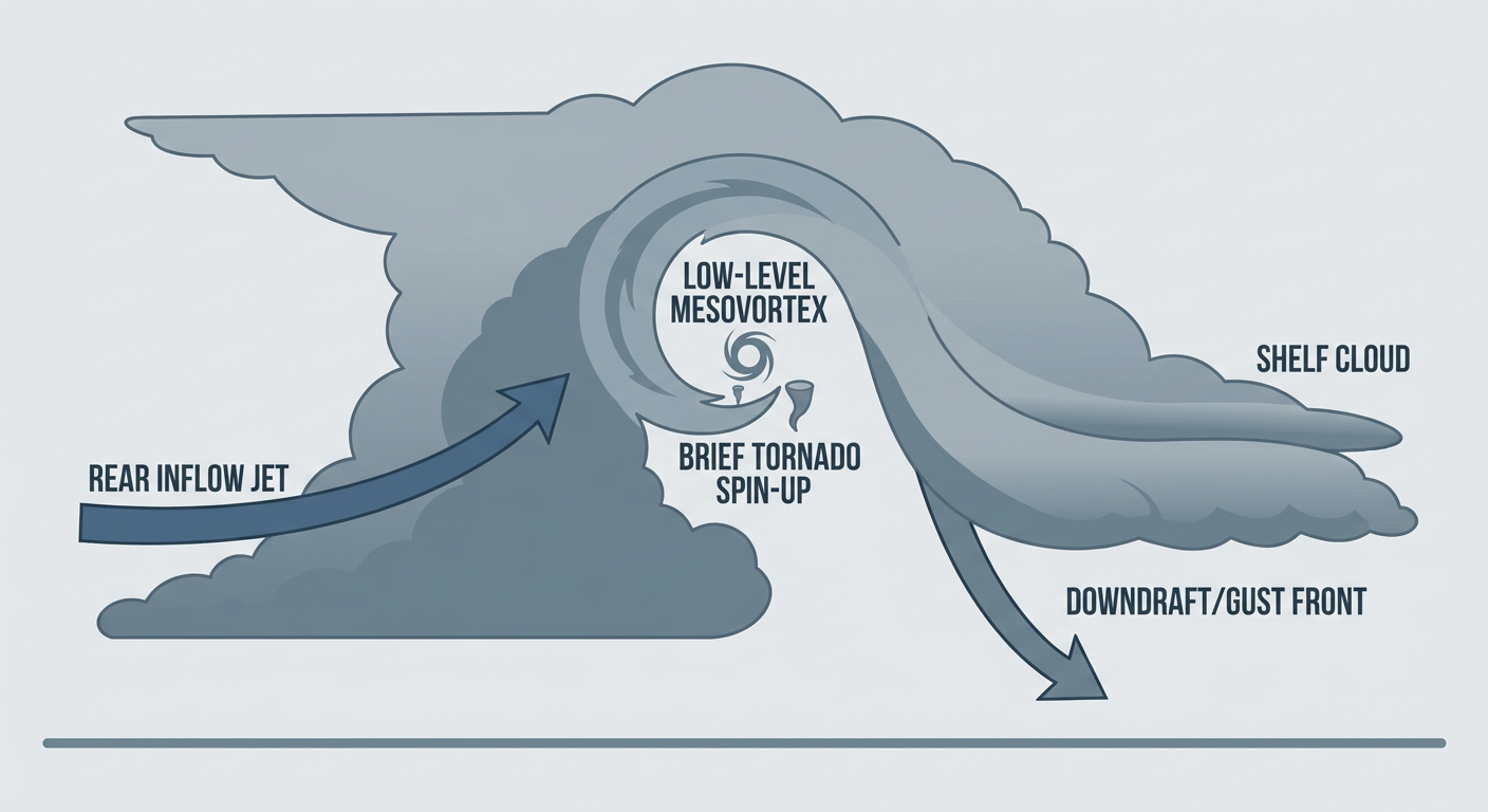
That's exactly what happened here. The Iowa tornadoes were brief, low-end, and packed inside a線 of storms that was mostly about straight-line wind on radar. It took NWS Storm Survey teams getting out to Delaware and Buchanan Counties to confirm three separate tornado tracks, each with real damage to homes, outbuildings, and trees. That's not a forecast miss so much as a reminder that quasi-linear convective systems, the kind meteorologists call QLCS setups, can hide small spin-up tornadoes that don't announce themselves the way a classic supercell does. The lesson for anyone watching a bowing line of storms: don't assume no tornado warning means no tornado risk.
What's Coming Next
Today, August 12, SPC has a Slight Risk of severe thunderstorms up from the northern and central Plains into the lower Ohio Valley, covering Indianapolis, Louisville, Omaha, Des Moines, and Cedar Rapids. A broader Marginal Risk stretches out to Chicago, Philadelphia, Charlotte, and Denver. Damaging wind gusts and isolated hail are the main threats again, with only a 2 percent isolated tornado chance, so today reads more like yesterday's wind and hail story than a tornado day.
On top of that, WPC has a Slight Risk of excessive rainfall painted from the central Plains through the Tennessee Valley, as the same kind of repeating storm pattern that soaked the region this week keeps training over already-saturated ground. Flooding, not tornadoes, is the bigger concern in that corridor right now.
Farther out, keep an eye on the Atlantic. A tropical wave well west-southwest of the Cabo Verde Islands has an 80 percent chance of organizing into a tropical depression over the next couple of days. It's thousands of miles from the US coast right now, so there's no direct US impact to talk about yet, but it's the kind of system worth tracking as we move deeper into peak hurricane season.
Bottom Line
August 11 turned out to be a bigger tornado day than the initial wind-and-hail framing suggested, with four confirmed tornadoes, three of them surveyed and rated EF1 in eastern Iowa, plus a fourth confirmed by a trained spotter in central Illinois. The damage was real but localized: farmsteads, outbuildings, and trees took the brunt of it, and there's no indication in the confirmed reports of serious injuries. The bigger takeaway for forecasters and weather watchers alike is that fast-moving convective lines can produce tornadoes that don't show up clearly until damage survey teams walk the path days later. Today's setup looks calmer on the tornado front but keeps the same wind, hail, and flooding themes going into the Ohio Valley and Plains.