Blog Article
August 15, 2026 Weather Recap: Lala Hits Hawaii, IL/IN Flood
Recap of August 15, 2026: Hurricane Lala clipped Hawaii Island with 140 mph gusts while Illinois and Indiana saw flooding rains over 8 inches and a confirmed Ohio tornado report.

August 15, 2026 Severe Weather Recap: Lala Clips the Big Island, the Ohio Valley Drowns
Alright folks, yesterday had two completely different weather stories running at the same time, one tropical, one convective, and both of them delivered.
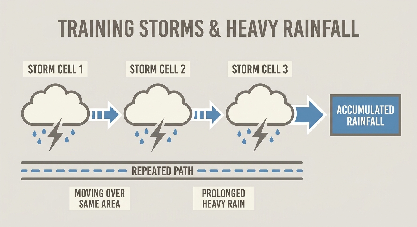
Out in the Pacific, Lala did exactly what the forecast said it would do. It strengthened into a Category 1 hurricane and made its closest pass to Hawaii Island. Back on the mainland, a corridor of training thunderstorms sat over central Illinois and Indiana and just would not move, dropping rainfall totals that read more like a landfalling tropical system than a run of summer storms.
How The Day Unfolded
The day actually got rolling the night before, with a tree down on a house near Mountain View, Hawaii around 9 PM local time as Lala's outer bands started arriving on the Big Island.
By midday Saturday Hawaii time, Lala had crossed the hurricane threshold a short distance off South Point. That's when the real impacts showed up. Emergency managers logged downed trees and power lines closing Mud Lane near Kamuela, Kaauhuhu Road near Hawi, and Mamalahoa Highway in two separate spots near Naalehu and the Hawaiian Ocean View area. Honolulu, on Oahu, took roof damage in several neighborhoods, Punchbowl, Aiea, Kapahulu, Aina Haina, Kaimuki, Kalihi, and Makiki, mostly between 11 AM and noon.
Meanwhile back on the mainland, an unstable and moisture-rich pattern was setting up trouble across the Ohio Valley. Through the morning and afternoon, thunderstorms trained repeatedly over the same stretch of central Illinois and central Indiana, meaning storm after storm rolled over the same ground instead of spreading the rain out. Vermilion County, Illinois, ended up with more than 8 inches over about a 30-hour stretch. Marion and Hamilton counties in Indiana saw road washouts, boat rescues, and closures on Interstate 74.
By late afternoon and into the evening, the atmosphere reloaded. Severe convection fired again across the High Plains, the Front Range, the Ohio Valley, and the Appalachians. Out of that second round, a small supercell tracked through west-central Ohio and prompted multiple Tornado Warnings. We've got one confirmed tornado report out of that storm: a tree down on a Ward Road property two miles north of Saint Paris, Ohio, called in through 911 around 8:29 PM Eastern.
Around the same time down in the Keys, a thin waterspout was photographed and reported about 7 miles north of Key West, moving slowly west-southwest for roughly 10 minutes. Separate story, no connection to the mainland severe weather, just Florida being Florida in August.
Overnight, more than 150,000 utility customers stayed in the dark across Lake, Porter, and LaPorte counties in northwest Indiana, a holdover from the day's storms that lingered well past sunset.
What We Can Confirm
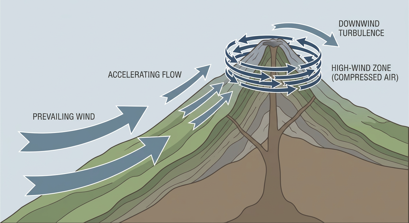
- Lala intensified into a Category 1 hurricane south of Hawaii Island, with a non-thunderstorm wind gust of 140 mph recorded at the Mauna Kea Summit observation station, and 82 mph measured on Molokai.
- Multiple road closures across the Big Island from downed trees and power poles, confirmed by emergency management reports out of the National Weather Service Honolulu office.
- Roof damage reported across several Honolulu neighborhoods during Lala's passage.
- Rainfall totals of 5.00 to 8.25 inches across central Illinois and central Indiana, with a confirmed 8-plus inch total over 30 hours in Vermilion County, Illinois.
- Interstate 74 closures and boat rescues tied to flooding in Marion and Hamilton counties, Indiana.
- One confirmed tornado report near Saint Paris, Ohio, tree damage only, no rating available yet since damage surveys take time.
- A waterspout confirmed near Key West, Florida, lasting about 10 minutes.
- Over 150,000 customers without power overnight in northwest Indiana.
We want to be straight with you on the tornado count. Multiple Tornado Warnings went up for that Ohio supercell, but the confirmed report we have in hand right now is the one near Saint Paris. If more reports surface as survey teams get out today, we'll pass that along.
Forecast Versus Reality
Our Saturday morning forecast called Lala's intensification almost exactly right. We said it would cross the hurricane threshold before its closest approach to the Big Island, and it did, with the 140 mph Mauna Kea gust actually running above what flight-level data was suggesting the day before. The rainfall side of that forecast, 10 to 20 inches with locally higher totals on the volcanic slopes, still needs to be checked against final rain gauge totals, but the road closures and landslide reports line up with a heavy rain, high wind event just like we expected.
On the mainland side, we flagged the Moderate Risk of excessive rainfall sliding from Iowa into Illinois overnight and into Indiana and Ohio on Sunday. That's exactly where the worst of it landed. What we didn't fully capture was the magnitude. We were talking about 2 to 4-plus inches on top of saturated ground. What actually fell was 5 to over 8 inches in spots. That's a miss on our end, and it's worth owning. Training convection is notoriously hard to pin down precisely because a shift of just a few miles in storm motion can double or triple totals in one county while leaving the next one dry.
We also didn't headline a tornado threat for west-central Ohio in Saturday's forecast. The severe setup there came together with less lead time than the flooding and hurricane stories, and that's a good reminder that even on a day dominated by two big headline events, a small supercell can still sneak in and do its own thing.
What's Coming Next
Lala has weakened back to a tropical storm with 69 mph winds as it pulls away from the islands, so the worst of the wind threat there has passed, though cleanup continues. Out in the eastern Pacific, two separate disturbances are being watched for possible development later this week, both carrying a medium, 40 to 50 percent chance of formation by day 7. Nothing imminent, just something to keep an eye on.
Back on the mainland, SPC has a Slight Risk up today for the Ohio Valley, central Appalachians, Mid-Atlantic, and central High Plains, with damaging wind gusts as the headline threat at 15 percent and an isolated tornado threat at 2 percent. WPC has bumped the rainfall threat up to a Moderate Risk of excessive rainfall centered on West Virginia today, so the flood danger has shifted east from where it was hammering Illinois and Indiana. That threat continues to slide eastward into Monday and Tuesday, moving toward the central Plains and Mid-Mississippi Valley by midweek.
Bottom Line
Yesterday was a reminder that a hurricane forecast can be dead on and a rainfall forecast can still undersell the final numbers, both in the same 24 hours. Lala's intensification into a Category 1 hurricane went about like we said it would, and the impacts on the Big Island, road closures, downed lines, roof damage, back that up. The flooding across Illinois and Indiana verified the setup we flagged, but the actual rainfall ran well past what our numbers suggested, and that's the kind of gap that matters when you're talking about water rescues and interstate closures. The Ohio tornado report is a good example of why we watch every storm, even on a day with two bigger headlines already on the board. Keep an eye on that Moderate Risk rainfall threat sliding into West Virginia and the Mid-Atlantic today. That's where the next flood concern is setting up.