Blog Article
August 20, 2026 Severe Weather Recap: Tornadoes & Flooding
Full recap of August 20, 2026 severe weather: confirmed tornadoes in Kentucky, Delaware, and Alabama, flash flooding, and a fatal lightning strike in Virginia.
August 20, 2026 Severe Weather Recap: A Day That Touched Kentucky, Delaware, and Everywhere In Between
Alright folks, let's talk about yesterday. August 20 started before most of us were even awake and didn't let up until well past dark. By the time it was over, we had confirmed tornado activity in three different states, flash flooding along a corridor stretching from Ohio to New York City, and a tragedy in coastal Virginia that reminds us lightning is no joke.
How the Day Unfolded
Overnight into early morning (western Kentucky): The first tornado touched down just before midnight Central time in Carlisle County, about 3 miles east-southeast of Cunningham. NWS survey crews later confirmed this as an EF-1, on the ground for 1.5 miles before lifting two miles west of Lowes in Graves County. Peak winds were estimated at 100 mph with a maximum width of 75 yards. Public reports out of Lowes described multiple homes damaged and trees down across Highway 131 near the 3-mile marker, with the storm survey noting a likely tornadic debris signature (TDS) on radar. This same line of storms brought a measured 82 mph wind gust in Calloway County, Kentucky, and widespread structural damage across that corner of the state.
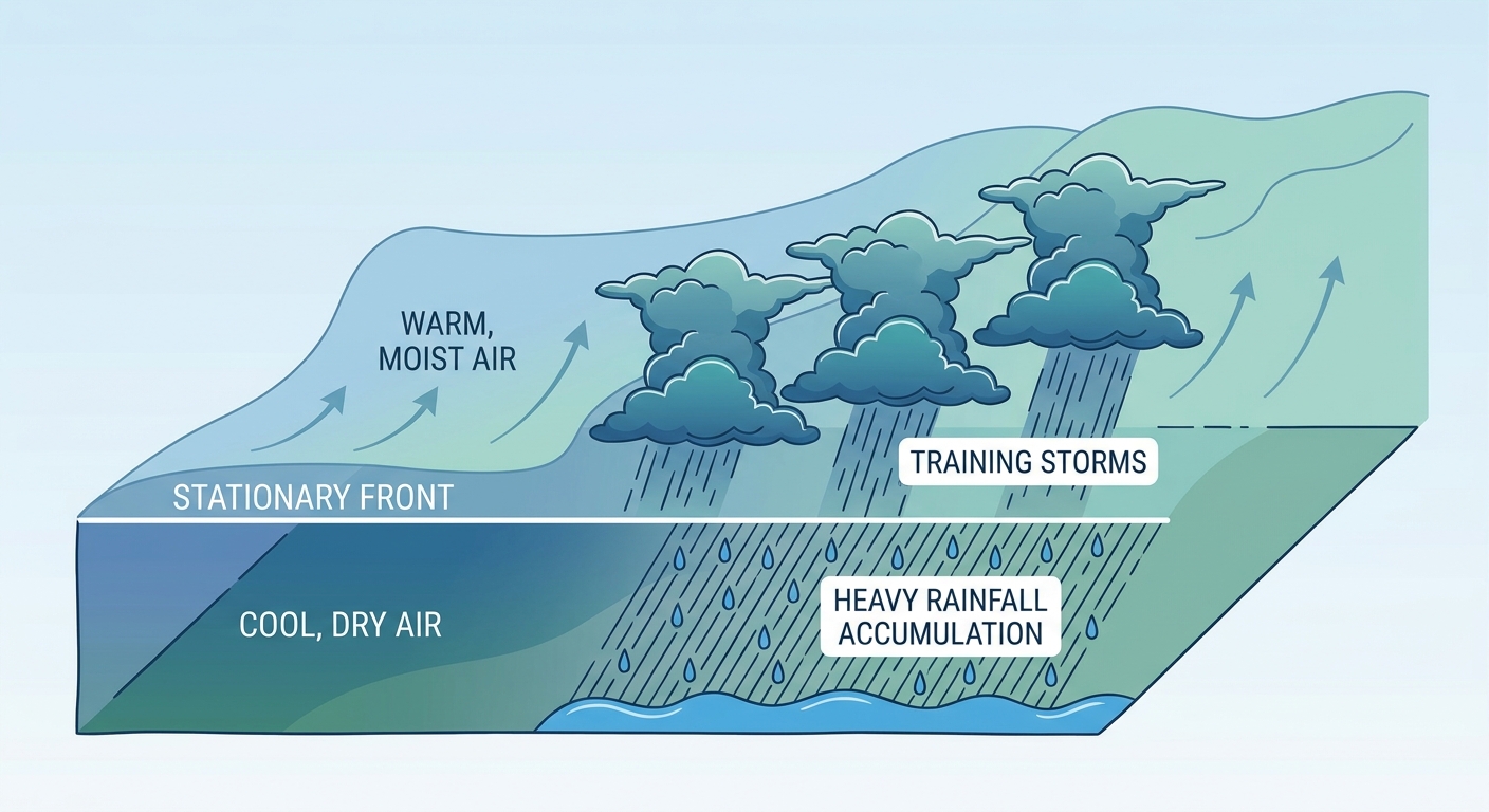
Midday (Ohio Valley): As the morning storms pushed off, the story shifted to water. Rainfall totals of 2 to 4.5 inches fell across central and eastern Ohio, southwestern Pennsylvania, and the northern West Virginia panhandle. Flash flooding closed roads and triggered multiple water rescues.
Afternoon into evening (Mid-Atlantic and Northeast): This is when things got busy fast. Severe Thunderstorm Watch 604 went up across the Mid-Atlantic corridor, and it wasn't long before Tornado Warnings followed. Around 6:18 PM Eastern, a trained spotter confirmed a rain-wrapped tornado on the ground in Dover, Delaware, with flying debris reported. Around the same window, urban flash flooding hit the I-95 corridor hard, with water rescues and road closures in Hudson and Passaic counties in New Jersey, Delaware County, Pennsylvania, and near LaGuardia Airport in Queens.
Evening (Deep South and Gulf Coast): Down in Alabama, broadcast media captured video of a tornado near the Tensaw River, about 2 miles west-southwest of Hurricane, Alabama, around 4 PM Central. Radar showed a tornadic debris signature consistent with the video. Meanwhile in Florida, waterspouts were reported off Anclote Key near Port Richey and twice off Key West, and a tree came down near the University of Florida in Gainesville.
A somber note: A lightning strike at Cape Charles in Northampton County, Virginia, killed one person and injured another. That's the kind of headline number that matters more than any wind speed or hail size, and it's worth remembering that lightning doesn't need a warning to be dangerous.
Elsewhere: Storms in the Upper Midwest and Northern Plains produced a measured 76 mph wind gust in South Dakota and hail up to 1.75 inches across South Dakota, Nebraska, and Minnesota.
What We Can Confirm
- Kentucky: EF-1 tornado confirmed by NWS storm survey, Carlisle to Graves counties, 1.5 mile path, 100 mph peak winds, 75 yard width. Homes damaged, trees down on Highway 131.
- Delaware: Rain-wrapped tornado confirmed by trained spotter in Dover, Kent County, with flying debris.
- Alabama: Tornado reported near Hurricane, Alabama, via broadcast media video and radar signature.
- Virginia: One fatality, one injury from a lightning strike in Cape Charles.
- Flooding: 2 to 4.5 inches of rain triggered flash flooding and water rescues from Ohio through the West Virginia panhandle and along the I-95 corridor.
- Wind and hail: 82 mph gust in Calloway County, Kentucky; 76 mph gust in South Dakota; hail to 1.75 inches in the Dakotas, Nebraska, and Minnesota.
Forecast vs. Reality
Here's where we've got to be honest with y'all. Earlier reporting on the Kentucky event described an 18.5-mile macroburst swath with winds up to 105 mph. Once the NWS storm survey got out on the ground, the confirmed picture was a bit different: a tighter, tornado-driven damage path, 1.5 miles long, 75 yards wide, with 100 mph peak winds rated EF-1. That's not a knock on the initial reports, storm surveys almost always sharpen the picture after the fact, but it's a good reminder that first reports and final surveys can tell slightly different stories. The Dover, Delaware tornado and the Cape Charles lightning fatality both played out pretty much as the overnight reporting described.
As for the tornado count, our verified reports show three distinct tornado touchdowns yesterday, western Kentucky, coastal Alabama, and Dover, Delaware, each backed by either a storm survey, a trained spotter, or broadcast video with a radar signature. That's a meaningful severe weather day by any measure, even if it doesn't match some of the higher preliminary counts floating around online.
What's Coming Next
The pattern is shifting today. SPC has a Slight Risk up for parts of the central Plains, the Midwest, and the Carolinas, covering cities like Chicago, Charlotte, Milwaukee, Raleigh, and Madison, with a broader Marginal Risk stretching from Kansas City and Omaha down through Wichita and into New Orleans and Baton Rouge. The main threats today are scattered damaging hail (some stones over 2 inches) and severe wind gusts, with only an isolated tornado chance, SPC has that pegged at 2 percent.
Out in the Pacific, Hurricane Lala has pulled away from Hawaii and is down to a Category 2 with 98 mph winds as it tracks north-northeast, away from the islands. Right behind it, Tropical Depression Two-C is sitting a few hundred miles southeast of Hilo and is expected to approach south of the Big Island this weekend, bringing a real flood threat of 5 to 10 inches of rain, with isolated totals near 15 inches possible in favored terrain. That's a story we'll keep watching closely.
On the East Coast, WPC has a Slight Risk for excessive rainfall today across Virginia and the Carolinas, with 2 to 4 inches possible and localized amounts over 6 inches in the Sandhills and Piedmont. That risk expands toward the broader East Coast tomorrow as a deepening trough moves in.
Bottom Line
August 20 was a legitimate multi-hazard severe weather day, not a single big headline but a string of confirmed impacts spread across half the country. Kentucky got a confirmed EF-1 tornado and damaging straight-line winds. Delaware got a rain-wrapped tornado right in Dover. Alabama had a tornado caught on video near the Tensaw River. Flash flooding soaked the Ohio Valley and the I-95 corridor hard enough to trigger water rescues. And in Cape Charles, Virginia, lightning took a life, a sober reminder that the most common severe weather hazard is often the most overlooked.
The lesson for forecasters and readers alike: first reports get you moving, but storm surveys and confirmed spotter accounts are what set the record straight. Yesterday's Kentucky tornado ended up smaller in scale than early chatter suggested, but no less real for the people whose homes were damaged. That's why we wait for the data before we settle on the story.