Blog Article
August 21, 2026 Severe Weather Recap: Tornadoes & 83 MPH Gust
A full recap of August 21, 2026 severe weather: confirmed tornadoes near Sublette, IL and Tucson, AZ, an 83 mph Kansas gust, and destructive Nebraska hail.

August 21, 2026 Severe Weather Recap: Two Tornadoes, an 83 MPH Gust, and a Coast-to-Coast Kind of Day
Alright folks, yesterday was one of those days where severe weather showed up in about five different corners of the country at once. We had a brief tornado touch down in north-central Illinois, a landspout twist up on the edge of the Sonoran Desert outside Tucson, destructive hail in the Nebraska Panhandle, and wind damage stretching from Alabama into coastal North Carolina. Let's walk through how it all came together.
How the Day Unfolded
The day actually got rolling overnight. Storms rumbling through northern Alabama around 11 PM to midnight Central time downed trees near Douglas and Albertville, blocking roads that emergency managers had to work through before sunrise.
By afternoon, the action shifted to the High Plains. An AWOS station at Oakley, Kansas, KOEL, measured an 83 mph thunderstorm wind gust, backed up by a 67 mph reading from a KDOT sensor nearby. Up in the Nebraska Panhandle, spotters and chasers near Bayard documented baseball-size hail, 2.75 inches, big enough that the National Weather Service tagged those warnings as destructive.
As the evening set in, a cluster of storms in north-central Illinois turned tornadic. A Tornado Warning went up for Lee and Putnam Counties, and public video confirmed a brief tornado 4 miles southeast of Sublette, just north of US-52 at Cedar Grove Road, around 5:57 PM Central.
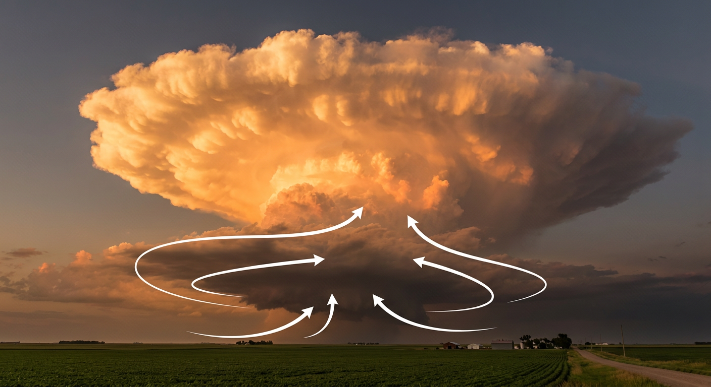
Around the same time out west, a trained spotter in Saguaro National Park East watched a landspout tornado spin up southeast of Tucson, Arizona. Landspouts form differently than the classic supercell tornado, more on that below, but they're still tornadoes, and this one counts.
Over in south Florida, a waterspout crossed Lake Okeechobee near Pahokee, visible from Belle Glade. Not a land tornado, but worth noting since it's the same rotating-column physics playing out over water.
Late in the evening and overnight, attention swung to the Gulf Coast. Acadiana Regional Airport in Louisiana measured a 76 mph gust, and a mesonet station at New Orleans Lakefront Airport logged 68 mph. Down in southeastern North Carolina, a Tornado Warning went up for New Hanover and Pender Counties after radar-indicated rotation and a spotter-reported wall cloud near Wrightsville Beach. Wind damage also hit Columbus County, North Carolina, where crews found downed trees blocking roads near Lake Waccamaw. As the overnight hours wore on, more wind damage reports came in from Thomasville and Crosby, Alabama, and Mire, Louisiana, trees and power lines down in all three spots.
What We Can Confirm
- Tornado, 4 SE Sublette, IL: Public video confirmed a brief tornado just north of US-52 at Cedar Grove Road, around 5:57 PM CDT. No rating is available yet, and none should be assumed until NWS completes a damage survey.
- Landspout tornado, 6 SSE Tucson, AZ: Confirmed by a trained spotter looking west from Saguaro National Park East. Same rule applies, no rating confirmed.
- 83 mph thunderstorm wind gust measured by AWOS KOEL near Oakley, Kansas, with a supporting 67 mph reading from a KDOT sensor.
- 2.75-inch (baseball-size) hail documented near Bayard, Nebraska, prompting destructive-tagged warnings.
- 76 mph gust measured at Acadiana Regional Airport, Iberia Parish, Louisiana.
- 68 mph gust measured at New Orleans Lakefront Airport.
- Wind damage reports confirmed by emergency managers, law enforcement, and 911 centers in Douglas, AL; Albertville, AL; Thomasville, AL; Crosby, AL; and Mire, LA, mostly downed trees blocking roads.
- Tornado Warning issued but no confirmed tornado for New Hanover and Pender Counties, NC, near Wrightsville Beach. Radar showed rotation and a spotter saw a wall cloud, but there's no LSR confirming a touchdown. That's an important distinction, warned does not always mean it happened.
Forecast Versus Reality
The morning-of outlook we published had already flagged the Oakley, Kansas gust, the Bayard hail, and the Sublette tornado as the previous day's headline hazards, so those verified exactly as expected. What that outlook didn't fully capture was how far the severe weather spread beyond the Plains and Midwest. The Gulf Coast wind reports in Louisiana, the Tucson landspout, and the North Carolina activity all developed as the day went on, a reminder that a broad multi-region setup like this one can produce surprises well outside the areas getting the most attention that morning.
On the tropical side, the previous forecast tracked Tropical Storm Moke's approach toward Hawaii and Hurricane Lala's weakening trend well. Moke strengthened from Tropical Depression Two-C into a named storm while still about 660 miles southeast of Hilo, and by this morning it had closed to around 545 miles out with 46 mph winds, right in line with what was expected. Lala, meanwhile, has weakened to a Category 1 with 86 mph winds far out at 30.3N 172.0W, more than 1,400 miles from land and pushing into cooler water and more shear, exactly the fade forecasters called for.
What's Coming Next
Today, the Storm Prediction Center has a Slight Risk up for the upper Ohio Valley, Columbus, Cleveland, Pittsburgh, Akron, and Erie, with a Marginal Risk stretching from Dallas-Fort Worth through Denver, Nashville, and Detroit. An upper low digging into the western Great Lakes is the driver, and SPC has a 15% chance of scattered damaging gusts in that Ohio Valley zone, with a hatched area suggesting isolated gusts could reach 75 mph. The Weather Prediction Center also has a Slight Risk for excessive rainfall along the coastal Mid-Atlantic today.
Out in the Central Pacific, Moke is still forecast to pass roughly 200 miles off Hawaii Island's south side late Sunday into Monday at tropical storm strength, with 5 to 10 inches of rain possible on the Big Island and isolated totals up to 15 inches. Lala should continue weakening as it tracks northwest.
Bottom Line
August 21 turned into a genuinely busy severe weather day, two confirmed tornado reports on opposite sides of the country, a measured 83 mph gust in Kansas, destructive hail in Nebraska, and wind damage scattered from Alabama to coastal North Carolina. The headline hazards we knew about that morning, the Plains wind and hail and the Illinois tornado threat, verified almost exactly as expected. The lesson for the rest of us watching from home: a Tornado Warning means rotation was detected or reported, not that a tornado is guaranteed on the ground. New Hanover and Pender Counties got warned last night with no confirmed touchdown, and that's the system working as designed, better to warn early than to wait for confirmation. Today's focus shifts to the Ohio Valley for wind, and to Hawaii for Moke's close pass. We'll keep tracking both.