Blog Article
September 06, 2026 Severe Weather Recap: ND Tornado Report
Recap of September 06, 2026: brief tornado near Arnegard ND, 83 mph Nebraska wind gusts, flash flooding, and Hurricane Lowell nearing Hawaii.

September 06, 2026 Severe Weather Recap: A Brief Tornado Near Arnegard, ND
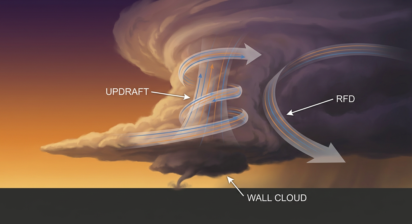
Alright folks, let's talk about yesterday. September 6th turned into one of those sprawling severe weather days where almost every region of the country had something going on. The headline moment came out of McKenzie County, North Dakota, where a storm chaser caught a brief tornado touchdown 8 miles south-southwest of Arnegard. That report came in right around 7:17 PM Central, with the location estimated by radar. No damage survey has come back yet, so we're not slapping an EF-rating on this one. What we know for certain is a trained storm chaser saw it happen.
How the Day Unfolded
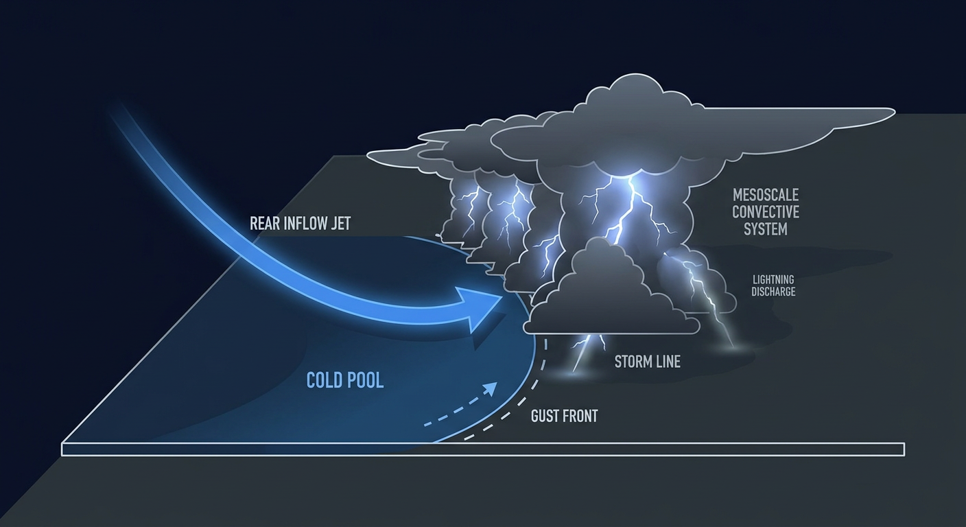
The day actually got rolling well before sunrise. A nocturnal convective cluster rolled through western Nebraska overnight, and automated mesonet sensors caught a measured gust of 83 mph near Kingsley Dam, with a 78 mph gust reported near Paxton. That 83 mph reading is one for the record books locally, a genuinely impressive number for a non-tornadic thunderstorm wind.
By afternoon, the Storm Prediction Center had Severe Thunderstorm Watch 661 up across Iowa, Kansas, and Missouri for 70 mph winds and large hail. At the same time, Watch 660 went up over South Carolina, western North Carolina, and eastern Georgia. Those Southeast storms did what watches like that usually mean: downed trees onto homes, roads, and power lines. We saw reports of trees down near Berea, South Carolina, along Saluda Dam Road, more trees down near Springfield, South Carolina, on Highway 37, and additional tree damage near Brevard, North Carolina, and Central, Alabama.
As the evening set in, the action shifted north and west. That's when the tornado report came in near Arnegard, North Dakota, along with multiple reports of 1.75 inch hail near Watford City. Down in southeastern North Carolina, a waterspout formed on Lake Waccamaw, caught on video and shared by broadcast media. Overnight into early Tuesday, storms kept firing in Missouri, with wind damage reported near Montrose, and in Georgia, with a tree down along Highway 125 near Cottle.
Running underneath all of that convection was a flooding threat that made good on its promise. Torrential rain brought flash flooding to northwest and west-central Iowa, central Minnesota, and southeastern North Carolina. Water got into apartments in Wilmington, North Carolina, and roads in Perham, Minnesota, saw more than a foot of standing water.
And out in the Pacific, Hurricane Lowell held everyone's attention. The storm weakened from Category 4 down to Category 3 as it tracked south-southwest of Hawaii, which triggered a Tropical Storm Warning for Kauai County and a Hurricane Warning for the Papahanaumokuakea Marine National Monument.
What We Can Confirm
- Tornado report: Brief touchdown 8 SSW Arnegard, ND (McKenzie County), reported by a storm chaser, location radar-estimated. No EF-rating available yet.
- Waterspout: Confirmed via video near Lake Waccamaw, NC.
- Measured wind: 83 mph gust at Kingsley Dam, NE, and 78 mph near Paxton, NE, both non-tornadic convective gusts.
- Tree and wind damage reports: Central, AL; Berea and Springfield, SC; Brevard, NC; Cottle, GA; Montrose, MO.
- Flash flooding: Northwest and west-central Iowa, central Minnesota, and southeastern North Carolina, including water intrusion into Wilmington apartments and over a foot of water on roads in Perham, MN.
- Power outages: Between 27,000 and 34,000 customers without power in southeastern Michigan, attributed by utilities to wind and tree damage.
- Hurricane Lowell: Weakened from Category 4 to Category 3 approaching Hawaii; Tropical Storm Warning issued for Kauai County, Hurricane Warning for the Papahanaumokuakea Marine National Monument.
- Cold snap ahead of schedule: NWS Medford issued an early-September Freeze Watch for high-elevation basins of southern Oregon and northern California, a genuine rarity this time of year.
Forecast Versus Reality
Here's the thing, the outlook for September 6th held up pretty well. The Storm Prediction Center had a Slight Risk posted for northwest into central North Dakota, down through southeast South Dakota and northeast Nebraska, with a broad Marginal Risk wrapping around it. The tornado report near Arnegard landed inside that Slight Risk zone, just on the northwest corner instead of the southeast South Dakota area that got the specific tornado mention. Close, but not a bullseye. The measured wind gusts out of western Nebraska fell right where that Marginal Risk covered, so that part of the forecast nailed it.
The flash flooding across Iowa also lined up with what forecasters were watching for heading into the day. The Southeast storms in South Carolina, North Carolina, and Georgia fit inside that same broad Marginal Risk swath that stretched all the way down toward the Gulf Coast.
What didn't get flagged ahead of time was Michigan. Those power outages from wind and tree damage in the southeastern part of the state weren't part of the highlighted risk areas in the forecast we had going into the day. That's a good reminder that convection can pop and do damage even outside the areas getting the most attention, especially when instability and shear line up just enough on the margins of a bigger system.
Hurricane Lowell tracked almost exactly as expected, Category 3 strength with warnings escalating as it closed in on the islands.
What's Coming Next
Today's outlook keeps a Slight Risk over parts of North Dakota again, stretching into southeast South Dakota and northeast Nebraska, so that same corridor is worth watching for another round of large hail and an isolated tornado threat. A Marginal Risk wraps around a much bigger area, all the way down to the Gulf Coast. Tuesday shifts the Marginal Risk into the central Plains and Upper Midwest, putting Omaha, Minneapolis, Des Moines, and Duluth in the target zone as an upper shortwave trough digs across the northern Plains. By Wednesday, that risk slides into the Midwest, touching Columbus, Indianapolis, and Cleveland.
On the rainfall side, WPC has a Slight Risk of excessive rainfall over northwestern Montana today and over Iowa on Tuesday, so the flooding threat isn't done yet for parts of the upper Midwest.
Out in the Pacific, Hurricane Lowell remains a Category 3 storm with 115 mph winds as it continues its approach toward Hawaii, and Tropical Storm Marie is pulling away from the Mexican coast with 63 mph winds, mainly a surf and rip current concern along Baja and Southern California beaches. There's also a new area of disorganized showers and thunderstorms off southwestern Mexico that forecasters are watching, with a 50 percent chance of development by day 7.
Bottom Line
September 6th delivered on most of what the forecast promised. The Northern Plains got its tornado threat, even if the exact spot shifted a county or two from where the Slight Risk was drawn tightest. Nebraska's wind gusts backed up the hail and wind threat in the Marginal Risk zone, and Iowa's flooding matched the flood risk flagged in advance. The surprise was Michigan, a reminder that severe weather doesn't always stay inside the lines drawn the night before. Hurricane Lowell continues to behave close to forecast as it nears Hawaii, and the pattern setting up for the next couple days keeps the Northern Plains and Upper Midwest in the crosshairs for more hail, wind, and heavy rain. Keep an eye on those areas through midweek.