Blog Article
September 11, 2026 Severe Weather Recap: MN Tornadoes
September 11, 2026 recap: confirmed Minnesota tornadoes, Atlanta flash flooding, Arizona monsoon flooding, and a 68 mph NM wind gust, fact-checked hour by hour.

September 11, 2026 Severe Weather Recap: Minnesota Tornadoes, Atlanta Flooding, and a Coast-to-Coast Active Day
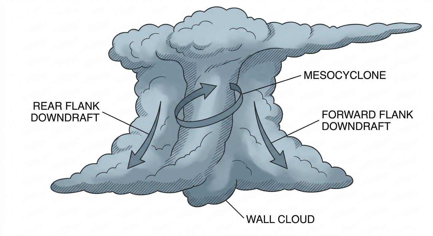
Alright y'all, let's talk about Thursday. September 11th turned into one of those days where the atmosphere had something going on in almost every corner of the country. The headline moment came out of west-central Minnesota right around 7:50 PM Central, when trained spotters confirmed two tornado touchdowns within minutes of each other near Alberta and Artichoke, Minnesota. Eight power poles came down blocking County Highway 9 near Trinity Lutheran Cemetery. That's the kind of report that tells you a strong circulation was on the ground, not just a gusty storm rolling through.
How the Day Unfolded
The day actually started quiet-turned-messy well before the Minnesota storms fired. Early Thursday morning, flash flooding shut down US-33 near Glenville, West Virginia, and stranded a vehicle in central Appalachia. By midday, pulse thunderstorms were rolling through the Southeast, dropping trees on roads in Lugoff and Westville, South Carolina, and near Chase City, Virginia. Atlanta caught the worst of it in the metro area, with 2 to 5 inches of rain closing westbound I-285 at I-85 and flooding sections of GA-400. Mesonet stations out in Jacksonboro, South Carolina, and Dog Island, Florida, both measured over 4.3 inches of rain.
Meanwhile the Desert Southwest had its own show. Monsoonal thunderstorms triggered Flash Flood Warnings with considerable damage tags across the Fossil Creek, Canyon Creek, and Cibeque Falls drainages in Gila, Navajo, and Pima counties, Arizona. Out in southwestern New Mexico, the ASOS station at Deming (KDMN) measured a 68 mph severe thunderstorm wind gust, a legitimate, instrument-verified number, not an estimate.
But the real escalation came late afternoon into evening, when the Storm Prediction Center's attention turned to the Upper Midwest. Severe Thunderstorm Watch 666 went up covering 22 counties in Minnesota and 6 counties in eastern South Dakota, and supercells wasted no time making good on it. Within a couple hours, trained spotters were calling in tornado touchdowns near Alberta and Artichoke, plus separate reports of large trees down blocking County Road 23 near Blue Grass, Minnesota, where spotters flagged possible tornado damage. Chokio, Minnesota, lost power when tree branches came down on lines. Farther north, wind damage near Embarrass, Minnesota, added to the list of trees down and blocked roads across the Duluth forecast area.
What We Can Actually Confirm
- Two spotter-confirmed tornado touchdowns in Minnesota: 8 S Alberta and 7 NE Artichoke, both reported by trained spotters.
- Eight power poles down blocking County Highway 9 near Trinity Lutheran Cemetery, Alberta, MN.
- A separate wind damage report near Blue Grass, MN, noted possible tornado damage, but that event is catalogued as wind damage, not a confirmed tornado. We're not calling it a third tornado until better evidence says otherwise.
- Severe Thunderstorm Watch 666 covered 22 MN counties and 6 eastern SD counties ahead of the tornadic storms.
- Atlanta metro flash flooding closed westbound I-285 at I-85 and flooded GA-400 after 2 to 5 inches of rain.
- Flash Flood Warnings with considerable damage tags issued for Fossil Creek, Canyon Creek, and Cibeque Falls drainages in Arizona.
- A measured 68 mph thunderstorm wind gust at Deming, New Mexico (KDMN).
- Rainfall over 4.3 inches recorded at mesonet stations in Jacksonboro, SC, and Dog Island, FL.
- US-33 near Glenville, WV, was rendered impassable by flash flooding early Thursday, with one vehicle stranded.
- Tree damage and road blockages reported in Lugoff and Westville, SC, and near Chase City, VA.
We want to be straight with y'all on one thing: early chatter suggested three tornado events for the day, but when we went back through the verified spotter reports, only two locations had an actual confirmed tornado touchdown. The third report, near Blue Grass, is wind damage with a possible tornado note attached. That distinction matters. Damage surveys take time, and we're not going to hand out tornado counts or EF-ratings that haven't been confirmed.
Forecast Versus Reality
Here's the honest read. The tornado threat in Minnesota came with real lead time. Severe Thunderstorm Watch 666 was up and covering the counties involved before the touchdowns near Alberta and Artichoke happened, which is exactly how the watch-to-warning pipeline is supposed to work. That's a win worth naming.
What we don't have in front of us is the specific day-ahead outlook language that was issued for Thursday morning before any of this kicked off, so we can't grade the exact risk category call for Minnesota against what actually happened. What we can say is that the overall pattern, a belt of enhanced flow riding across the north-central US behind a Pacific Northwest upper low, is the same broad setup that's still influencing the Plains and Midwest today. This wasn't a one-day fluke. It's a pattern with staying power.
What's Coming Next
As of Saturday morning, the Storm Prediction Center has a Marginal Risk of severe storms today across the central and southern Plains, the Ozark Plateau, and the upper Ohio Valley, mainly large hail up to 2 inches and damaging gusts. That risk slides east on Day 2 into a corridor from western New England through the upper Ohio Valley, catching Columbus, Cincinnati, Pittsburgh, Akron, and Syracuse Sunday afternoon and evening. By Day 3, Monday night, the Marginal severe risk swings back into the central Plains and Upper Midwest, near Omaha, Madison, Des Moines, and Cedar Rapids, which is the same general neighborhood that got hit Thursday night.
On the rain side, the Weather Prediction Center has a Slight Risk of excessive rainfall today across the Ohio Valley and Mid-Atlantic, and that Slight Risk holds over similar ground into Sunday. By Monday, a second Slight Risk corridor lights up across the Midwest and southern Arizona, with forecasters flagging a strong IVT signal into the Upper Mississippi Valley, the kind of moisture transport that produced 7.80 inches on West Des Moines back on September 9th.
Out in the tropics, Post-Tropical Cyclone Lowell got its final advisory in the Central Pacific, so that system is done. Tropical Storm Norbert has weakened some, down to 58 mph as of Saturday, and continues tracking generally westward well off the Mexican coast, no direct US impact expected. Behind it, a new area of low pressure, Invest 97EP, has an 80 percent chance of development in the next two days and 90 percent through the week. We'll keep an eye on that one as it organizes.
Bottom Line
Thursday was a genuinely active day nationwide, but the headline was Minnesota. Two spotter-confirmed tornadoes touched down in the same evening window that a well-timed severe thunderstorm watch had already covered, which is the system working the way it should. Everywhere else, from Georgia's flooded interstates to Arizona's monsoon drainages to that 68 mph gust in New Mexico, showed how one broad upper-level pattern can produce wildly different hazards depending on the local setup. Going into the weekend, that same pattern isn't finished. Watch for hail and wind risk sliding from the Plains into the Ohio Valley, and keep an eye on rainfall totals building again over the Midwest early next week.