Blog Article
October 30, 2026 Severe Weather Recap: Tornado and Floods
A full recap of October 30, 2026: a Kansas tornado report, record flash flooding in Arizona and Nevada, and how the forecast held up against what happened.
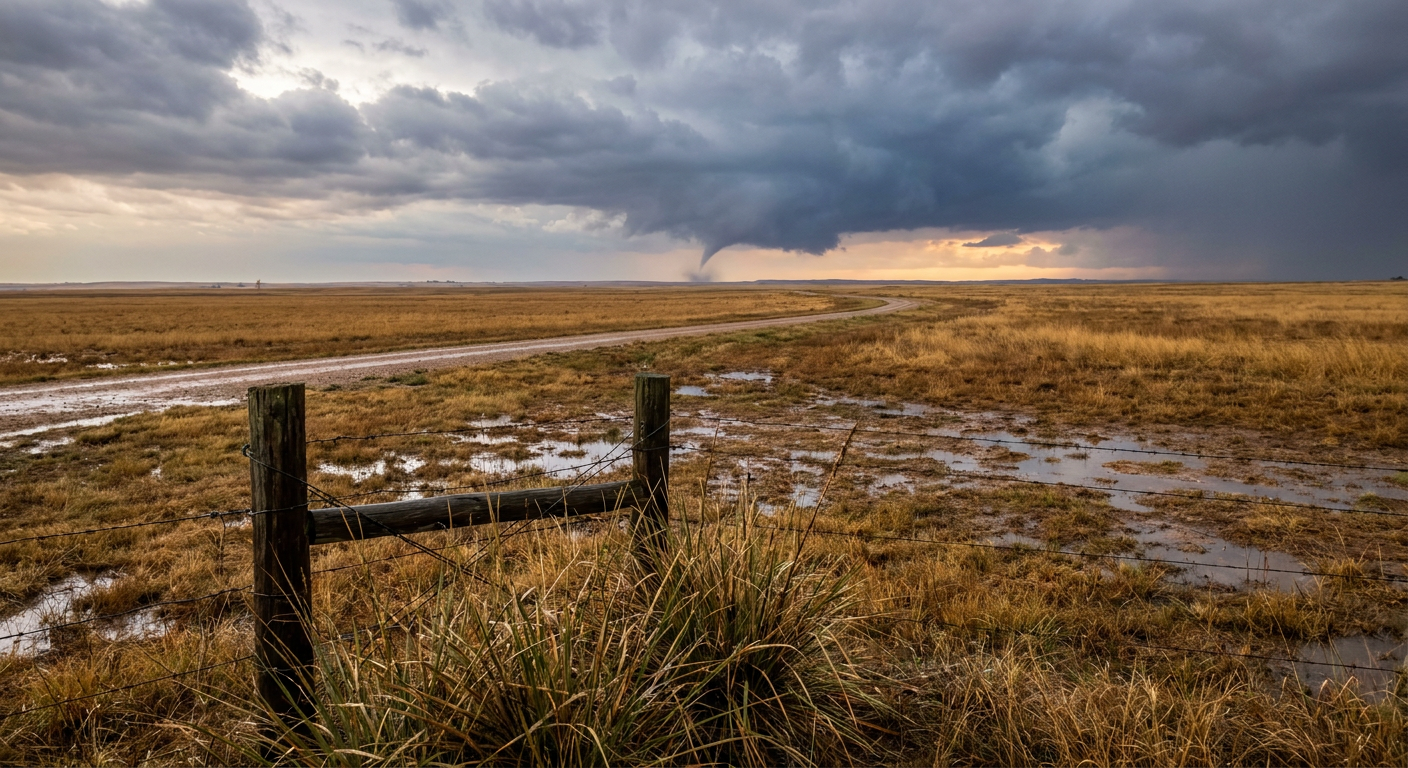
October 30, 2026 Recap: A Kansas Tornado Report, Desert Flash Floods, and the Southwest Soaking Begins
Alright folks, let's talk about yesterday. October 30 wasn't a tornado outbreak day, but it was a flooding day in a bunch of different places at once, and it did produce one confirmed tornado report out of Kansas that's worth walking through carefully.
The Headline Moment
Around 1:45 PM Central, broadcast media and multiple social media accounts, including at least one video, caught a brief tornado touchdown about 5 miles northeast of Marion, Kansas. The National Weather Service office in Wichita logged it as a delayed report, meaning the time and especially the location were estimated off radar after the fact rather than pinned down by a trained spotter on scene. That's honest uncertainty we should pass along to you. There's no damage survey in yesterday's data, so we're not going to slap an EF-rating on this one. It was brief, it touched down, and that's what we can say for sure.
How the Day Unfolded
The day actually started with flooding, not storms chasing headlines. Overnight into the morning, training thunderstorms parked over the Permian Basin and South Plains of West Texas, dropping enough rain to flood streets in Stanton and pond water on roads in Ector and Midland counties. A Flash Flood Warning covered nine counties out there, and at least one report had water over the interstate near Warfield.
Meanwhile, up in northeast Kansas, Marshall, Nemaha, and Shawnee counties got hammered by repeat rounds of heavy rain. Marysville measured 5.50 inches, enough to flood roadways and push water into parks under active Flash Flood Warnings. That's the kind of rainfall total that turns a quiet Thursday into a rough one for anybody near a drainage ditch.
By afternoon the action shifted hard to the Desert Southwest. Severe thunderstorms fired over southern Nevada and central Arizona, and this is where things got serious. In Clark County, flash flooding closed Moapa Valley Boulevard near Overton under 2 to 4 feet of flowing water. Law enforcement also reported an impassable intersection near Laughlin, and in Henderson, East Lake Mead Parkway flooded with mud, debris, and large rocks thick enough that crews said the road would need scraping before it reopened.
The biggest single number of the day came out of Arizona. Sonoran Wash, north of Deer Valley near Phoenix, went from dry to cresting at 6.00 feet, blowing well past its 3.5-foot bankfull stage. A county official confirmed the surge likely flooded the low-water crossing at North Valley Parkway. Law enforcement also responded to flooding along the Colorado River corridor near Fort Mohave, where sand and water covered multiple sections of roadway.
Far from any of that, a mesonet station 16 miles northeast of Paxson, Alaska sat under a High Wind Warning, and tide gauges at Charleston Harbor, South Carolina measured a peak of 7.31 feet MLLW, enough to push into shallow coastal flooding territory on its own, no storm required.
What We Can Actually Confirm
- One tornado report near Marion, Kansas, brief touchdown, location and time estimated from radar, no damage survey released yet
- Marysville, Kansas measured 5.50 inches of rain, with flooded roadways and park inundation
- Nine West Texas counties under Flash Flood Warnings, with street flooding in Stanton and road ponding in Ector and Midland counties
- Sonoran Wash near Deer Valley, Arizona crested at 6.00 feet against a 3.5-foot bankfull stage
- Multiple flash flood road closures across Clark County, Nevada, including Moapa Valley Boulevard, East Lake Mead Parkway, and an intersection near Laughlin
- Charleston Harbor tide gauge hit 7.31 feet MLLW, above the shallow coastal flooding threshold
Forecast Versus Reality
Here's the thing, the Southwest flooding call was a good one. Forecasters had been flagging an atmospheric river digging into the Desert Southwest, and the timing lined up. The Sonoran Wash surge and the Nevada road closures happened right in that overnight window forecasters pointed to as "the real event." That's a case where the meteorology did what the models said it would do, and the warnings got out ahead of it.
The Kansas tornado report is a different story, it wasn't the headline threat going into the day. That's a reminder that isolated severe weather can pop up even on days when the bigger forecast story is flooding, not tornadoes. Nobody batted a thousand here, and that's fine. Forecasting a brief, radar-estimated touchdown ahead of time is tough even in a good setup.
What's Coming Next
The Southwest isn't done. WPC has already bumped the Four Corners region, including the San Juan Mountains of southwest Colorado and parts of southern Utah, up to a Moderate Risk of excessive rainfall for Sunday into Monday, with widespread totals of 2 to 4 inches possible and higher amounts in steep terrain. That atmospheric river that soaked Phoenix and Las Vegas on Thursday is just getting started.
Further east, SPC has a Marginal Risk of severe storms posted for central New Mexico into the Texas Panhandle today, mainly isolated damaging gusts. The bigger watch is Monday, when a Slight Risk covers Oklahoma City, Tulsa, Wichita, and Topeka, with a Marginal Risk stretching south into Dallas-Fort Worth and Kansas City. Out in the Pacific, the National Hurricane Center is watching a broad area of low pressure southeast of Hawaii with a 40 percent chance of development over the next week, nothing imminent, but worth keeping an eye on.
Bottom Line
October 30 was a flash flood day first and a tornado day second. The Southwest atmospheric river delivered almost exactly what forecasters warned about, with Sonoran Wash cresting at nearly double its bankfull stage and Nevada roads closing under feet of fast water. The Kansas tornado report reminds us that isolated severe weather can show up even when the main story is water, not wind. Keep watching the Southwest through the weekend, because the heavier rain event is still ahead, not behind us.