Blog Article
Denver Storms Greet Red Sox in Baseball's Wildest Weather City
An Enhanced severe storm risk targets Denver and the High Plains tonight as the Red Sox visit Coors Field. Here's the hail, wind, and tornado threat explained.
Rockies, Rooftops, and Hail in June: Why the Boston Red Sox Are Walking Into the Stormiest City in Baseball
Alright folks, let's talk about a road trip nobody warned the Boston Red Sox about.
They flew into Denver to play the Rockies tonight, first pitch around 6:40 local. Coors Field, mile-high air, balls flying out of the yard. Classic. Here's the thing though. That same chunk of Colorado got absolutely worked over two days ago. We're talking a measured 113 mph wind gust near Akron, six inches of hail on the roads in Logan County that needed snowplows to clear, and grapefruit-sized hail near Joes. In June. And the atmosphere out there isn't done.
So while the sports world is busy watching Ronaldo, the World Cup, and the Yankees-Tigers game tonight, there's a quieter story unfolding right where a big-league ballgame is about to happen.
The Front Range Is Lit Up Again
The Storm Prediction Center has an Enhanced Risk, that's Level 3 of 5, painted across the central High Plains for today. Denver, Colorado Springs, Pueblo, and Cheyenne are all sitting inside it. That zone covers close to 5 million people.
What does that risk actually mean? A few things, and none of them are subtle:
- Wind: Up to a Level 3 (30%) damaging wind threat, with 75+ mph gusts possible in the strongest cells
- Hail: Up to a Level 3 (30%) severe hail threat, and a hatched zone where stones could reach 2 inches, hen-egg size, or bigger
- Tornadoes: A Level 2 (5%) threat, meaning a few tornadoes are possible if storms get their act together
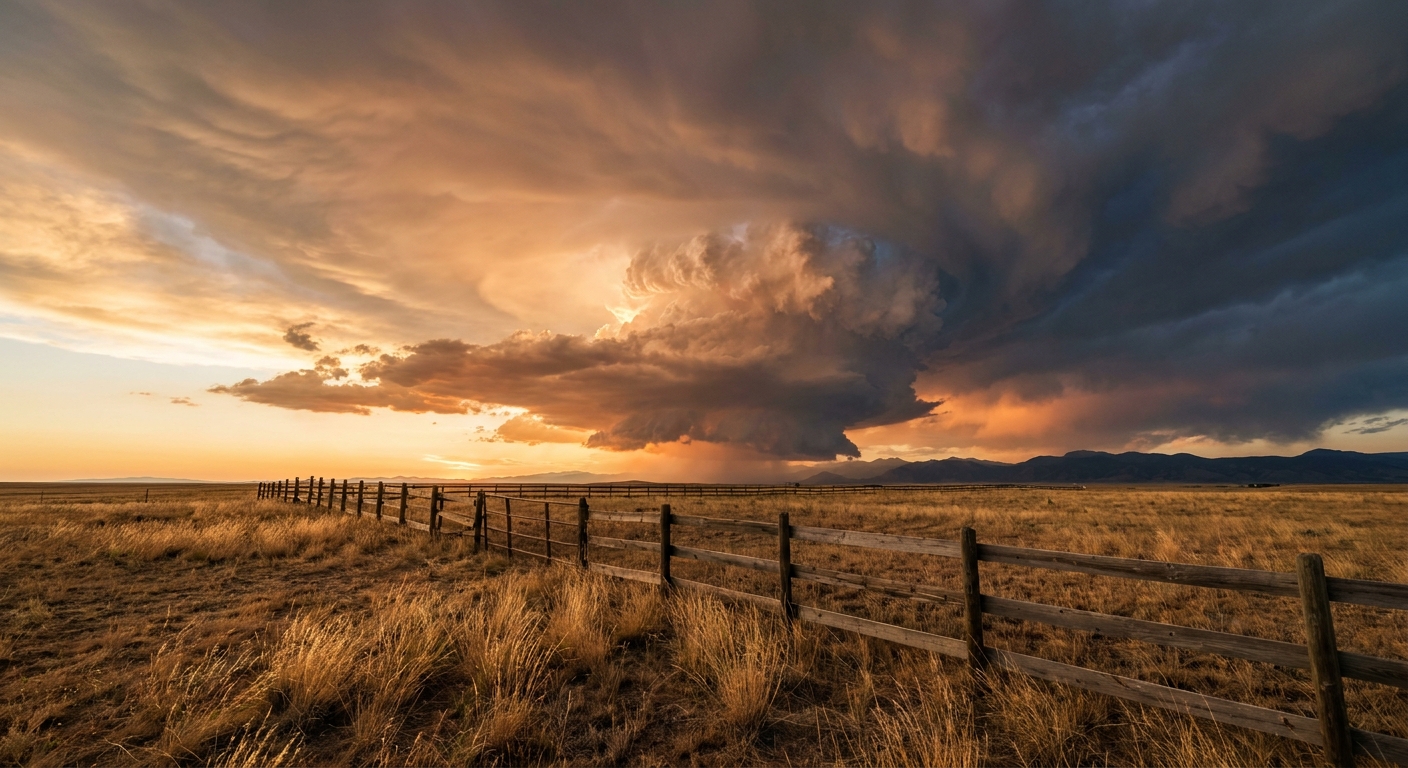
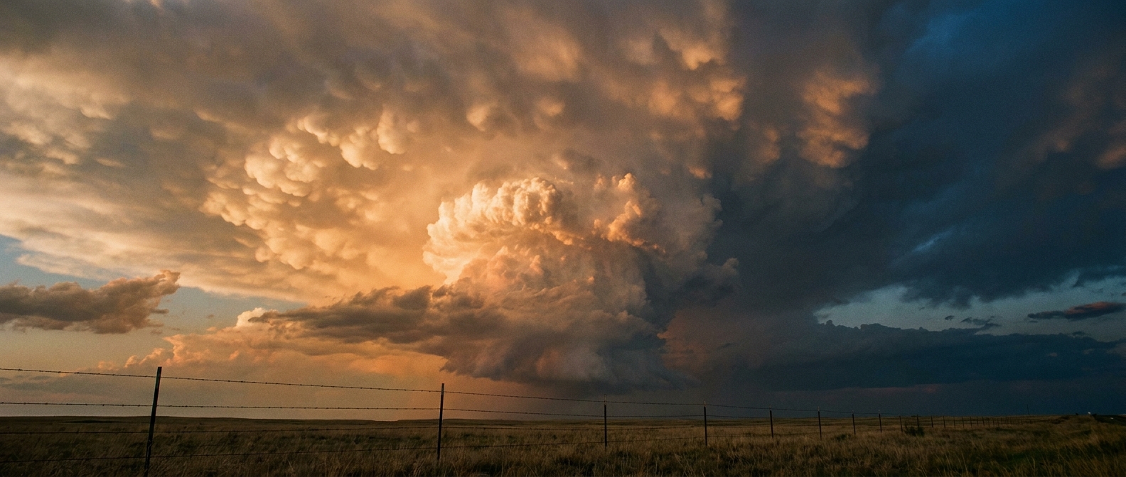
The High Plains has a habit of producing storms that look almost gentle from a distance and then drop hail the size of your fist. Two days ago it did exactly that. The setup tonight has a similar flavor.
Why Coors Field Is a Weird Place to Watch Weather
Here's a fun wrinkle. Denver sits at 5,280 feet. The air is thinner up there, which is why baseballs carry and why the Rockies have always played in a hitter's paradise. But that same elevation messes with how storms behave.
Up on the High Plains, storms often build off the higher terrain to the west, the Front Range and the Palmer Divide, then roll east onto the plains in the evening. That's the late-day timing the SPC is flagging. So a 6:40 first pitch in Denver isn't sitting safely outside the threat. It's sitting right at the front door of it.
Will the game get rained out? I'm not going to promise you that, because storm coverage on the High Plains is scattered and one cell can soak Coors while another misses it by ten miles. But fans heading downtown tonight should keep one eye on the western sky. If you see a hard, crisp tower of cloud building over the foothills with a flat anvil spreading off the top, that's your cue. Those are the storms that drop the big hail.
For June context, Denver's normal high this time of year is about 83 degrees. The heat and instability that feeds these storms is right on schedule. This isn't freak weather. It's June on the High Plains doing what June on the High Plains does.
This Has Been the Whole Month
If you've felt like the central part of the country can't catch a break, you're reading the pattern right. June 2026 has been relentless. A 113 mph gust at Salina, Kansas, on the 8th. Catastrophic flooding from the remnants of Tropical Storm Arthur down in Louisiana and Mississippi, with one spot near 27 inches of rain. A destructive bow echo through Oklahoma City just yesterday with that 102 mph gust. And now the High Plains firing off again.
The ingredients keep lining up the same way: plenty of heat and moisture down low, strong winds aloft, and terrain out west that acts like a launchpad. When those three things stack up day after day, you get exactly what we've been living through.
And it doesn't stop tonight. The Day 2 outlook keeps a Slight Risk over the central and southern High Plains for Wednesday, with the threat sliding a bit west and northwest. There's also a Slight Risk for excessive rainfall stretching from the central Plains down toward the Lower Mississippi Valley, on ground that's already soaked from earlier this week. Out in Utah, it's the opposite problem. Critical fire weather and dry thunderstorms, where lightning can start fires without much rain to put them out.
What This Means for You
If you're one of the folks heading to Coors Field tonight, dress for a quick change in conditions and know where you'd go if the stadium sends people to cover. High Plains storms move fast and hit hard.
If you're anywhere across eastern Colorado, southeast Wyoming, or the Texas and Oklahoma panhandles, today's the day to bring the car under cover if you can. Two-inch hail does real damage to windshields and roofs, and we already watched it happen this week.
And if you're just here for the box score, here's your nugget for the group chat: the Red Sox are playing in the single most weather-active corner of the country right now. The same air that makes Coors Field a home run derby is the air that's been spinning up 113 mph gusts and burying roads in June hail. Same atmosphere. Different outcomes. That's the High Plains for you.