Blog Article
Severe Weather Outbreak: Tornadoes, Flooding, and Snow Update
Tracking an Enhanced risk of severe storms for the Plains and Midwest today, plus heavy snow in Colorado and weekend flooding threats for the South.
Round Two: Severe Storms March East While Colorado Gets Dumped With Snow
Alright folks, let's talk about this massive storm system.
Yesterday was an absolute doozy. We saw a very dangerous PDS tornado near Nash, Oklahoma, and some life-threatening flash flooding over in the Ohio Valley. If you read yesterday's post, you know we were testing out the Storm Prediction Center's new Conditional Intensity Groups (CIG). Well, that system actually verified in a big way.
But here is the thing. This storm is not done with us yet. It is reloading today and pushing further east, bringing a little bit of everything to the table. We are talking severe thunderstorms, heavy mountain snow, and even critical fire danger depending on where you live. Let's break it down.
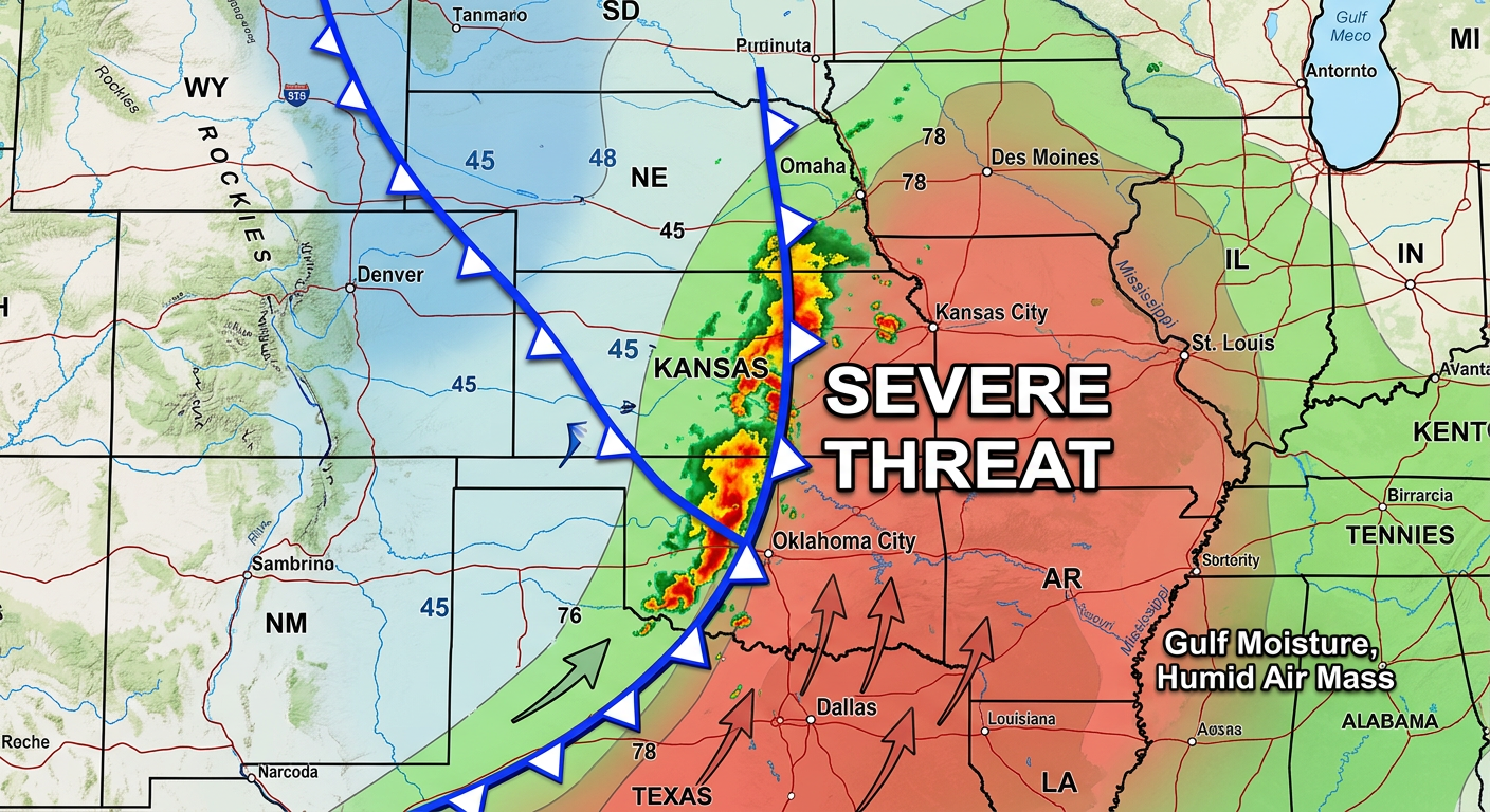
The Severe Threat: Enhanced Risk for the Plains
Get this. The Storm Prediction Center has outlined an Enhanced Risk (that is a level 3 out of 5) for severe weather today stretching from parts of North Texas up through Eastern Oklahoma, Kansas, Missouri, and into southwest Iowa.
If you live in Kansas City, Tulsa, or Springfield, you need to have your weather radio on standby today and tonight.
A strong cold front is crashing into a warm, juicy airmass pulling moisture right off the Gulf of Mexico. This is a classic springtime setup. We are looking at a 30% chance for some massive hail, damaging winds, and yes, the potential for a couple of strong tornadoes.
Shifting Focus to Saturday
By tomorrow, this cold front is going to keep slowly marching east. The severe threat drops to a Slight Risk (level 2 out of 5), but it covers a massive area from Central Texas all the way up through the Lower Mississippi Valley and into the Ohio Valley.
Here is how this impacts your weekend plans. If you are heading out to the massive Rangotsav Holi Festival in Pflugerville, Texas on Saturday, you need to keep one eye on the sky. We could see some discrete supercells popping up with isolated very large hail.
On top of the severe threat, we are really worried about all this water. There is a Slight Risk for Excessive Rainfall right over the ArkLaTex region today and tomorrow. The ground is already saturated from earlier this week. If we get a few of these storms training over the same areas, flash flooding is going to become a major issue really quickly.
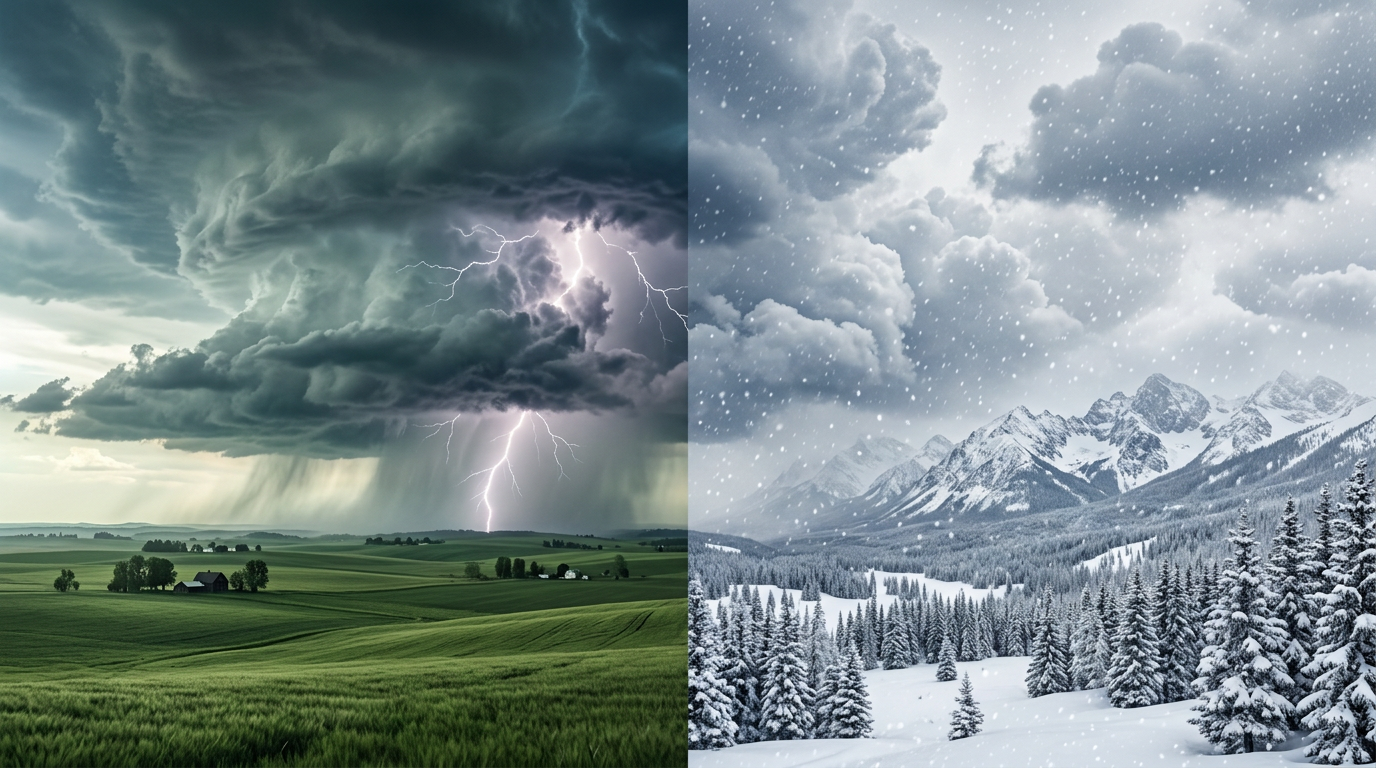
Blizzard on One Side, Fire on the Other
Now, let's talk about the backside of this system. It is a completely different world out west.
If you are in Colorado, you are trading your light jackets for heavy winter coats. We have a powerful upper-level trough digging into the Rockies, pulling deep moisture up the mountains. Snow levels are dropping fast. We are expecting 6 to 12 inches of snow in the Colorado high country. If you are commuting around the Denver metro or the Palmer Divide today, please leave early and take it slow. The snow rates could hit an inch an hour this afternoon.
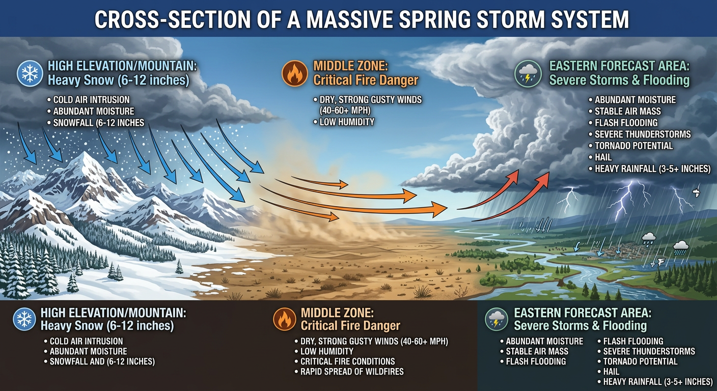
Meanwhile, tucked right in between the snow and the severe storms, we have a Critical Fire Weather area today. The dryline is sweeping through Eastern New Mexico, the Oklahoma Panhandle, and West Texas. We are talking about bone-dry air and southwesterly wind gusts howling across the plains. Cities like Lubbock and Amarillo need to be on high alert. One spark in these conditions will spread incredibly fast.
What to watch for the rest of the week
- The Northwest gets soaked: A progressive northern stream is going to keep slamming Pacific moisture into Washington and Oregon. Expect multiple rounds of mountain snow for the Cascades over the next few days.
- Temperature roller coaster: We are seeing massive temperature swings. As this cold front passes, folks in the Plains are going to swing from AC weather straight back to hoodies, with highs plummeting into the 40s and 50s behind the front.
- Northeast melting: That historic ice storm in the Northeast from earlier this week? It is going to start melting fast as anomalous warmth moves in next week, which could lead to some localized river flooding and ice jams.
The Bottom Line
Y'all, this is a highly dynamic, multi-hazard storm. If you are in the Plains or Midwest, do not ignore the severe weather watches today. Make sure your phones are charged and your weather alerts are turned on loud enough to wake you up tonight. If you are in the path of the heavy rain down south, remember to turn around, don't drown. And if you are out west, respect the snow and the fire danger.
Stay safe, keep an eye on the radar, and we will keep you updated as this massive system rolls across the country.