Blog Article
Heat Dome Builds as Plains Storms Fire, Kentucky Floods Ease
A heat dome strengthens over the central and eastern U.S. into July 4 weekend while severe storms hit the northern Plains and Kentucky's catastrophic flooding finally winds down.
Same Pattern, Different Day: Heat Builds, Plains Storms Fire, and Kentucky Finally Gets a Break
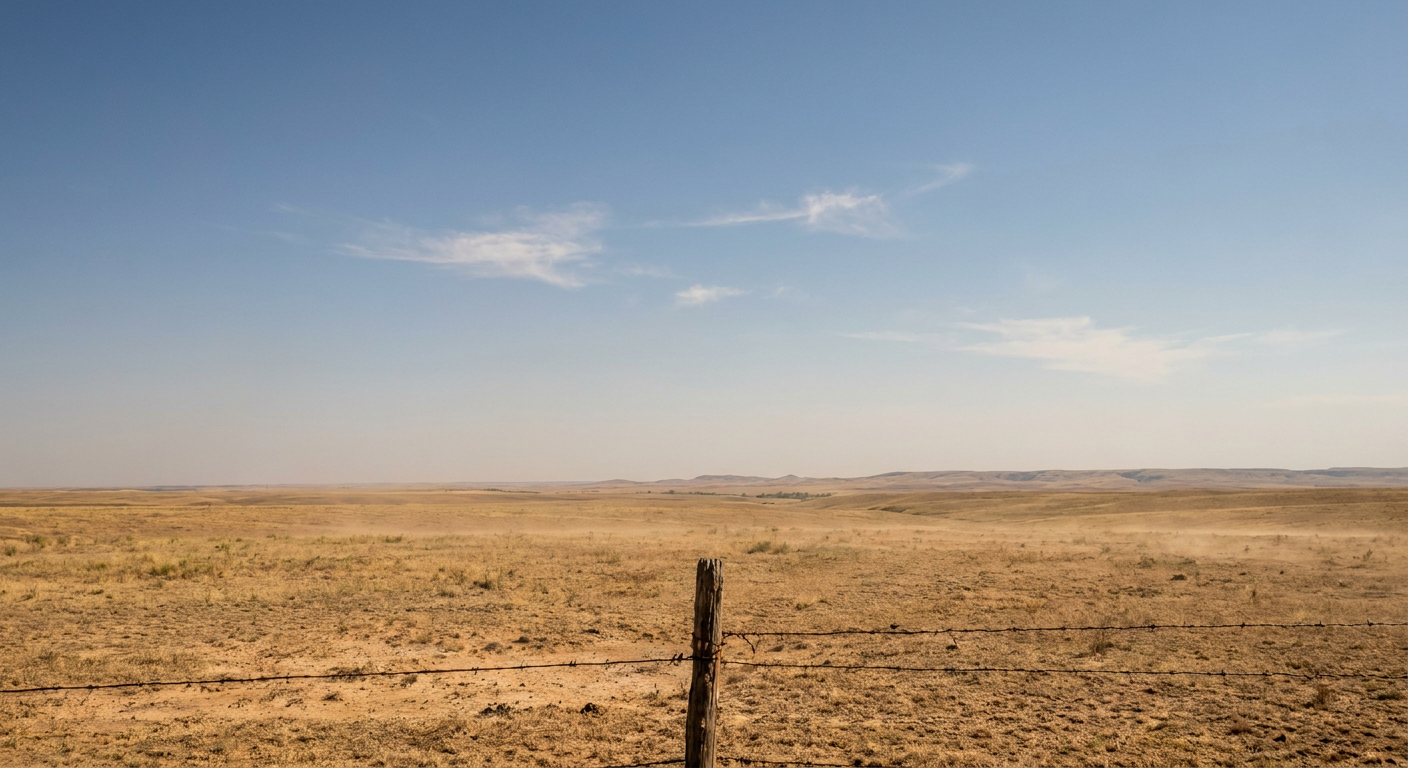
Alright y'all, here's where things stand on this Monday morning. The big-picture pattern hasn't changed much since yesterday, but the pieces are shifting around in ways that matter depending on where you live. A western trough, an eastern ridge, and a moist airmass parked across the middle of the country. That combination is going to keep giving us the same menu for days: heat in the East, storms in the northern tier, and bone-dry fire weather out West.
Let me walk you through it.
The flooding nightmare in Kentucky is finally easing up
First, the good news, because folks in south-central Kentucky and East Tennessee have earned it. The catastrophic rainfall that hammered that region all weekend is winding down. We're talking 10 to 12 inches in spots, a Flash Flood Emergency in Clinton, Cumberland, and Metcalfe counties, a bridge washed away in Cumberland County, and water rescues from Albany all the way into Richmond, Virginia and the Philadelphia metro overnight.
That deep upper low responsible for so much of it is shifting northward now. The Weather Prediction Center has dropped Kentucky and Tennessee out of the excessive rainfall picture for today. The only Slight Risk for excessive rain on the map sits way up in North Dakota, where wrap-around moisture along the Canadian border could still drop locally heavy totals.
If you're in the flood zone, the rain stopping does not mean the danger stops. Creeks and rivers crest after the rain ends, not during it. Saturated ground stays unstable. Watch for that landslide and washout risk on back roads for another day or two.
Today's severe threat: northern Plains into the Upper Midwest
The Storm Prediction Center has a Slight Risk posted today across parts of the northern Plains and Upper Midwest. That covers about 7 million people, with Minneapolis, Sioux Falls, Fargo, Duluth, and Bismarck all inside it. A broader Marginal Risk wraps in Omaha and parts of Iowa and Michigan.
Here's the setup. A shortwave trough is dropping out of the northern Rockies into the Plains, and a surface low is lifting north out of Nebraska. That combination fires storms along the warm front and through the warm sector this afternoon and tonight.
The main threats:
- Large hail. The 15% hail zone covers nearly 7 million people. Inside a hatched area, stones could reach 2 inches, hen-egg size. That's car-denting, window-breaking hail.
- Damaging wind. Same story, 15% scattered wind threat, with the strongest gusts capable of 75 mph or more in the hatched zone.
- A couple of tornadoes. There's a 5% tornado area, Level 2, across eastern North Dakota near the Red River Valley. The hatched zone there means any tornado that forms could reach EF2 strength or stronger. Grand Forks and Fargo, keep your heads up this evening.
This is not the same caliber of event as the destructive bow echoes and 100+ mph wind gusts that rolled through Oklahoma and Colorado earlier this week. But a Slight Risk is still a "have your phone charged and your alerts on" kind of day.
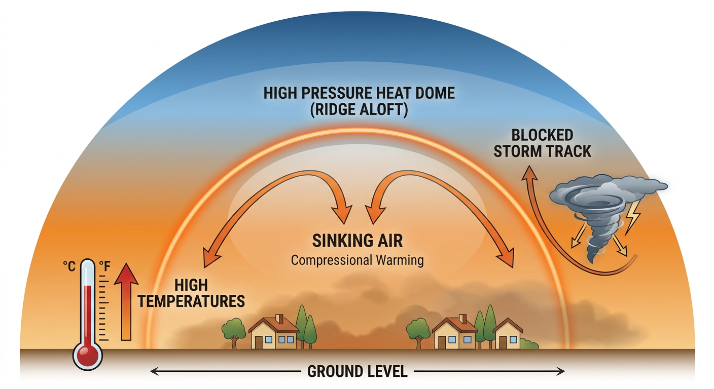
The heat dome keeps building, and the timing is still rough
We talked about this yesterday, and nothing in the data has backed off. That persistent upper ridge is locked over the north-central and eastern U.S., and it's driving a prolonged heat wave right through the holiday weekend. The trending headlines aren't exaggerating: a heat dome pushing toward triple digits across the Midwest and East.
The Climate Prediction Center discussion keeps the broad trough in the West and the ridge in the East through the rest of the week. East of the Rockies, dewpoints climb into the upper 50s to low 70s. That's the part people underestimate. It's not just the temperature, it's the humidity riding with it that makes the heat dangerous and the nights uncomfortable.
For reference, Detroit and Minneapolis both average a high near 79 this time of year. New York sits around 80. When the heat dome cranks up, those cities can run well above normal day after day, and the overnight lows barely drop. That's the setup that wears people down.
There's a packed sports and event slate riding right into this. The Tigers are at Yankee Stadium tonight in the Bronx. The Phillies host the Pirates in Philadelphia, the same city hosting the MLB All-Star Game on July 14. Summerfest Weekend 3 kicks off in Milwaukee on July 2, and Boston Harborfest opens the same day. If you're headed to any of these, plan around the heat. Hydrate before you're thirsty, find shade between innings, and check on the older folks and the little ones.
Out West: critical fire weather builds again
The Four Corners region cannot catch a break. The SPC has a Critical Fire Weather Area posted for tomorrow across northeastern Arizona, northwestern New Mexico, western Colorado, and eastern Utah. That'll be the fourth straight day of sustained 20 to 25 mph winds, relative humidity down in the 5 to 10 percent range, and energy release components running in the 80th to 98th percentile.
If you've been following along, you know how dangerous this region has been. The Cottonwood Fire in Utah grew past 93,000 acres and claimed three firefighters this week. Our weather analog data points to this exact kind of June setup: the 416 Fire near Durango in 2018 burned more than 54,000 acres, and the Missionary Ridge Fire in the 2002 drought torched roughly 70,000. When the air is this dry and the winds this steady, a single spark can run.
If you're in fire country, no open flames, no dragging chains, no parking on dry grass. One careless moment is all it takes.
A note on the tropics and the sky
The Atlantic is quiet for now. The National Hurricane Center is watching a disorganized area of showers off the North Carolina coast tied to a frontal system, but development odds sit at just 10% through the next seven days. Low end. Nothing to plan around yet, but worth a glance if you've got Gulf or Southeast coast plans.
And if you missed it, last night was the Strawberry Moon. Space weather stays mostly quiet, though forecasters note a chance of minor G1 geomagnetic storm conditions late tonight into tomorrow if a CME from last week arrives. That's aurora-watcher territory for the far northern tier, not a disruption for the rest of us.
Bottom line
- Kentucky and Tennessee: The rain is ending, but stay off flooded roads and watch for delayed creek and river rises through tomorrow.
- Northern Plains and Upper Midwest: Slight Risk for severe storms this afternoon and tonight. Large hail and damaging wind are the main players, with an isolated tornado possible near the Red River Valley. Keep alerts on.
- Central and eastern U.S.: The heat dome is here and building through the Fourth. Hydrate, find shade, and pace yourself at outdoor events.
- Four Corners: Critical fire weather again tomorrow. Do not be the spark.
Same pattern, but the details move every day. We'll keep tracking it for you.