Blog Article
Flood Risk Slides South, Storms Target Tennessee Valley
Slight Risk of excessive rain from the Mississippi Valley to the Appalachians over soaked ground, plus severe wind threats in the Tennessee Valley and Carolinas.
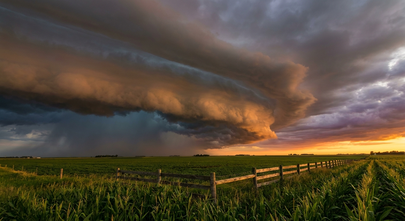
Same Story, New Water: Flooding Risk Slides South While Storms Circle Nashville and the Carolinas
Alright y'all, if you've been following along this week, you know the theme. Water. Too much of it, too fast, over ground that's had all it can hold. Yesterday it was Southeast Missouri, where a mesonet spotter near Oates measured 12.25 inches of rain and forecasters had to pull out a Particularly Dangerous Situation Flash Flood Emergency for Iron and Reynolds counties. Swift-water rescues. Bridge washouts. The real deal.
Today the map calms down a notch, but it does not clear out. Here's where we stand.
The Flood Threat Steps Down, But It's Not Gone
The Weather Prediction Center dropped the Moderate Risk we talked about yesterday. For today, the top tier is a Slight Risk (level 2 of 4) of excessive rainfall stretching from the Mid-Mississippi Valley into the central Appalachians. That's a step down from the Moderate Risk that verified so brutally on Thursday and Friday.
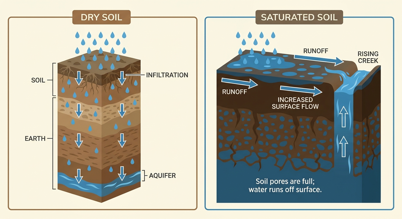
But here's the thing about a step down that still matters. The ground doesn't reset overnight. Places like Paducah, Nashville, and Memphis are sitting on soil that's already saturated. When rain falls on ground that can't soak it up, almost all of it runs straight off into creeks and low spots. That's why the Paducah office is flagging flash flood guidance under an inch in three hours in spots. It doesn't take a 12-inch day to cause problems when you're starting from full.
A cold front is sagging slowly south through the Tennessee Valley and stalling out. Slow-moving fronts are the recipe for training storms, where one cell after another rolls over the same towns like train cars on a track. That's the setup to watch through the afternoon and evening.
Where the Storms Turn Severe
Separate from the flooding, the Storm Prediction Center has a Slight Risk (level 2 of 5) for severe thunderstorms from the Ozarks eastward into the mid-Mississippi and Tennessee Valleys. Nashville, Memphis, Huntsville, and Little Rock are all inside it.
The main threat here is damaging wind. SPC has a 15 percent wind probability, their Level 2 tier, meaning scattered gusts over 60 mph are possible if storms get organized. Hail and an isolated tornado are lower-end possibilities, with the tornado threat sitting at just 2 percent.
On that note, our analog data makes a good point. July severe weather in the Tennessee Valley is usually a damaging-wind story more than a big tornado setup. But tornadoes aren't off the table. Tennessee has logged significant July tornadoes before, including an EF3 back on July 27, 2014. So a wind-focused day still earns your respect.
We saw exactly how a wind-driven setup plays out yesterday across the Carolinas. Dozens of trees and power lines down from Charlotte to Charleston, over 200 customers dark in Greenville, and a camper flipped in Burke County that may have been a tornado. That same corner of the country is on deck again.
Sunday: The Carolinas Take Center Stage
For tomorrow, SPC shifts the Slight Risk to east Georgia and much of South Carolina. Charleston, Columbia, Greenville, and Augusta are the focus. Again, wind damage is the headline threat, with a 15 percent wind probability posted for the Palmetto State.
That matters for anybody with plans. The Washington Spirit play at the North Carolina Courage in Cary this evening, and the Carolinas broadly are in the mix both days. If you're heading to an outdoor event down there this weekend, keep one eye on the sky and have a way to get indoors quick.
By Monday, the risk narrows to a Marginal Risk (level 1 of 5) from northern Florida into South Carolina, and WPC keeps a Slight Risk for excessive rainfall along the central Gulf Coast where training and backbuilding storms can align near the water.
The Heat Behind the Rain
Step back from the storms and there's a bigger pattern at work. A strong upper-level ridge is anchored over the north-central states and building. That ridge is pumping deep Gulf moisture and heat across the central and eastern country, which is exactly why the humidity feels like a wet blanket and the storms keep finding fuel.
Dallas sits right around its July normal of 97 for the high. Nashville near 91, Memphis in the low 90s, all pretty typical for mid-July. The story isn't record heat right now. It's the moisture riding along with it, the stuff that turns an ordinary afternoon storm into a flooding problem.
One bright spot. If you're up across the western Great Lakes into northern New England, a Canadian high is giving you highs near 80, dewpoints in the mid-50s, and clear skies. That's about as good as mid-July gets. The Brewers and Pirates in Pittsburgh and the Yankees at the Nationals in DC should stay mostly comfortable today, though DC sits closer to the muggy zone.
What I'm Watching
- Training storms over saturated ground in the Tennessee Valley and Mid-Mississippi Valley. The flood risk is conditional but real where cells stall.
- Damaging wind gusts across the Ozarks and Tennessee Valley today, then the Carolinas and east Georgia on Sunday. 60-plus mph gusts are the main hazard.
- Flash flood guidance around Paducah, Nashville, and Memphis, where the ground is already full and it won't take much.
- The Gulf Coast Monday, where backbuilding storms could dump heavy rain near the coast.
Bottom Line
The worst of this week's flooding has eased, but don't confuse a step down with an all-clear. If you're in the Tennessee Valley or Mid-Mississippi Valley today, watch for fast-rising water on roads and never drive through a flooded one. If you're in the Carolinas or east Georgia this weekend, the bigger concern is wind that can drop trees and knock out power, same as yesterday. Have a way to get weather alerts, keep your phone charged, and if you've got outdoor plans, know where you'll shelter if a storm rolls up.