Blog Article
Saturday Severe Storm Risk Grows for Ohio Valley, Mid-Atlantic
SPC raises Saturday's severe storm threat for the Ohio Valley and Mid-Atlantic while monsoon flooding continues across West Texas and Arizona.
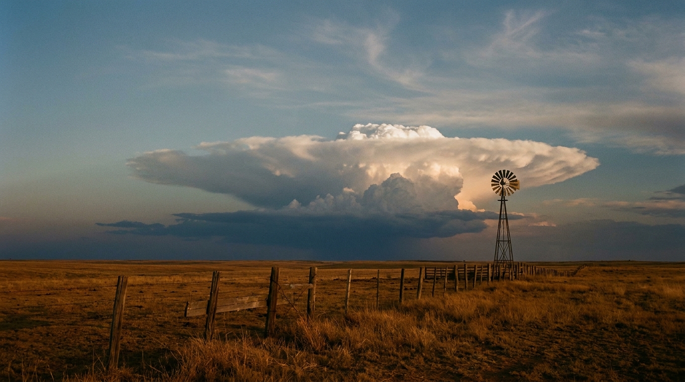
Saturday's Severe Threat Sharpens Over the Ohio Valley and Mid-Atlantic While the Monsoon Keeps Flooding the Southwest
Alright y'all, let's pick up where we left off yesterday. We told you Saturday looked like a day to watch for the Ohio Valley into the Mid-Atlantic, and that system has now slid into SPC's Day 2 outlook with more detail and, frankly, a little more punch behind it.
Saturday's the day, and the numbers went up
SPC has a Slight risk of severe thunderstorms posted for Saturday afternoon through Saturday night, and this one covers a genuinely huge chunk of the East Coast population, about 88 million people between the Slight and surrounding Marginal zones. New York, Philadelphia, Columbus, Indianapolis, and Washington DC sit in the Slight risk. Chicago, Charlotte, Boston, Louisville, and Lexington sit in the Marginal ring around it.
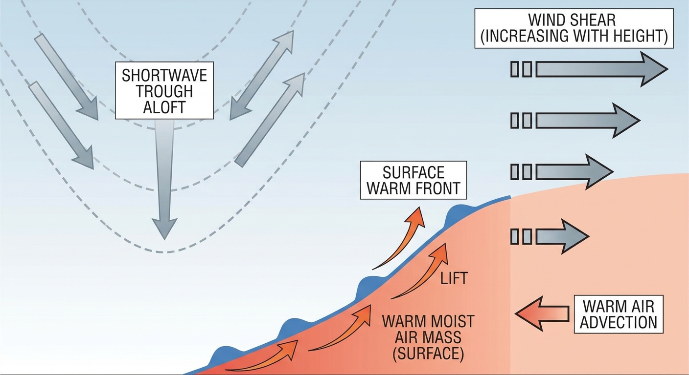
Here's what changed since yesterday: the damaging wind probability jumped to a Level 3, numerous damaging wind threat, at 30 percent. That's the kind of number SPC doesn't hand out lightly. There's also a Level 2 tornado threat now on the table, 5 percent, meaning a few tornadoes are possible, not just an isolated spin-up. SPC's discussion points to an upper shortwave trough amplifying over the Great Lakes and pivoting east across the Ohio Valley, running into a warm front and a moderately unstable, well-sheared airmass. That combination is exactly what you want if you're trying to grow storms that mean business.
If that pattern sounds familiar, it should. Our analog data flagged a real-world echo for this same corridor: July 29, 2021, when four EF2-or-stronger tornadoes tore through Ohio and Pennsylvania. That's not a forecast for Saturday, just a reminder this setup has produced before.
If you're headed to a ballgame this weekend in any of those Slight risk cities, this is a build-in-a-weather-check kind of Saturday. Sunday shifts the target: SPC's Day 3 outlook puts a Slight risk over the Carolinas into southeast Virginia, with Charlotte, Raleigh, Virginia Beach, and Norfolk in that zone as embedded upper-level disturbances roll through. Our analog file also flagged July 19, 2023, when an EF3 tornado injured 16 people in North Carolina almost exactly this time of year. Again, not a forecast, just useful history for a corridor that clearly knows how to produce.
And if you've got plans for Sunday's FIFA World Cup Final at MetLife Stadium in East Rutherford, keep half an eye on this too. WPC's Day 2 excessive rainfall outlook stretches a Slight risk into the northern Mid-Atlantic and southern New York, valid Saturday into Sunday morning. That timing sits right ahead of kickoff. Nothing locked in, but it's on the radar.
The monsoon isn't done with the Southwest, and Texas is still cleaning up
We spent a lot of time this week talking about the catastrophic flash flooding in the Texas Hill Country. Flash Flood Emergencies hit Uvalde, Kerr, Kendall, and Blanco counties, the Bear Creek Road bridge in Kerr County got destroyed, and Coral Ball Ranch measured 30 inches of floodwater. That event is still fresh, and the pattern behind it hasn't left.
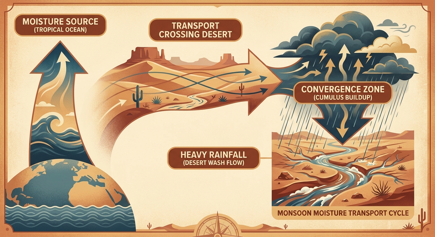
WPC has a Slight risk of excessive rainfall today across West Texas, southern New Mexico, Arizona, and the southern Great Basin, driven by a monsoonal moisture plume with standardized moisture anomalies running 2 to 3-plus standard deviations above normal. That Slight risk holds through Saturday and pushes toward southern Utah too. By Sunday, WPC trims it to Marginal but widens the footprint to include the Florida Gulf Coast and, notably, southeast Virginia and eastern North Carolina, the same general area under Sunday's severe threat.
For West Texas and Arizona, this is the same broad setup that's been running most of the month. San Antonio's normal high this time of year is 96, Dallas sits at 97, and neither city needs extra rain piling onto already saturated ground from earlier this week. If you're in the Big Bend or Hill Country, this isn't a one-and-done system. Give it room to surprise you.
Heat and smoke are the quieter story
Our internal air-mass analysis flags heat as the dominant theme for the Southwest and southern Plains into the weekend, with max heat indices running 99 to 107 degrees. For context, Dallas and Tulsa's average July highs sit at 97 and 94 respectively, so actual air temps aren't wildly out of line for mid-July, but the added humidity in that heat index number makes it feel a good deal worse than a typical summer afternoon.
On top of that, Canadian wildfire smoke is still degrading air quality across the Upper Midwest and Northeast, a story that's been trending in the news and one we've mentioned before this month. If you're in Chicago, Detroit, or the I-95 corridor and you notice a hazy sky or a scratchy throat outdoors, that's the smoke, not just summer haze.
Tropical watch: quiet for now
No named storms anywhere in the Atlantic or Pacific basins as of this morning. NHC is tracking a couple of low-risk disturbances in the eastern tropical Atlantic near the Cabo Verde Islands, both sitting at 20 percent or less through the seven-day window. Out in the Central Pacific, two weak invests (90C and 91C) are spinning at 25 knots with no immediate threat to land. Nothing here needs your attention yet, but it's worth knowing what's out there.
Space weather is a non-story too. SWPC's outlook calls for quiet to unsettled geomagnetic conditions with no G1-or-stronger storms expected through early August. There's a small chance of an M-class solar flare over the next few days, but that's a radio blackout risk for ham operators and aviation, not something that touches your weekend plans.
What we're watching
- Saturday afternoon into evening: Slight risk severe storms from the Ohio Valley into the Mid-Atlantic and southern New England, with a 30% damaging wind threat and a few tornadoes possible
- Sunday: Slight risk severe storms shift to the Carolinas and southeast Virginia
- Ongoing monsoon flooding threat across West Texas, southern New Mexico, and Arizona through the weekend
- Heat indices in the 99-107 range across the Southwest and southern Plains
- Wildfire smoke continuing to affect air quality in the Upper Midwest and Northeast
- WPC's Slight risk footprint creeping into the northern Mid-Atlantic and southern New York Saturday into Sunday, right around World Cup Final timing at MetLife Stadium
Bottom line
If you live between Columbus and Washington DC, or anywhere in that Ohio Valley-to-Mid-Atlantic Slight risk zone, treat Saturday like a real severe weather day. The numbers moved up from yesterday, not down. Sunday, the same general threat drifts south into the Carolinas. And if you're anywhere near West Texas, southern New Mexico, or Arizona, understand the ground is already soaked from this week's Hill Country disaster, and the monsoon isn't backing off. Keep your weather radio or a solid weather app handy through the weekend, especially if you've got outdoor plans tied to any of those regions.