Blog Article
Central Plains Severe Storms & Midwest Flood Risk This Weekend
SPC's Slight Risk targets Kansas Saturday for severe storms while a separate system brings flood-prone rain to the Upper Midwest. Full forecast breakdown.

Saturday's the Day to Watch: Central Plains Severe Weather and a Soggy Upper Midwest
Alright y'all, Friday morning and there's a lot of little stories going on out there, but let's get you the big picture first.
Tropics Watch: Busy Water, Quiet Coastline
The National Hurricane Center is watching two areas in the Eastern Pacific right now, both carrying a HIGH chance of development. One system well southwest of the Baja Peninsula (EP-AREA-2) has an 80% chance of becoming a tropical depression by day seven, and a second area (EP-AREA-3) is sitting at 60% through 48 hours and 80% through the week. Both of these are forecast to track westward, out into open water, away from any landmass. There's also a weak area of low pressure a few hundred miles east of Bermuda that NHC gives just a 10% chance of development, and it's drifting the wrong way for anybody to worry about it.
Bottom line on the tropics: interesting to meteorologists, not a threat to the U.S. mainland right now. We'll keep watching in case that changes.
Saturday's the Real Story: Central Plains Severe Weather
Today (Friday) is a warm-up act. SPC has a Marginal Risk of severe storms stretching from the Carolinas into northern Georgia, plus the mid-Missouri Valley and parts of the Intermountain West. If you're headed to Shaky Knees in Atlanta this evening, keep an eye on the sky. Isolated severe wind gusts are possible late afternoon into the evening, but this is a low-end, "stay aware" kind of risk, not a "cancel your plans" one.
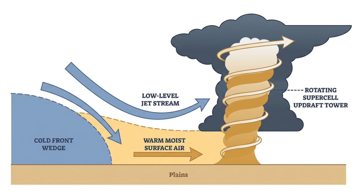
Saturday is a different animal. A cold front sags southward across the Plains, running into warm, humid air that's already in place, and several mid-level disturbances plus a strengthening low-level jet help storms get organized instead of staying messy. SPC has posted a Slight Risk for portions of Kansas and nearby parts of Nebraska, Iowa, and Oklahoma, with a much broader Marginal Risk fanning out across the central High Plains, central Rockies, Midwest, Ohio Valley, and Southeast.
Inside that Kansas Slight Risk zone (Topeka, Emporia, Great Bend, and Ellsworth are the named cities), the setup supports transient supercells and multicell clusters through the afternoon and evening, with a 15% chance of scattered damaging wind gusts over 60 mph and a 15% chance of scattered one-inch-plus hail. That's a level-2 threat on SPC's scale, meaning this isn't isolated, it's a real chance of multiple severe reports.
By Sunday (Day 3), the risk area shifts and shrinks a bit, with a Marginal Risk covering the central High Plains, southern Plains, and Midwest into the Ohio Valley, including Oklahoma City and Tulsa. Mainly a wind and hail threat there, nothing SPC is flagging as widespread.
A Slow, Soggy System for the Upper Midwest
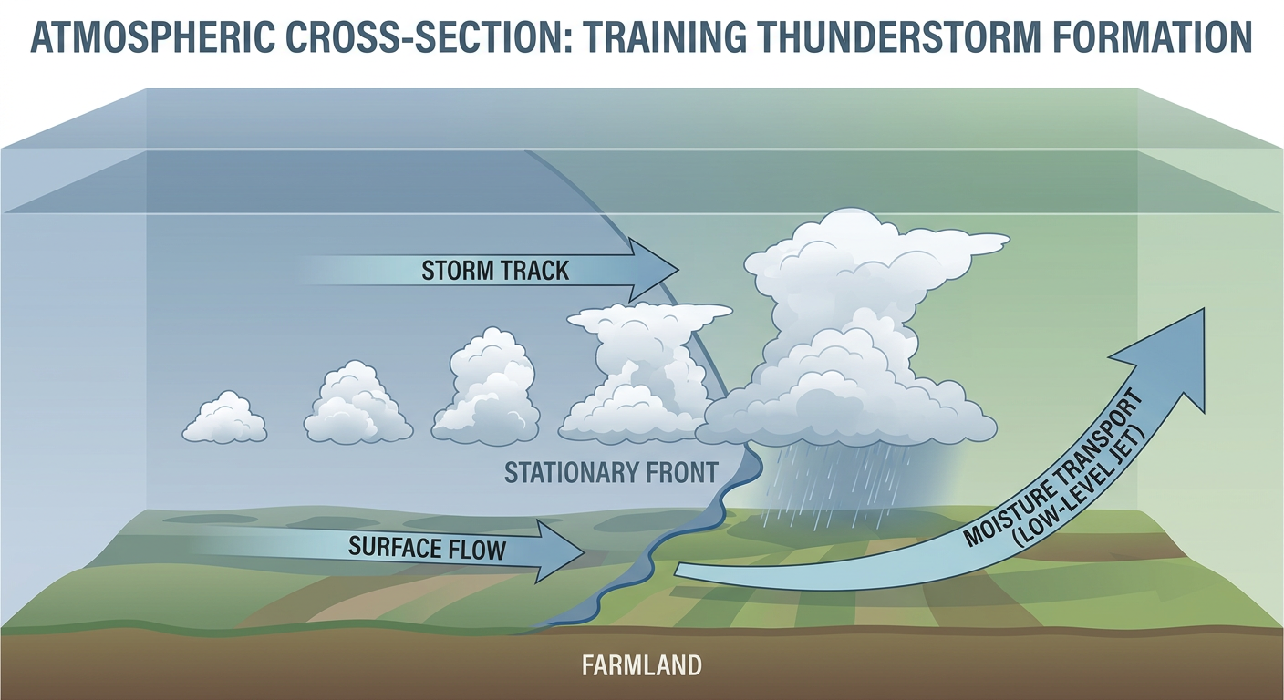
While the Plains deal with severe storms, a completely separate moisture-rich disturbance is set up over the Upper Mississippi Valley. WPC has a Slight Risk of excessive rainfall today into Saturday for that corridor, and it's a multi-day nuisance rather than a one-and-done event. A disturbance tracking from the Dakotas across southern Minnesota into Wisconsin, riding on top of an already moisture-laden atmosphere, is going to produce local downpours tonight into Saturday.
The forecast has 2 to 4 inch rainfall totals in play for the corridor running through southern Minnesota, Wisconsin, northern Illinois, and into the lower Great Lakes, with Milwaukee, Chicago, Minneapolis, Grand Rapids, and Detroit all sitting in or near the zone. If you remember back in early September, West Des Moines picked up 7.8 inches in 24 hours during a similar setup and Walnut Creek hit moderate flood stage. This one isn't forecast to be that extreme, but urban flash flooding is a real possibility anywhere storms train (repeatedly move over the same spot), especially in low-lying city streets and underpasses.
By Sunday into Monday, WPC shifts that Slight Risk into the Ohio Valley and a small slice of the Northeast, as the same general moisture plume gets pulled along by the departing system.
Heat and Fire Weather in Oklahoma and North Texas
High-amplitude ridging is keeping temperatures running well above normal from the southern Plains into the Southeast. Fire weather forecasters are flagging southern Oklahoma into north-central Texas today and tomorrow, with southerly winds of 10 to 15 mph, relative humidity down near 20 to 25%, and highs pushing toward 100°F. For reference, Oklahoma City and Tulsa's average high for mid-September is 84°F, so that's roughly 15 to 16 degrees above normal. Combine that heat with dry, critically stressed fuels (in the 90th to 95th percentile for dryness) and you've got an elevated fire weather day. If you're headed to the Oklahoma State Fair in OKC, plan for genuinely hot conditions plus a marginal chance of storms creeping in by Sunday.
Where the Nice Weather Is
If you want the calm, pretty day, head for the central Rockies and Intermountain West, the Boise-to-Spokane-to-Winslow corridor is enjoying dry air and building high pressure behind a departing upper low. That's good news if you're at the Telluride Blues and Brews Festival this weekend. Most of the rest of the country is dealing with some combination of clouds, humidity, or that Plains/Midwest storminess we already covered.
Space Weather Note
Quick aside for the sky-watchers: SWPC logged a G1 (Minor) geomagnetic storm on the 16th and 17th, driven by a coronal hole high-speed stream, and there's another window of unsettled-to-active conditions possible September 24 through 26. Nothing disruptive, but far-northern latitudes might have caught some aurora the last couple nights.
Key Things We're Watching
- Saturday's Slight Risk in Kansas and nearby Nebraska, Iowa, and Oklahoma for scattered severe wind and hail
- The broader Marginal Risk footprint sliding across the central Rockies, Midwest, Ohio Valley, and Southeast Saturday into Sunday
- Slight Risk of excessive rainfall and potential 2-4 inch totals from southern Minnesota through Wisconsin into the lower Great Lakes
- Urban flash flooding potential in Milwaukee, Chicago, and Minneapolis metro corridors
- Elevated fire weather in southern Oklahoma and north-central Texas with near-100°F heat and low humidity
- Two HIGH-chance tropical development areas in the Eastern Pacific, currently no U.S. threat
Bottom Line
Today's a low-grade watch day for the Carolinas and northern Georgia, but Saturday is when things get real for folks in Kansas and the central Plains. If you live in or near Topeka, Emporia, or Great Bend, keep a way to get warnings Saturday afternoon and evening. If you're in the Upper Midwest, especially Milwaukee, Chicago, or the Twin Cities, watch for that Slight Risk excessive rainfall and don't drive into flooded streets, turn around instead. And if you're heading to the Oklahoma State Fair, load up on water and sunscreen, because it's going to feel like mid-summer out there.