Blog Article
Severe Storms Hit the Ohio Valley & Midwest Temperature Drop
An Enhanced Risk for severe weather covers the Ohio Valley today. Expect large hail, fast-moving storms, and a massive 30-degree temperature drop by Friday.
Severe Storms Take Aim at the Ohio Valley While the Plains Bake
Yesterday we talked about that storm system setting up over the Midwest. Well, today is the day. A powerful cold front is slicing through the region, and it is bringing a little bit of everything. We have severe thunderstorms ahead of it, a massive temperature drop behind it, and howling winds out west.
The Ohio Valley Severe Threat
The Storm Prediction Center has upgraded parts of the Mid-Mississippi and Ohio Valleys to an Enhanced Risk for severe weather today. This covers a large area from Peoria over to Indianapolis, Fort Wayne, and Columbus.
The atmosphere ahead of this front is unusually warm for late March. Folks heading out for Opening Day baseball festivities in Cincinnati will feel that near-record warmth before the storms arrive. As the cold front crashes into that juicy air late this afternoon, discrete supercells will fire up.
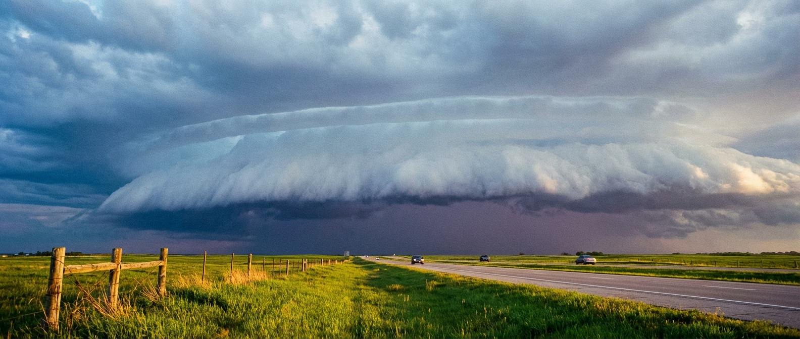
The main hazards are very large hail and severe wind gusts. A few tornadoes are also possible. These storms are going to be moving fast. That rapid movement limits the flash flood threat, but it means you will have less time to react when a warning is issued.
The Big Cooldown
Once that front passes, you will absolutely feel it. We are tracking a 20 to 30 degree temperature drop by Friday. Chicago averages a high of 47 degrees this time of year. They will be lucky to get out of the 30s tomorrow. Dig out the heavy jackets if you have an early commute on Friday.
If you are flying through Northeast hubs like JFK, Newark, or Boston on Friday, plan for delays. The severe storms will weaken into a steady, soaking rain with low cloud ceilings as they hit the coast.
Wind and Fire Out West
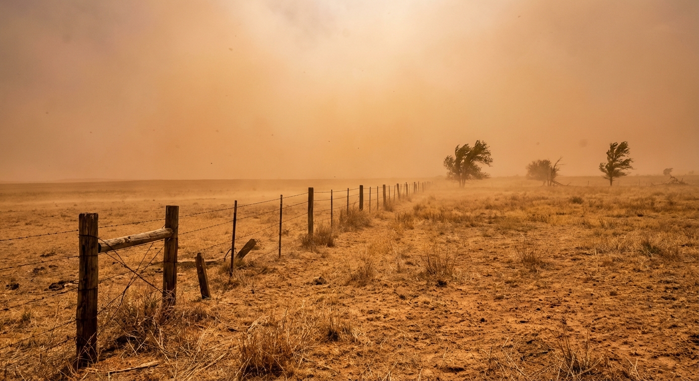
The severe storms are only half the story. Down in the Southwest, a backdoor cold front is surging into New Mexico. The National Weather Service has High Wind Watches posted for the Albuquerque metro. Wind gusts could hit 60 mph through the canyon gaps.
That wind is blowing over incredibly dry ground. The Southern High Plains and central New Mexico are sitting in a Critical fire weather risk area today. We saw temperatures top 100 degrees in parts of Texas and New Mexico yesterday. The brush is bone dry. Any spark will spread rapidly.
Key Items to Watch
- Enhanced Risk: Peoria to Akron faces the highest threat for large hail and tornadoes late this afternoon.
- Fast Storm Motions: Supercells will move quickly. Keep your phone charged and alerts turned on loud.
- Temperature Crash: Expect a 20 to 30 degree drop behind the cold front across the central United States.
- Fire Danger: Critical fire weather and 60 mph wind gusts will impact central New Mexico and the Texas Panhandle.
Bottom Line: Have a reliable way to get weather warnings today if you live in the Ohio Valley or Midwest. If you are out in the Southern High Plains, avoid any outdoor burning and secure your loose patio furniture before the winds pick up.
https://ryanhallyall.com/blog/severe-storms-take-aim-at-the-ohio-valley-while-the-plains-bake