Blog Article
Severe Storms in Mid-South, Heavy Snow in Rockies Today
A powerful spring storm system brings a threat of large hail and tornadoes to the Mid-South today, while heavy, wet snow continues to pile up in the Rockies.

We talked yesterday about a massive clash of seasons taking place across the country, and that pattern is fully locked in today. While folks up in Illinois are still cleaning up from those wild, zero-visibility dust storms yesterday, we have a very active setup taking shape across the southern half of the country.
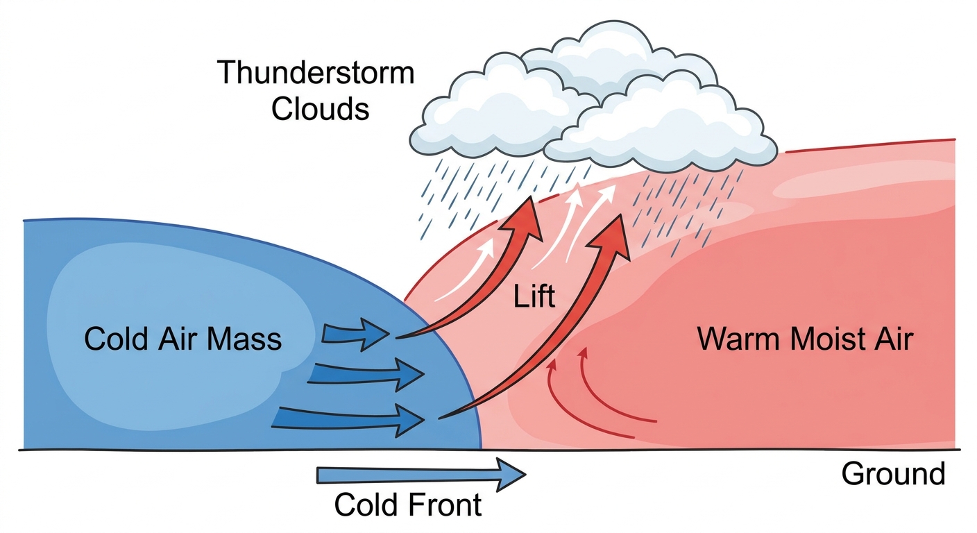
Here is the setup. That same upper-level trough bringing heavy snow to the Rockies is pulling a ton of Gulf moisture northward. When that cold, dry air out West crashes into the warm, juicy air over the Plains, you get fireworks.
Severe Storms Fire Up Today
The Storm Prediction Center has a Level 2 out of 5 Slight Risk centered right over Arkansas today. This stretches down into northeast Texas and up into western Tennessee. If you live in Dallas, Little Rock, or Memphis, you need to be paying attention this afternoon and evening.
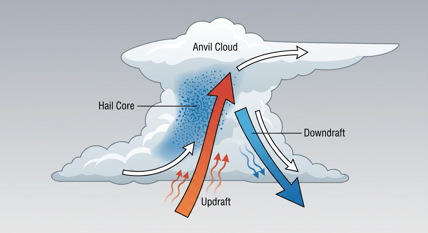
The atmosphere is primed for discrete supercells before things eventually merge into a line. The main things we are watching are large hail and damaging winds. And when I say large hail, the data shows the potential for hailstones over two inches in diameter. That is hen-egg size, big enough to dent your truck or bust a windshield. We also have a hatched risk for tornadoes today, meaning a few strong tornadoes are absolutely possible if these storms can stay by themselves and tap into the available energy.
The Threat Moves East on Wednesday
By tomorrow, this whole system slides east. The severe threat will cover a large chunk of the Deep South, from Shreveport over to Jackson and up into Birmingham. Again, we are looking at a Level 2 Slight Risk with all hazards on the table, including large hail and a couple of tornadoes.
But tomorrow also brings a heavy rain threat. The Weather Prediction Center has highlighted the interior Southeast for a Slight Risk of excessive rainfall. These storms might start training, which means they just line up and move over the exact same areas like train cars on a track. We could easily see 3 to 5 inches of rain in some spots, so flash flooding is a real concern for your Wednesday evening commute.
Winter Hangs On in Denver
While the South deals with severe weather, the Rockies are still stuck in winter. The New York Mets are scheduled to play the Rockies in Denver again today and tomorrow. Normally, Denver hits about 71 degrees this time of year. Instead, they are looking at heavy, wet snow, and I would not be surprised to see some delays at the ballpark.
The foothills of Colorado and Wyoming could see 1 to 3 feet of snow before this is all over. This is that heavy, cement-like spring snow that snaps tree branches and takes down power lines because the trees already have their leaves back. If you are driving on I-25 or I-80 over the next 24 hours, expect some serious delays and slick spots.
The Bottom Line
If you live in the Arklatex or Mid-South, have a way to get warnings tonight that will actually wake you up. Keep your phone charged and park your car in the garage or under a carport if you can to protect it from the hail. For folks out West, give yourself extra time on the roads today and prepare for some localized power outages.
https://ryanhallyall.com/blog/severe-storms-target-the-mid-south-while-winter-grips-the-rockies