Blog Article
Enhanced Severe Risk Today, Massive Temperature Crash Tomorrow
A powerful spring cold front brings an Enhanced Risk of severe storms to the Midwest today, followed by a 30-degree temperature drop and a hard freeze.

Severe Storms Today, Shivering Tomorrow
We talked about this massive spring front yesterday, and now it is officially knocking on the door. If you are heading to Wrigley Field tonight for the Mets and Cubs game, you might want to pack a heavy poncho and a lot of patience. This system is not messing around, and it is bringing a little bit of everything to the middle of the country today.
The Friday Severe Setup
The Storm Prediction Center has an Enhanced Risk posted for today. That is a level 3 out of 5 on the severe weather scale, and it covers a huge chunk of real estate from Wisconsin all the way down into northern Oklahoma. Cities like Chicago, Kansas City, and Tulsa are right in the thick of it.
Here is how this is going to play out. Early this afternoon, the atmosphere out ahead of the cold front is going to destabilize. We will likely see discrete supercells pop off first. That is our window for large hail and a few strong tornadoes, especially across Iowa, Illinois, and Wisconsin. By this evening, those individual storms are going to merge into a solid line pushing east. Once that happens, the main threat shifts to widespread, damaging straight-line winds.
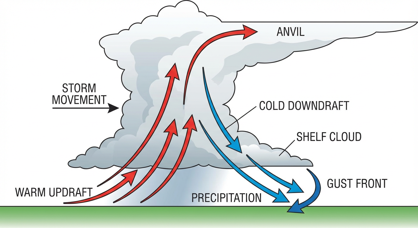
We also have a flash flood threat to watch. The ground from Oklahoma up through the Midwest is already soaked from storms earlier this week. The Weather Prediction Center has a Slight Risk for Excessive Rainfall in this corridor today. These storms are going to dump heavy rain over areas that simply cannot hold any more water.
Extreme Contrasts
It is wild how different the threats are depending on which side of this system you are on. Out ahead of the front, we have severe storms and flooding. Behind the dryline in the Texas Panhandle and eastern New Mexico, it is bone dry. We have a Critical Fire Weather risk out there today. Wind gusts could hit 60 mph around Amarillo. If a spark catches in those dry fuels, it is going to spread incredibly fast.
Then there is the temperature crash. This cold front is going to drastically change how it feels outside. We are looking at a 30-degree temperature drop behind this system. Chicago usually sees highs around 59 degrees this time of year, but they are going to be shivering in the 40s by tomorrow.
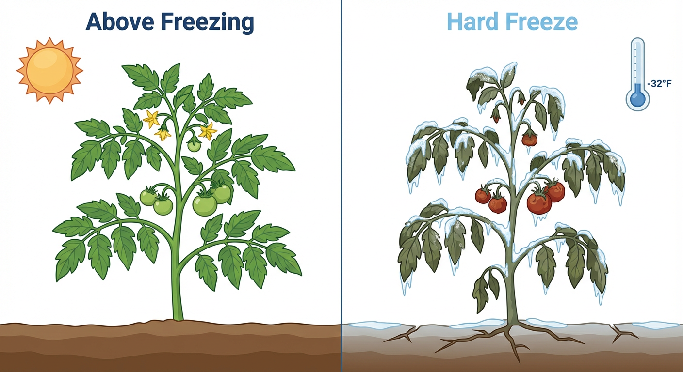
Out west, it gets even colder. Denver and Amarillo are staring down a hard freeze tonight. Denver's normal low for mid-April is around 33 degrees, so this is a significant late-season chill. If you got excited and planted your spring garden early, you need to cover those sensitive plants tonight.
Saturday's Shift East
By Saturday, the severe threat shifts into the upper Ohio Valley and the lower Great Lakes. The SPC has a Slight Risk, a level 2 out of 5, for places like Columbus, Cleveland, and Pittsburgh. The main threats there will be damaging winds and some hail, though extensive cloud cover from today's storms might limit how unstable the air gets.
Down south, the front is going to slow down and stall out. That is going to squeeze out a lot of moisture over the Gulf Coast. Houston and Beaumont need to watch out for urban flash flooding Saturday evening as heavy rain sets up over the metro areas.
Bottom Line
- Midwest and Plains: Have multiple ways to get warnings today. Make sure your phone is charged and your weather radio is on. If you are going to an outdoor event tonight, know where your nearest sturdy shelter is.
- Texas Panhandle and New Mexico: Avoid any outdoor burning. The fire danger is critical today.
- High Plains and Rockies: Cover your sensitive plants tonight. The hard freeze will damage them if they are left exposed.
- Ohio Valley: Keep an eye on the forecast for Saturday afternoon as the severe threat moves your way.
https://ryanhallyall.com/blog/severe-storms-today-shivering-tomorrow