Blog Article
Weather Update: Northeast Clipper, Rockies Snow & Central Warm-Up
A fast-moving clipper hits the Northeast while heavy snow buries the Rockies. Plus, a warm-up for the Central US before the next storm system arrives Friday.
Snow Machines West & East, Plus a "False Spring" Warm-Up
Alright folks, happy Tuesday. It is February 10, and if you have been following along, you know the weather map has been looking a bit like a chaotic abstract painting lately. Yesterday we had Arctic air in the East and fire weather in the High Plains. Today, things are shifting gears again.
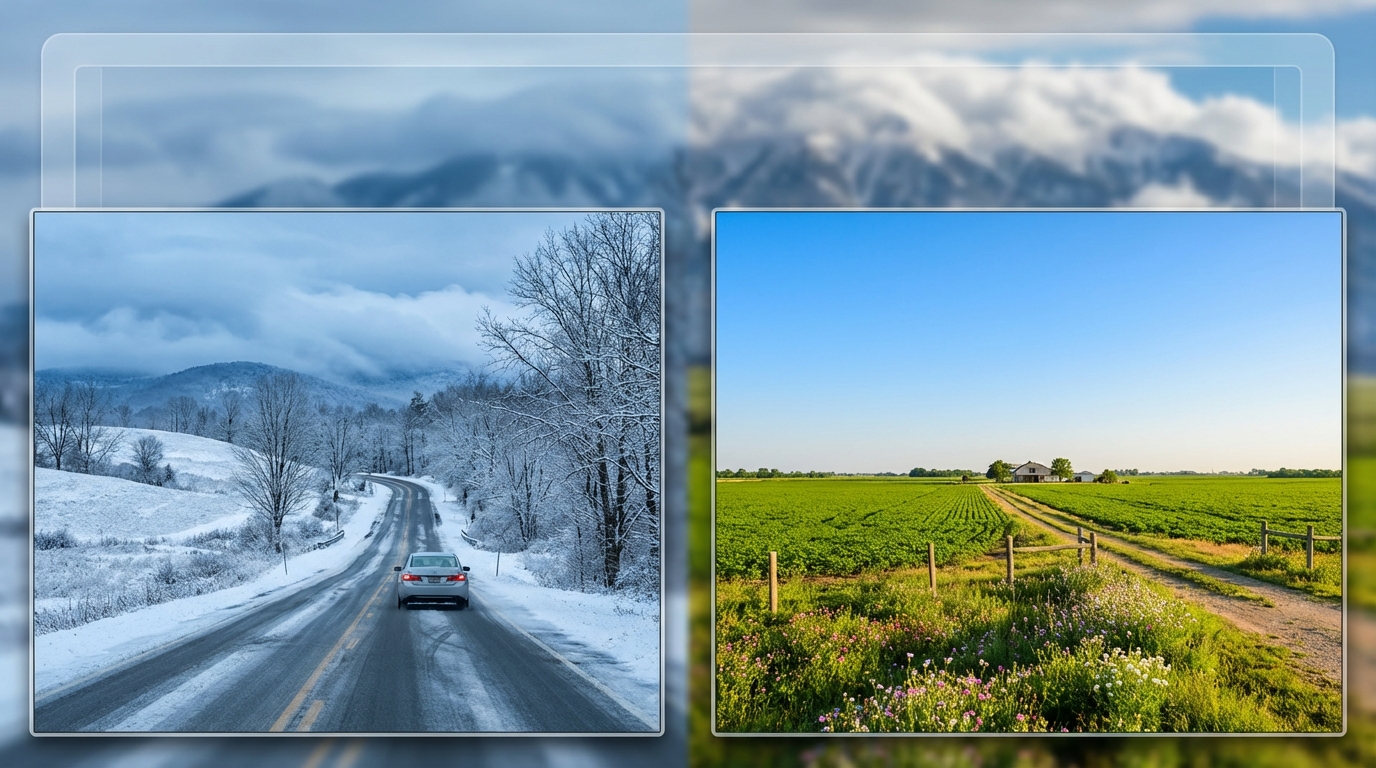
Here is the thing. We are seeing a classic "battle of the air masses" week. The deep freeze is retreating, but it is leaving some parting gifts for the Northeast, while the West Coast is keeping the snow machine running full tilt. Let's break down what you need to know for your commute, your ski trip, and your Valentine's Day weekend plans.
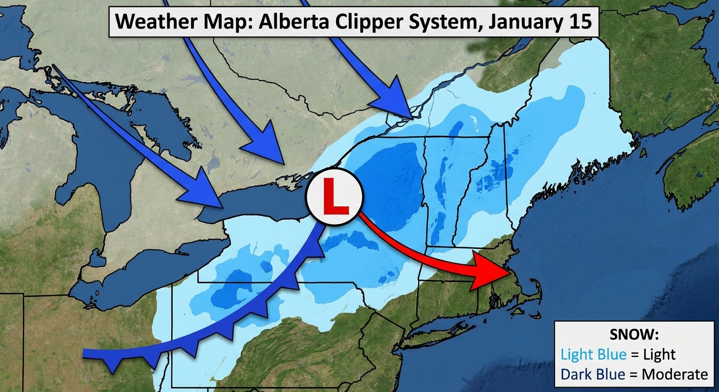
The Northeast "Clipper": Fast & Sneaky
If you are in New England or interior New York today, you are probably seeing snowflakes flying. This isn't a massive Nor'easter, but it is a classic "Alberta Clipper." These systems move fast, like a bowling ball sliding across the northern tier of the country.
What to expect:
- Accumulation: We are talking moderate snow for the interior. Places like Western NY and parts of New England could see enough to slick up the roads.
- The Lake Effect: As this system exits, it is dragging cold air over the Great Lakes. That means if you live southeast of Lake Erie or Ontario, the lake effect snow machine is turning on. Watch out for rapid visibility drops if you are driving.
- The Chill: Behind this system, we get a reinforcing shot of cold air. It's not the -30 wind chills we saw yesterday in PA, but it's definitely "keep the heavy coat" weather.
The West: Powder Days & Mountain Travel
While the East deals with nuisance snow, the West is getting the heavy stuff. That Pacific moisture plume we talked about is pushing inland. It is slamming the Sierra Nevada and moving into the Great Basin and Rockies.
For my skiers out there, this is great news. We are seeing reports of solid accumulation in the high country of Wyoming, Utah, and Colorado. I saw that American skier Ben Ogden just broke a 50-year medal drought, and if you are inspired to hit the slopes, conditions in the Rockies are looking prime.
However, for travelers:
- Sierra Nevada: Heavy snow continues. Chains are likely required on the passes.
- Rockies (WY/UT/CO): Winter Weather Advisories are up. Expect 12 to 16 inches in the Snowy Ranges. If you are driving I-80 or I-70 through the mountains, take it slow.
The Central U.S. Warm-Up (And What Comes Next)
Get this. Yesterday, parts of the Plains were dealing with critical fire danger and wild temperature spreads. Today and tomorrow, we are seeing a massive ridge build over the Central U.S.
We are going to see temperatures rebound significantly. The Texas Panhandle is jumping back into the 60s. It is going to feel like spring for a minute in the middle of the country. But don't put the hoodies away just yet.
The Friday System
We are already watching the next playmaker. By Friday, a strong shortwave is going to dive into the Southwest. This is going to interact with Gulf moisture returning to Texas and the Deep South.
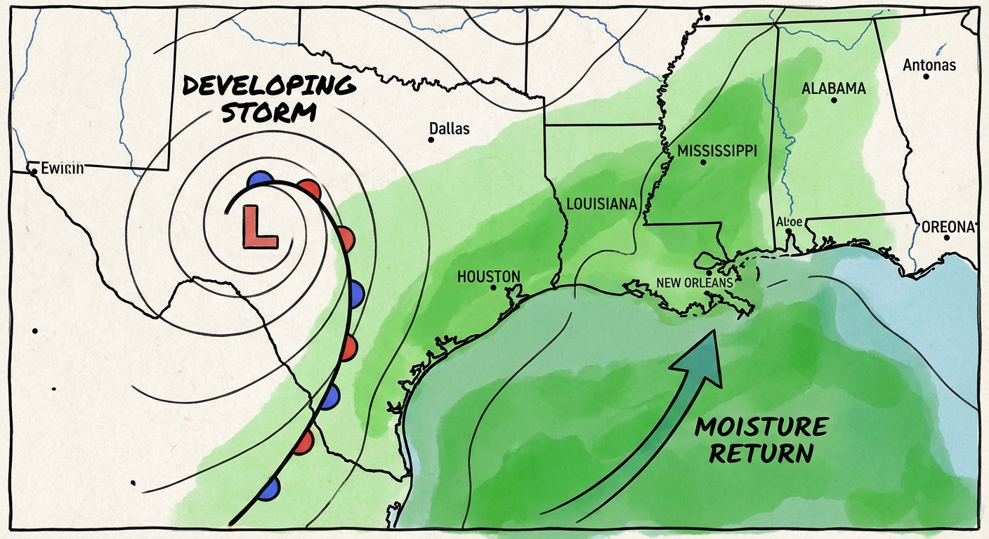
The Bottom Line for the South:
- Friday/Saturday: We are looking at rain returning and potentially some low-end severe weather for Texas and the Lower Mississippi Valley.
- Uncertainty: The exact track is still wobbling in the computer models, but if you have outdoor plans for Friday night or Saturday (maybe early Valentine's celebrations?), keep an eye on the forecast.
Space Weather Bonus
One last thing before I let y'all go. The sun has been active lately. We have a high chance (65%) of M-class flares continuing through mid-week. While the geomagnetic storm risk is fading a bit, don't be surprised if radio signals are a little static-y or if you see some cool aurora photos popping up on your feed from our friends way up north.
Bottom Line:
If you are in the Northeast, watch for slick roads tonight. If you are in the Rockies, enjoy the snow but drive safe. And for everyone in the Central/South, enjoy the warmer temps, but keep an eye on that Friday system. It's loading up to be a wet start to the weekend.
Stay safe out there, y'all!
https://ryanhallyall.com/blog/snow-machines-west-east-plus-a-false-spring-warm-up