Blog Article
SoCal Thunderstorms & Plains Fire Danger: Post-Holiday Weather Update
Severe storms target Los Angeles while 'Extremely Critical' fire danger threatens the Plains. Plus, a winter storm eyes the Midwest. Get the full breakdown.
SoCal Thunder & Plains Fire: The Post-Holiday Weather Whiplash
Alright folks, I hope y'all had a relaxing Presidents Day weekend. Whether you were glued to the TV watching Michael Jordan's team take the Daytona 500 or just enjoying an extra day off, the weather has been absolutely relentless. And here is the thing: it is not slowing down just because the long weekend is over.
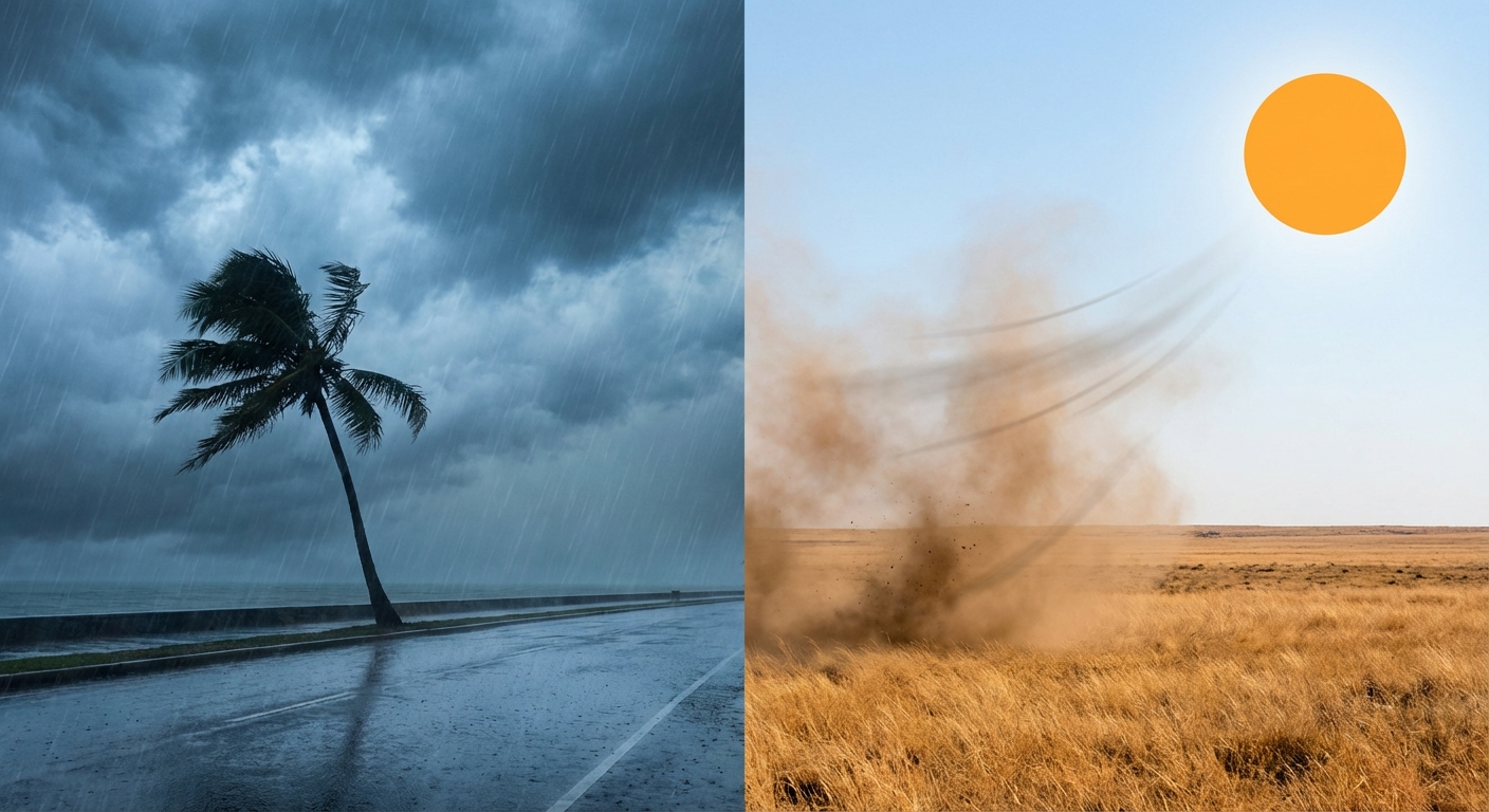
We are looking at a classic case of weather whiplash today. We have gone from watching snow pile up by the foot in the mountains to tracking thunderstorms on the coast. Let's break down what is happening right now and what is coming down the pike for the rest of the week.
California: From Snow-nami to Severe Storms
If you are in Southern California, keep your head on a swivel today. We are seeing a pattern shift that is bringing a Marginal Risk (Level 1 out of 5) for severe thunderstorms directly to the coast. This includes Los Angeles, San Diego, and Long Beach.
Now, I know what you're thinking. "Thunderstorms in LA?" It happens, and today the ingredients are there. The Storm Prediction Center is watching for damaging wind gusts and there is even a non-zero chance (about 2%) of a brief tornado or waterspout coming ashore. It is not a massive outbreak, but it is enough to make your evening commute messy.
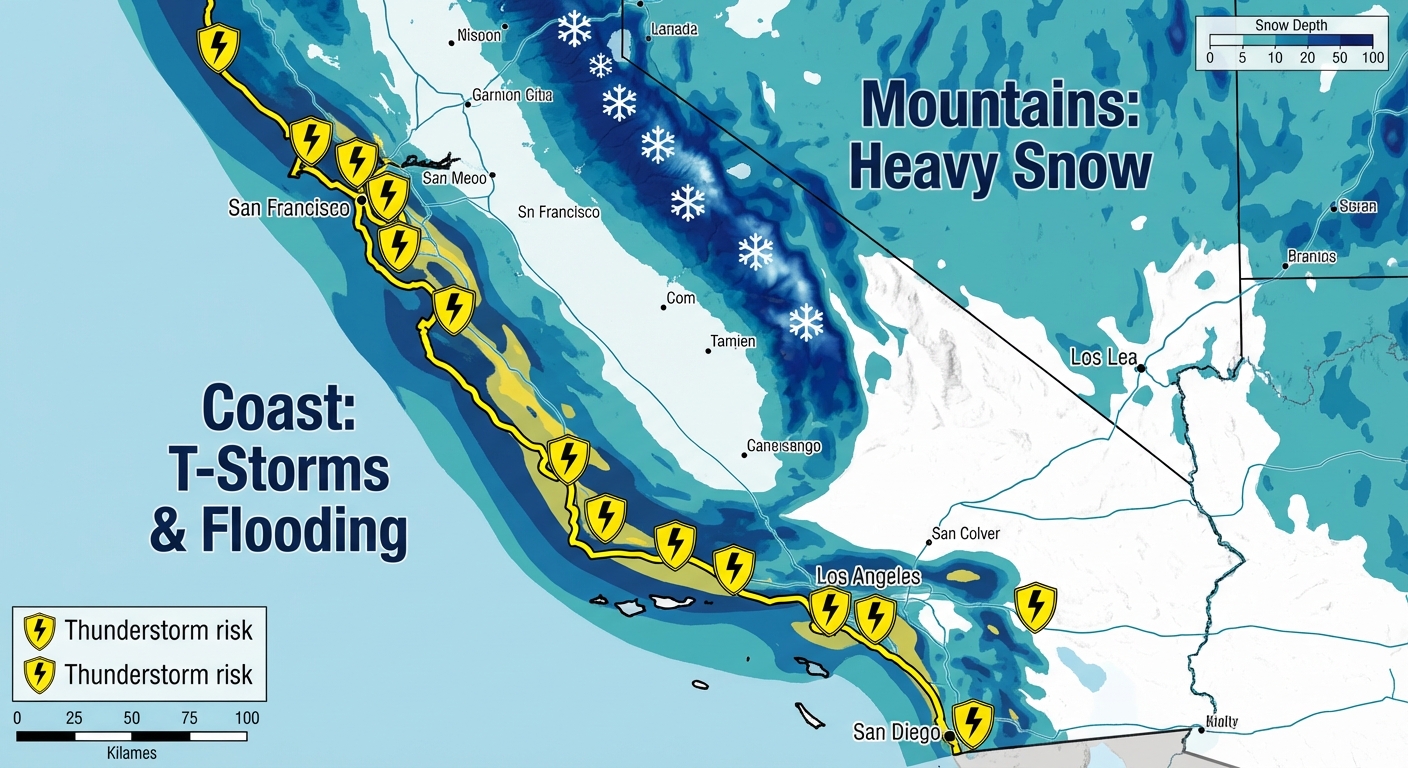
On top of the thunder, the ground is already soaked. The Weather Prediction Center has a Slight Risk for excessive rainfall today. If you are near a burn scar or a steep hillside, watch out for mudslides.
And get this: the cold air with this system is diving deep. Snow levels could drop as low as 1,000 to 2,500 feet. That means major travel arteries like the Grapevine (I-5) could see accumulating snow. If you are driving back home from a holiday trip today, check the road conditions before you go. You do not want to get stuck on a mountain pass in a hoodie.
The Plains: A Dangerous Fire Setup
While the West is dealing with too much water, the Central Plains are dealing with bone-dry air and howling winds.
For tomorrow (Tuesday), the fire danger is ramping up to scary levels. We are looking at an "Extremely Critical" fire weather area for parts of Northeast Colorado, Southwest Nebraska, and Northwest Kansas. That is the highest risk level the SPC issues, folks.
We are talking about wind gusts hitting 60 to 70 mph combined with humidity dropping near 15%. If a fire starts, it is going to move fast—faster than you can run. If you are in the Texas or Oklahoma Panhandles, you are also under the gun for high winds and blowing dust. Keep those cigarettes in the car and definitely do not burn any brush tomorrow.
Midwest: Winter is Reloading
Looking ahead to mid-week, winter is about to remind the Upper Midwest that it is still February. A deep low-pressure system is developing that looks to dump over a foot of snow in the Minnesota Arrowhead.
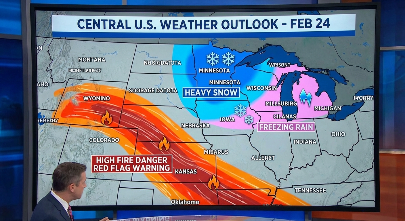
Northern Wisconsin and Michigan could see a nasty mix of freezing rain and icing. This isn't just "pretty snow"—this is the kind of heavy, wet glop that snaps tree branches and knocks out power. If you are in these areas, Tuesday and Wednesday are going to be your "stay inside and make chili" days.
Also, keep an eye on the Ohio Valley for Thursday. Moisture is streaming back north, and we might see some strong storms popping up around Indiana, Kentucky, and Ohio.
The Bottom Line
Here is what you need to know to stay safe:
- SoCal Residents: Have a way to get warnings today. If a storm warns, treat it seriously. Watch for flooding on the roads.
- Travelers: If you are driving I-5 in California or I-80 in the Plains, expect delays. Snow in the west and high winds in the plains will make high-profile vehicles dangerous.
- Plains Folks: Tuesday is a "no burn" day. Period. Secure loose outdoor furniture because the wind will be howling.
- Upper Midwest: Get your errands done today before the ice and snow arrive Tuesday night.
Stay weather aware, y'all!
https://ryanhallyall.com/blog/socal-thunder-plains-fire-the-post-holiday-weather-whiplash