Blog Article
Week Ahead: South Texas Flood Rain, Western Snow Nov 9
South Texas flood rain winds down Monday, then Pacific storms bring rain and mountain snow to the Northwest and Rockies. Day-by-day forecast for Nov 9 to 15.
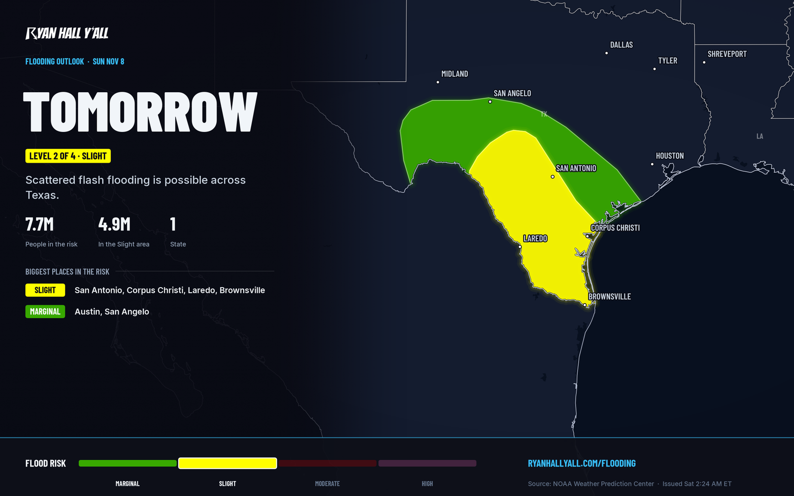
South Texas flood rain into Monday, then Pacific storms soak the West
Heavy rain across South and south-central Texas runs from Sunday into Monday morning, with flash flooding the main concern from the Hill Country down to the Rio Grande Valley. By Tuesday the weather focus shifts to the Pacific Northwest, where a string of storms brings rain to the lowlands and heavy snow to the mountains. Most of the rest of the country stays dry, cool and quiet, and no severe storms are expected from Sunday through Thursday.
The short version
- South Texas: Flood risk is Level 2 of 4 (Slight) Sunday and Level 1 of 4 (Marginal) Monday. Rain tapers off from west to east through Monday morning.
- Pacific Northwest and Northern Rockies: Periods of rain and gusty coastal winds are possible Tuesday through the end of the week. Snow above pass level, with 6 to 12 inches or more on high peaks.
- Great Basin and Central Rockies: Mountain snow spreads in Thursday and Friday.
- Gulf Coast and Southeast: Showers and thunderstorms Tuesday to Thursday. No severe threat is expected.
- Tropics: Tropical Storm Pena is moving west, well south of Hawaii, with no threat to land.
Day by day
- Monday, Nov. 9: Heavy rain lingers in South Texas through the morning, mainly near the coast, then ends west to east. Light rain moves through the lower Great Lakes and upstate New York. Rain returns to Washington.
- Tuesday, Nov. 10: Rain in western Washington and Oregon, mountain snow in the Cascades and Northern Rockies. Thunderstorms near the Texas and Louisiana coasts.
- Wednesday, Nov. 11: The Pacific storms keep coming. Gulf Coast showers continue.
- Thursday, Nov. 12: Showers and thunderstorms across the eastern U.S. Snow spreads into the Great Basin and Central Rockies.
- Friday, Nov. 13: Cool, dry high pressure settles over the central and eastern U.S. The West stays wet and snowy.
- Saturday, Nov. 14: Dry and cool from the Plains to the East Coast. More Pacific moisture for the West.
- Sunday, Nov. 15: Another surge of rain, wind and mountain snow is possible from Washington to California.
South Texas gets its heaviest rain Sunday, with a tail into Monday
Gulf moisture is streaming north ahead of a closed low coming out of northern Mexico. The rain focuses over the Edwards Plateau and Hill Country Sunday morning, then sinks south into South Texas through the afternoon and evening. The core sits along and south of I-10, with the Rio Grande Valley and the area between Laredo and Corpus Christi in the heaviest zone.
Totals of 2 to 3 inches are likely over a broad area, with 4 to 6 inches locally. If storms keep repeating over the same spots, a lower-confidence scenario puts totals above 8 inches near and east of Laredo. The likely trouble is flooded low-water crossings, urban street flooding in San Antonio and Corpus Christi, and small creeks rising fast.
Monday is the tail end. Another 1 to 2 inches is possible, mostly in the morning near the South Texas coast, before drier air pushes in. Sandier soils and fewer streets near the coast should limit the worst of it there. If the heavy rain shifts west toward Laredo and the Valley, impacts would be bigger. Delays are possible at San Antonio International on Monday.
Don't drive into water over the road, especially after dark Sunday night, and check your route before you leave. Our flash flood outlook has the latest. The timing is fairly firm. The exact spot of the heaviest band is not.
Pacific storms stack up in the Northwest and Northern Rockies
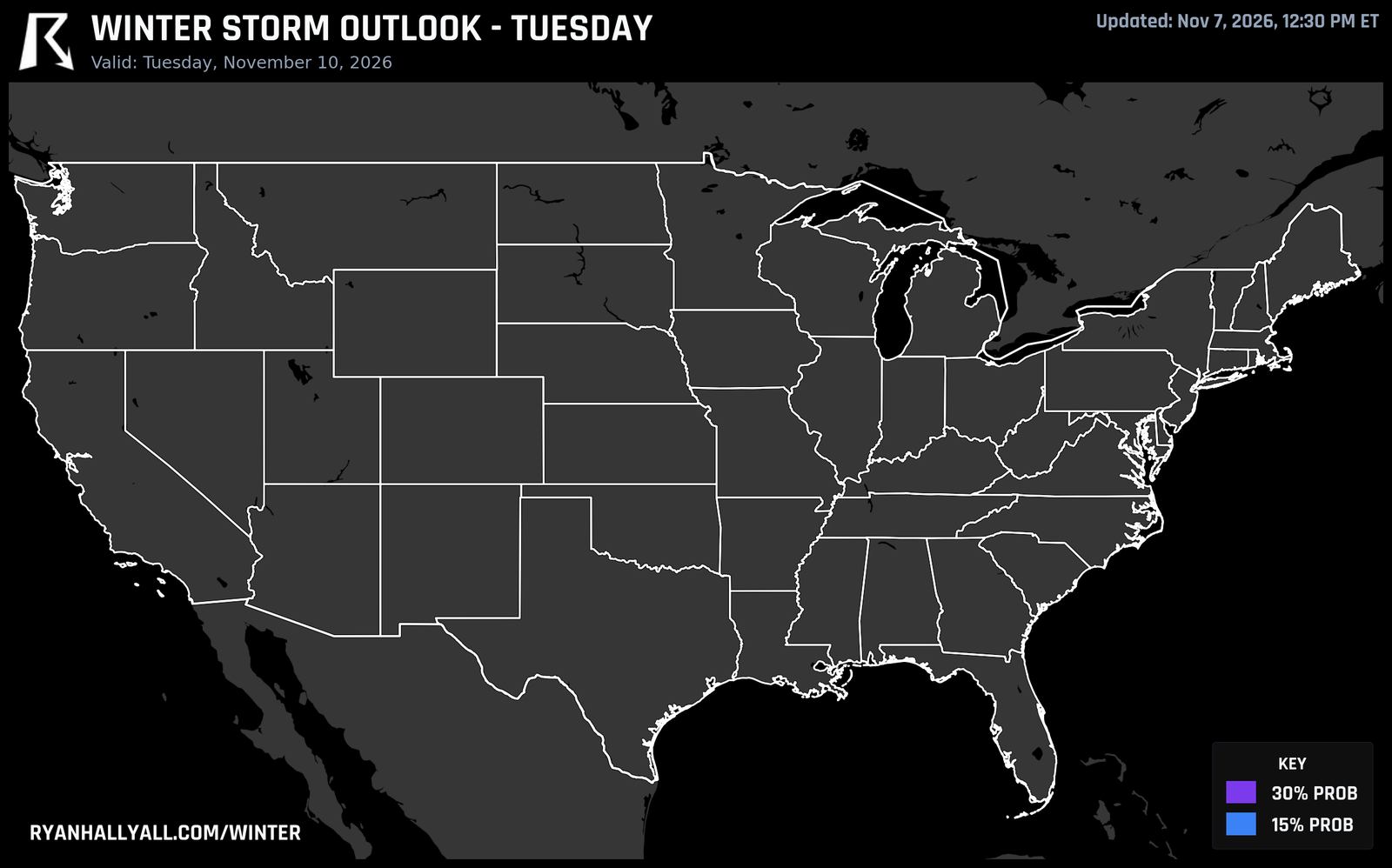
A deep trough parked over the northeastern Pacific keeps steering storms into the West. A cold front crosses Washington this weekend, with a first round of snow over Washington Pass on SR-20. The next push of moisture arrives Monday and runs through the week.
The snow level jumps around. By Tuesday it rises above 7,000 feet in Washington, so most Cascade passes see rain. The snow piles up above that, with 6 to 12 inches or more on the highest terrain of the Washington and Oregon Cascades and the mountains of Idaho and Montana, Tuesday and Wednesday. By Thursday and Friday, snow spreads into the Great Basin and Central Rockies. Coastal Washington and Oregon will also see gusty winds.
The wet pattern is high confidence. Snow levels and the exact timing of each storm are not. If you cross the northern mountains this week, check the pass forecast the morning you go. Our winter storm outlook is updated daily.
The East stays cool and quiet, and Pena stays far from land
East of the Rockies, this is mostly a dry week. The Southeast and Carolinas get the best weather early in the week, and high pressure brings cool, dry air to the central and eastern U.S. by Friday and Saturday. Thursday's showers and thunderstorms in the East are not expected to turn severe. The 6 to 10 day outlook favors above-normal temperatures across the West and central U.S., with 80 to 90 percent odds over the northern Plains. That means likelihood, not a number of degrees. The eastern third leans near or below normal.
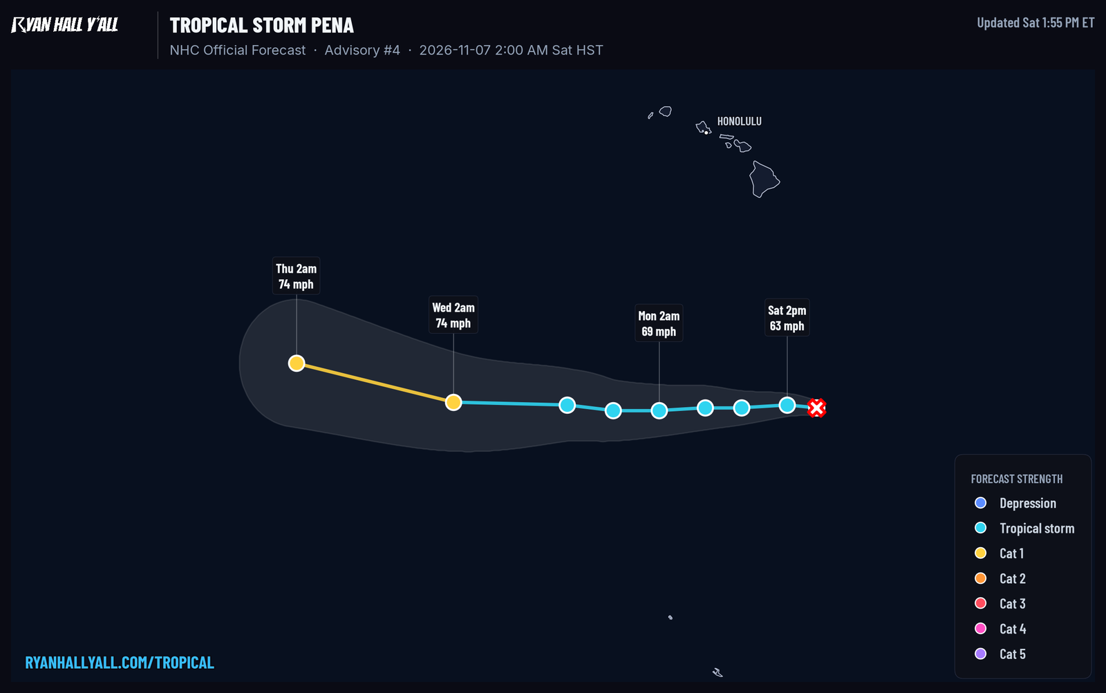
Tropical Storm Pena has 50 mph winds and is about 550 miles south-southeast of the Big Island, moving west at 13 mph. It is forecast to strengthen gradually and stay well south of Hawaii, with no watches or warnings. A turn toward the northwest is possible late in the week, and that is the part to watch. Follow it on our Pena page. In the Atlantic, a non-tropical low south-southeast of Bermuda has a 10 percent chance of development and is forecast to move generally eastward over the subtropical Atlantic.
Bottom line
Texas flood rain peaks Sunday and winds down Monday morning. The Pacific storm track then takes over the West for the rest of the week.
https://ryanhallyall.com/blog/south-texas-flood-rain-into-monday-then-pacific-storms-soak-the-west