Blog Article
Southwest Flood Risk Continues as Saturated Ground Meets More Rain
A cutoff low keeps flash flood and severe weather risks alive across New Mexico and west Texas this weekend, while Hurricane Vance stays offshore Mexico.
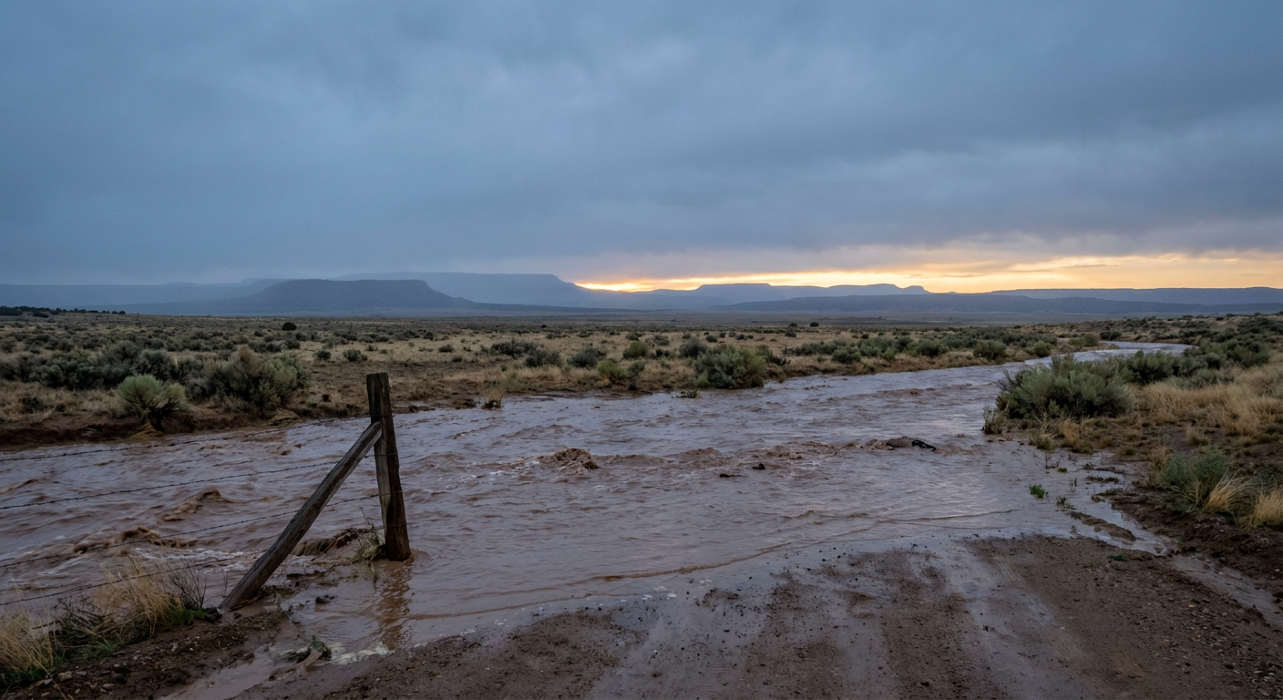
Southwest Flood Threat Isn't Over: Saturated Ground Meets Another Round of Heavy Rain
Alright y'all, if you've been following along this week, you know the Four Corners region has had about enough. San Juan County, New Mexico, is still digging out from river flooding that hit an estimated 1,500 structures and forced more than 60 water rescues between Farmington and Bloomfield. Up in Mineral County, Colorado, the Park Creek Bridge washed clean away. That ground is saturated, those rivers are still running high, and here's the thing: the pattern that caused it hasn't left yet.
The Setup: A Cutoff Low That Won't Quit
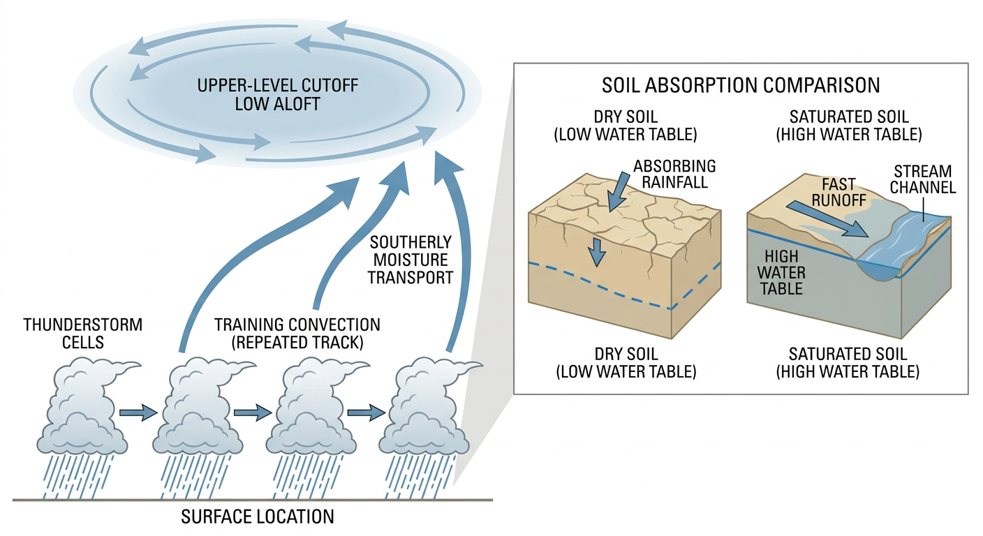
The upper-level trough that's been parked over the western U.S. all week is finally starting to fragment, but not before squeezing out one more round. SPC's forecast discussion says the main vort max is lifting northeast into southern Canada, but a piece of it is cutting off and will linger over the Southwest today. That cutoff low is dragging up deep southerly moisture ahead of it, with dewpoints running into the 50s, which is plenty juicy for late October in the high desert.
WPC has a Slight Risk of excessive rainfall posted today for West Texas, New Mexico, and Colorado, and that risk doesn't just disappear tomorrow. It shifts and expands onto the central and southern High Plains for Sunday, including western Kansas, the Oklahoma Panhandle, and the Texas Panhandle, with southeast Florida also getting a slice of slight risk from unrelated tropical moisture. The worry isn't one big rain event. It's repeated rounds of storms training over the same areas, with rainfall rates of 1 to 2 inches an hour possible. On fresh, dry ground that's a nuisance. On ground that's already full from this week, that's a flash flood setup.
Severe Weather: Slight Risk From El Paso to the Permian Basin
Layered on top of the flood threat, SPC has a Slight Risk of severe thunderstorms today across New Mexico and far west Texas, covering El Paso, Albuquerque, Roswell, Alamogordo, and Artesia. The main threats are large hail and damaging wind, with SPC's probabilities showing a 15 percent chance of scattered severe hail and wind in the core of that risk area, and hatched zones where hail could reach 2 inches or bigger. There's also a 2 percent isolated tornado chance, which sounds small, but remember this is the same corridor that saw two radar-indicated tornado warnings in Grant, Luna, and Sierra counties just yesterday, along with a Costco parking lot full of hail in El Paso and water over a foot deep on I-10 at Airway Boulevard.
Sunday brings a step down to a Marginal Risk for southern and eastern New Mexico into far west Texas, mainly an isolated hail threat as the upper low slides northeast. It's a smaller severe footprint than Saturday, but the flooding half of this story actually gets more serious, not less, as the rain shifts onto the High Plains.
If you're flying through ABQ or ELP today, or really anywhere in the Mountain West, the AI travel briefing flags afternoon and evening thunderstorms as the main disruption risk. DTW and IAD travelers should plan around morning fog instead. Texas, the West Coast, and the Southeast are your best bets for smooth flying.
Meanwhile, Out in the Eastern Pacific
Hurricane Vance is holding as a Category 2 with 110 mph winds, sitting about 365 miles south-southwest of Acapulco and creeping north-northwest at a crawl, just 7 mph. There are no coastal watches or warnings yet, but NHC's intensity forecast keeps Vance at or near Category 1 strength as it approaches the stretch from Manzanillo to Zihuatanejo, with a 1 in 3 chance of tropical-storm-force winds there by Sunday night. This storm has no forecast U.S. impact. It's purely a Mexican Pacific coast story for now, but if you've got friends or family along that stretch, it's worth keeping an eye on.
The Good News: A Genuinely Beautiful Fall Day for Most of the Country
Outside the Southwest, today is about as nice as October gets. The best conditions run from western New York through the Ohio Valley and southern Appalachians into north-central Alabama, plus coastal and inland Southern California. Crisp air, dry skies, light wind. If your weekend plans involve the Ohio Renaissance Festival in Waynesville or the Mac and Cheese Fest in Atlanta, you drew a good ticket. Sunday keeps a similar story going, with the best scores stretching from southeastern Arizona and California's San Joaquin Valley through the southern Appalachians into western New York.
Looking further out, a flat ridge parked east of the Rockies keeps most of the country mild and dry through the middle of next week, though periodic gusty winds and cloud cover will keep most places capped at a "nice" rather than "perfect" score. That ridge starts cracking by Day 7 as a new trough approaches the central Plains and West Coast.
What We're Watching
- Whether training thunderstorms redevelop over the same saturated New Mexico and Colorado river basins that flooded this week
- Expansion of the excessive rainfall threat onto the central and southern High Plains Sunday into Monday
- Hail potential today across the El Paso-to-Roswell corridor, with some areas capable of 2-inch stones
- Hurricane Vance's track and intensity as it nears the Manzanillo-to-Zihuatanejo coast of Mexico
- A G1 (Minor) geomagnetic storm chance October 25-26 as a coronal hole stream and a glancing CME effect combine; aurora watchers at far northern latitudes could get a show, nothing disruptive expected
Bottom Line
If you're anywhere near the Four Corners, southern/central New Mexico, or far west Texas this weekend, don't let the shrinking severe weather footprint fool you. The flood risk is the bigger story through Sunday, especially where the ground is already full from this week's historic San Juan River flooding. Avoid low-water crossings and don't drive into standing water, even water that looks shallow. Everywhere else, especially the Ohio Valley, southern Appalachians, and Southern California, go enjoy the fall weather. It's about as good as this season gets.