Blog Article
Southwest Severe Storms & Tropical Watch: Oct 20 Forecast
Severe storms and flash flooding threaten Arizona and New Mexico Wednesday while a 90% tropical system develops off Mexico. Full forecast breakdown inside.

Southwest Severe Weather Returns Wednesday While Two Tropical Systems Bear Watching
Alright y'all, let's get into it. We've got three storylines worth your morning coffee today: a tropical system that's about as close to a lock to develop as you'll see, a non-tropical low still giving the Carolina coast fits, and a repeat appearance from the Desert Southwest severe weather that put on a show last night.
Tropical Watch: 90% and Climbing in the Eastern Pacific
First, the news that matters most. Post-Tropical Cyclone Trudy is done. The National Hurricane Center issued its final advisory on Trudy overnight, with the remnant low drifting north at about 2 mph and sustained winds down to 35 mph. No coastal watches or warnings, no landfall expected. That one's going in the books.
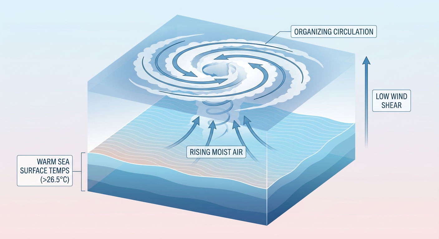
But right behind Trudy, there's a new area to watch. A broad low south of the Gulf of Tehuantepec, tagged Invest 94EP, is getting better organized by the hour. NHC has it at a 90% chance of development over both the next two days and the next seven, which is about as confident as these outlooks get. If it spins up, we'll have a new named storm in the Eastern Pacific basin this week. It's currently forecast to stay offshore, but we'll keep tracking it since these systems can still fling moisture into Mexico's Pacific coast even without landfall.
Over in the Atlantic, there's a second system worth a glance. A storm-force non-tropical low (Invest 93AL) remains attached to an occluded front a few hundred miles off the North Carolina coast. This is the same feature that's been driving the onshore flow behind this week's coastal flooding, the ocean overwash that closed NC 12 between the Marc Basnight Bridge and Rodanthe. NHC gives it a 30% chance of subtropical or tropical development over two days, 40% over seven, as it drifts slowly north-northeast over the Gulf Stream. Whether it ever gets a name or not, expect more rounds of coastal flood advisories and beach erosion through the Outer Banks this week.
Wednesday's Repeat Performance: Arizona, New Mexico, and the Four Corners
Now for the severe weather. Last night's action in southeastern Arizona and southwestern New Mexico was no joke. An emergency-management-confirmed tornado touched down west of Deming, New Mexico, hail up to 1.75 inches fell across Cochise and Grant counties, and a mesonet station near Rodeo clocked a 77 mph thunderstorm gust that knocked down power lines along NM-80. NM-9 was still impassable from flash flooding overnight.
Here's the thing: a very similar setup returns Wednesday. SPC has a Slight Risk posted for central into eastern Arizona, with a much broader Marginal Risk stretching from Los Angeles through Phoenix, Tucson, and Flagstaff into southern Utah and western New Mexico. A mid-level trough moves ashore Wednesday, and it's dragging real moisture with it. Dewpoints climbing into the 60s out there is unusual for the desert in late October, and that extra juice is what's fueling the concern for isolated supercells, hail an inch or bigger, and gusts over 60 mph. SPC also has a 2% isolated tornado chance tucked into the outlook, so it's not off the table.
On top of the severe threat, WPC has a Slight Risk of excessive rainfall for Wednesday across the Southwest and Four Corners, following a Marginal Risk today. The concern is training or backbuilding storms dumping 2 to 2.5 inches an hour, which is a recipe for flash flooding on the same kind of terrain, burn scars, dry washes, and arroyos, that turned NM-9 into a river last night. A deep-layer cyclone digging in off California is pulling tropical moisture northward, and that same system keeps the rain threat going into Thursday across the Four Corners and southern Sierra.
Key factors we're watching:
- Timing of peak storm coverage Wednesday, likely late morning through evening as the trough and surface low interact
- Dewpoints in the 60s providing unusually high moisture for the desert this time of year
- Flash flood potential on terrain still saturated from recent rounds of storms
- Whether Invest 94EP organizes into a named storm and adds even more moisture to the mix downstream
Quick Hits: Space Weather and the Rest of the Country
SWPC says the geomagnetic field is likely to hit G1 (Minor) storm levels today, October 20, thanks to a coronal hole high-speed stream arriving. That's a minor event, mostly a treat for aurora chasers at high latitudes, nothing that affects power grids or daily life for most folks.
Meanwhile, if you're nowhere near Arizona or the Carolina coast, today and tomorrow look genuinely pleasant. High pressure has scoured out the air over the central Plains into the Midwest and Southeast, with highs near 73°F across places like Oklahoma City and Charlotte, right at their October averages. That's good news if you've got outdoor plans this week, whether it's tailgating ahead of Saturday's games or getting outside before temperatures start shifting into the weekend.
Bottom Line
If you're in central or eastern Arizona, southern Utah, or western New Mexico, Wednesday is a day to have your weather radio charged and know where you'll go if a warning fires. The flash flood risk is just as real as the severe threat given how saturated some of that terrain already is from this week's storms. Along the North Carolina coast, expect more overwash and advisories tied to that offshore low regardless of whether it ever gets a name. And out in the Eastern Pacific, don't be surprised if we're talking about a newly named tropical storm by tomorrow's post.