Blog Article
Severe Storms in the South and Heavy Snow in Denver
A powerful May storm system is bringing heavy snow to the Colorado Rockies and a Slight Risk of severe thunderstorms to the ArkLaTex and Deep South.
Spring Storms South, Heavy Snow West: A May Weather Whiplash
Get this, y'all. If you have tickets to see the New York Mets play the Rockies in Denver tonight or tomorrow, you might want to pack a heavy winter coat instead of a baseball glove. We are looking at a classic spring setup where one massive storm system creates two completely different headaches depending on where you live.
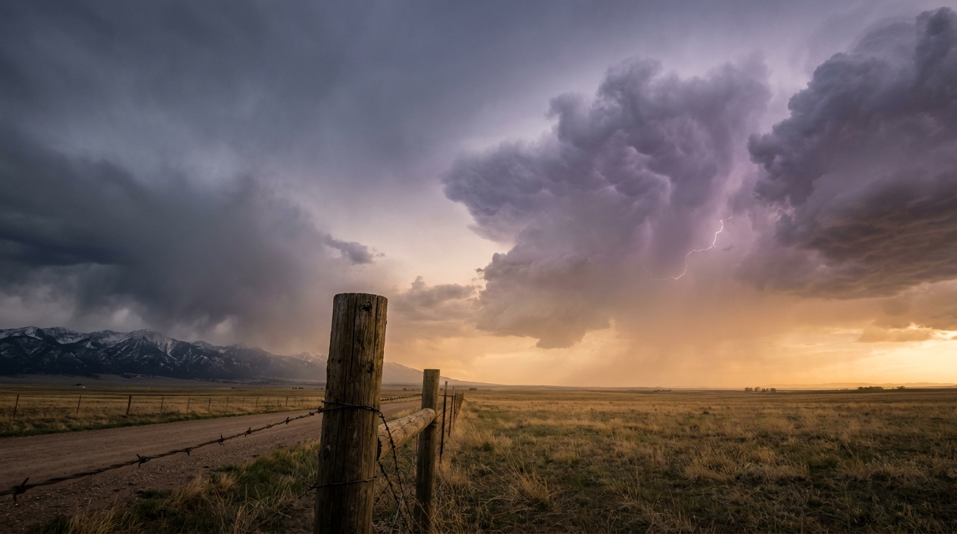
Out west, we have a late-season winter storm dropping into the Central Rockies. Down south, that exact same system is going to pull rich Gulf moisture northward and spark severe thunderstorms across the ArkLaTex and the Deep South.
Winter's Last Gasp in the Rockies
The normal high temperature for Denver in early May is 71 degrees. The Mile High City is about to see temperatures plummet well below that mark as rain transitions to heavy, wet snow.
The Storm Prediction Center has highlighted a Slight Risk for winter weather impacts across the Central Rockies and adjacent High Plains through Wednesday morning. We are looking at a 50 to 60 percent chance of 8 inches or more of snow for the Denver Metro area. The higher elevations in Colorado and Wyoming could easily see over a foot.

This is a classic upslope flow event. Winds are going to push cold, moist air right up against the Front Range. As that air rises, it cools and dumps snow. Travel along the I-25 corridor is going to be a mess, and you can expect significant flight delays or ground stops at Denver International Airport on Tuesday.
Severe Threat Shifts to the ArkLaTex
While Colorado gets snow, the southern end of this system is tapping into a juicy airmass. The normal high for Dallas this time of year is 84 degrees. That heat and humidity are sitting there waiting for a spark.
For Tuesday, the SPC has issued a Slight Risk for severe thunderstorms across Northeast Texas, Southeast Oklahoma, Arkansas, and Southeast Missouri. That is a Level 2 out of 5. We expect isolated to scattered severe storms to fire up in the afternoon and evening. The main threats here are large hail and damaging wind gusts of 60 mph or more. We also have a 2 percent tornado risk in this zone, so an isolated tornado is absolutely possible.
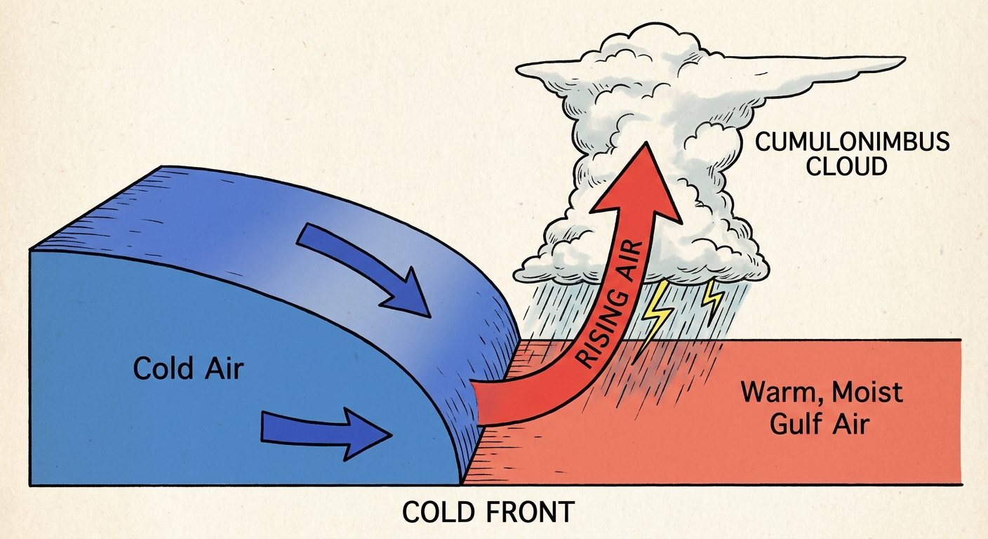
By Wednesday, the upper-level trough migrates eastward. The SPC shifts that Slight Risk into East Texas, the Lower Mississippi Valley, and parts of Alabama. Cities like Shreveport, Jackson, and Birmingham need to be on alert. We are looking at a similar threat profile on Wednesday with damaging winds, large hail, and a couple of tornadoes possible as the cold front pushes through.
Key Factors We Are Watching
- I-25 Corridor Travel: Heavy, wet snow will create slushy and icy conditions from Cheyenne down through Denver and Colorado Springs starting late tonight.
- Aviation Delays: Ground stops are highly likely in Denver due to near-zero visibility in snow. Expect ripple effects across the country.
- Tuesday's Storm Mode: We are watching to see if storms in Arkansas and Northeast Texas stay discrete, which increases the large hail threat, or if they quickly form into a line.
- Flash Flooding: The Weather Prediction Center has a Marginal Risk for excessive rainfall in the Mid-Mississippi and Ohio Valleys on Tuesday, and a Slight Risk for the Interior Southeast on Wednesday.
The Bottom Line
If you live along the Front Range in Colorado or Wyoming, treat Tuesday like a mid-winter day. Limit your travel if you can, and keep the ice scraper handy. If you live in the ArkLaTex or the Deep South, you need to have your severe weather plan ready. Make sure your phone is charged, keep your weather radio on, and know exactly where you will go if a warning is issued for your county.
https://ryanhallyall.com/blog/spring-storms-south-heavy-snow-west-a-may-weather-whiplash