Blog Article
Severe Storms Targeting 47M People on I-95 Monday
A Slight Risk of severe thunderstorms covers the Mid-Atlantic from Philadelphia to Raleigh tomorrow. MLB games, commutes, and flash flooding all in play.
Summer Solstice Severe: 47 Million People on I-95 Are Next in Line
Alright folks, today is the summer solstice. Longest day of the year. Most daylight of any day in 2026. And y'all, the atmosphere has been using every single minute of it.
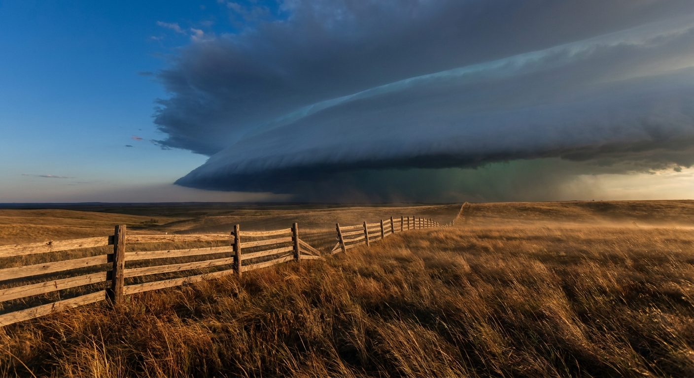
We've been tracking severe storms all day from the central High Plains into the Mississippi and lower Ohio Valleys. Oklahoma City, Tulsa, Louisville, Lexington, Cincinnati. All sitting under a Slight Risk today. Over 20 million people in that corridor. The SPC is flagging large to very large hail, damaging winds that could hit 75+ mph, and tornadoes. Some of those tornadoes could be strong, EF2 or greater, especially across parts of Illinois and Indiana.
But here's the thing. That whole setup is about to take a hard right turn and head east. And tomorrow, the bullseye lands on the most densely populated chunk of real estate in the country.
Tomorrow's Target: The I-95 Corridor
Get this. The SPC Day 2 outlook puts a Slight Risk across the Mid-Atlantic into the Southern Appalachians. The major cities listed? Philadelphia. Charlotte. Washington, DC. Baltimore. Raleigh. That is 47.7 million people.
Now, why should you care beyond the forecast? Because tomorrow is Monday. That means commutes. That means outdoor plans. And if you look at the MLB schedule, there are games all up and down that corridor tomorrow evening.
The Phillies are in DC playing the Nationals. The Cubs are at the Mets in Queens. The Brewers are in Cincinnati. All of those cities are in or near the risk area. First pitch for most of those games is around 7 PM, which is right when the atmosphere tends to peak for severe weather in the summer.
If you've got tickets to any of those games, keep your weather app handy. Stadium delays are a real possibility.
The Flooding Side of This
It's not just wind and hail. The WPC has a Slight Risk for excessive rainfall tomorrow from the Southern Plains all the way to the Northeast, generally along and around the I-95 corridor. Between DC and NYC, the guidance is showing potential for 2 to 3.5 inches of rain. That kind of rainfall in urban corridors means flash flooding, and it happens fast.
We just saw what training thunderstorms can do this week. Yesterday alone, we had flash flood emergencies in Mississippi and Alabama. Water rescues in Birmingham. Roads washed out in Harrison County, MS. The ground across a lot of the South is already saturated. Now we're moving that same kind of rainfall threat into concrete and asphalt country.
Urban flash flooding is a different animal. It doesn't take 26 inches like we saw with Tropical Storm Arthur last week. Two inches in an hour over a paved city can put cars underwater at underpasses and turn your commute into a parking lot.
History Says: Pay Attention to Pennsylvania
Here's something that caught my eye in the analog data. The last significant June tornado in Pennsylvania was an EF2 on June 26, 2024. Almost exactly two years before tomorrow's risk. And before that, on June 13, 2018, tornadoes hit Pennsylvania, including a damaging EF2 near Wilkes-Barre that injured several people.
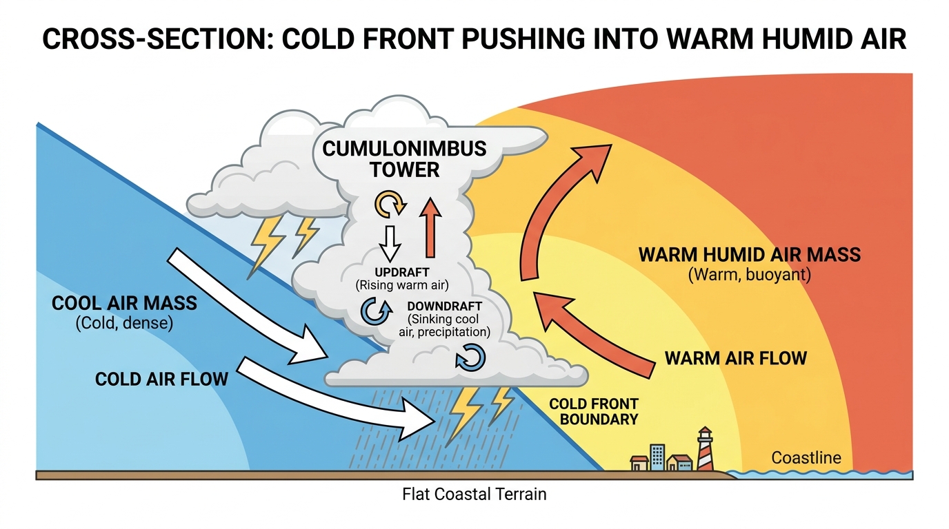
June tornadoes in the Mid-Atlantic are not common, but they're not unheard of either. When the setup is right, they happen. And tomorrow's setup has a 40-50 knot low-level jet feeding moisture into the region. That kind of wind shear in the lower atmosphere is exactly what you need for rotating storms.
The SPC has a 2% tornado probability across the Mid-Atlantic tomorrow. That's a Level 1, isolated tornado threat. Not a high number, but in this part of the country, it doesn't take a high number to get your attention.
The Plains Keep Going
Out west, it never really stops this time of year. The central High Plains have another Slight Risk tomorrow, and that continues into Tuesday and Wednesday. Eastern Colorado and eastern Wyoming keep getting that upslope flow, and with 40 to 50 knots of west-northwesterly flow aloft, the environment stays favorable for supercells.
The Telluride Bluegrass Festival wrapped up today, and honestly, they caught a break compared to what's been happening on the eastern side of the state. But fire weather is a concern across the Four Corners region. Elevated fire conditions from western New Mexico into central Colorado, with afternoon humidity dropping to 5-15% and winds 10-20 mph. If you're camping or recreating on public lands in that area, check the local restrictions.
What This Means for You
If you live between Richmond and Boston, tomorrow is a day to pay attention. Not panic. Just pay attention.
- Have a way to get warnings on your phone. WEA alerts work even if you're at a ballpark.
- If you're commuting tomorrow afternoon or evening, leave earlier if you can. The worst storms will likely fire during peak heat, which lines up with peak commute.
- Don't drive through flooded roads. You've heard it a thousand times because it's true. Two feet of water can float a car.
- If you're at an outdoor event and they tell you to shelter, do it. Stadium concourses are designed for this.
This has been a brutal June. A PDS Tornado Emergency in Illinois. A tropical system dumping 26 inches on the Gulf Coast. 91 mph winds in Kansas. Grapefruit hail in Nebraska. Dam failures in Mississippi. The atmosphere has been running wide open for three straight weeks.
Tomorrow it shifts to where the most people are. That's the story. Not that the weather is unusual for June. It's that it's heading directly toward 47 million people who are just trying to get to work on a Monday morning.
Keep your eyes on the sky, y'all.
https://ryanhallyall.com/blog/summer-solstice-severe-47-million-people-on-i-95-are-next-in-line