Blog Article
Summerfest and July 4th Weather: Storms and Heat Ahead
Severe storms target Milwaukee's Summerfest while heat grips Atlanta's Peachtree Road Race and DC's parade. Here's what your July 4th weekend plans need to know.
Summerfest, the Peachtree, and the July 4th Storm Setup: Reading the Weather Before Your Weekend Plans
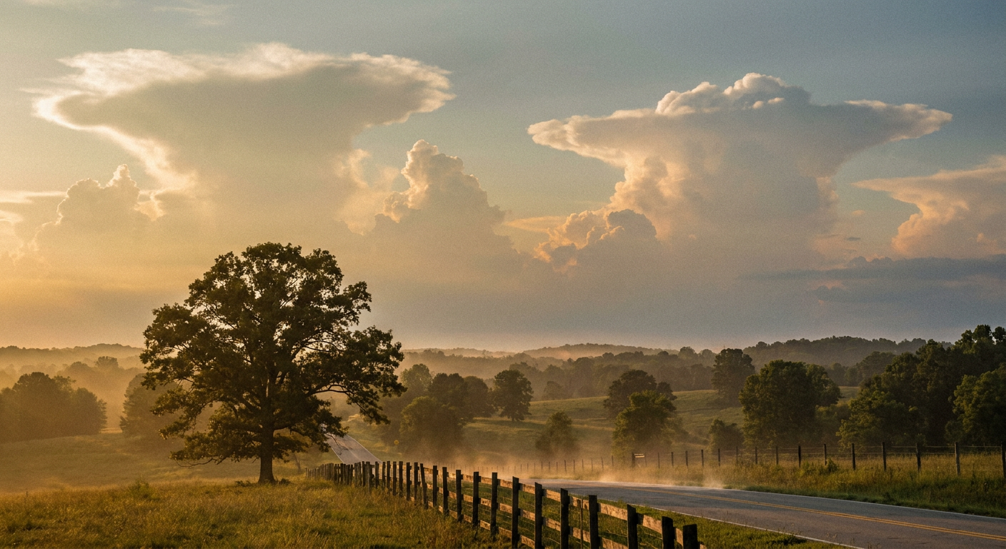
Alright folks, let's talk about the weekend you've actually got planned. Summerfest cranks into Weekend 3 down on the Milwaukee lakefront starting Thursday. Atlanta's got 60,000 runners about to pound the pavement for the Peachtree Road Race on the Fourth. Washington's throwing its Independence Day Parade, and Brooklyn's gonna watch grown adults inhale hot dogs at Nathan's. Big outdoor weekend, coast to coast.
And here's the thing. The same weather machine that's been chewing up the Upper Midwest all week isn't done. Not even close.
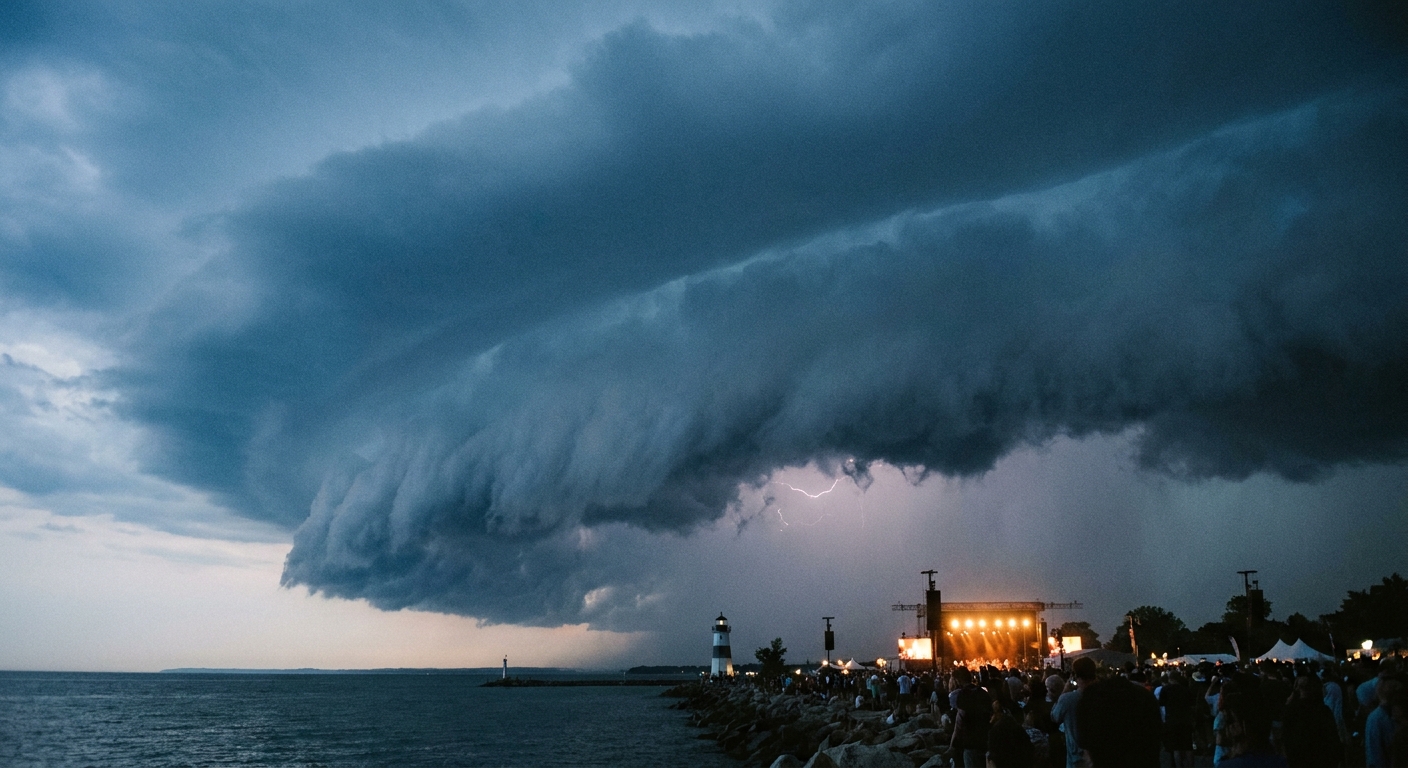
Milwaukee is sitting right in the crosshairs tonight
Get this. The Storm Prediction Center has an Enhanced Risk, that's Level 3 out of 5, drawn right across the Upper Midwest and Great Lakes this evening. Milwaukee, Madison, and Green Bay are all inside it. We're talking a 30% chance of damaging wind gusts near the center of that zone, which is the numerous damaging wind threat category. A couple tornadoes are possible, but the widespread hazard here is straight-line wind that can hit 75 mph or better.
That matters because Summerfest is an outdoor festival on a lakefront. Stages, tents, big crowds. If you're heading to the grounds Thursday for Weekend 3, keep one eye on your phone. Storms this time of year can organize into what we call a mesoscale convective system, basically a big self-sustaining cluster of thunderstorms that rolls through and packs a punch of wind out ahead of it.
This isn't a one-off, either. Look back at the week. Monday, a storm cluster measured a 131 mph wind gust in South Dakota. That's not a typo, and it's not a tornado. That's straight-line wind. Yesterday a bow echo tore up Upstate New York with 80 mph gusts, and another cluster dropped an 81 mph gust in Kansas. This pattern has been mean.
The threat slides west Thursday, then hangs around
For Thursday, the SPC pulls a Slight Risk, Level 2 out of 5, from the Northern Plains into the Upper Midwest. Milwaukee and Minneapolis are still in play, along with Des Moines and Madison. Supercells and another MCS are on the table, with the same 75 mph wind and 2-inch hail potential in spots.
There's a water angle too. The Weather Prediction Center has a Slight Risk of excessive rainfall over the Upper Midwest for three straight days. When you stack round after round of storms over the same ground, that's how you get flash flooding. Precipitable water values up around Rochester, Minnesota are running well above normal, which is a fancy way of saying the atmosphere is loaded up like a wet sponge.
Atlanta and the Peachtree: heat is the story
Now swing down to Georgia. Atlanta's Peachtree Road Race is a Fourth of July institution, and the weather question there isn't wind. It's heat and humidity.
Atlanta's normal early-July high is 89 with a low around 72. The pattern setting up keeps the Southeast under warm, muggy air, so runners should plan for a sticky morning. If you're running the Peachtree, this is the year to hydrate the day before, not just at the water stops. Georgia does see the occasional July storm, and the data backs that up, Georgia averages about 3 July tornado reports in the modern record, so it's uncommon but not zero. The bigger, more likely factor for race morning is heat stress.
Washington's parade and the East Coast heat
The National Independence Day Parade in DC lands in that same warm dome. Washington's normal high for early July is 89. Forecasters are flagging a heat wave peaking around Thursday across the Midwest and East, with heat indices that can climb past 100. If you're standing along Constitution Avenue for the parade, treat it like any hot-weather event: shade, water, and a hat.
The good news for the holiday itself is that airport and travel forecasts show the storm energy staying focused on the Midwest and Great Lakes, so the Northeast and Southeast look more like a heat-and-humidity story than a washout. Fireworks-wise, the main thing to watch is pop-up afternoon storms, which are just a summer fact of life in the South and along the East Coast.
Where the good weather actually is
If you want the pretty stuff, it's out West. The Pacific Northwest and northern Rockies are holding the nicest conditions in the country through the holiday weekend. Spokane, Medford, and the Idaho mountains are the sweet spot. Everybody east of the Rockies is trading between storms and heat.
Your takeaway
Here's how to read your weekend. If you're in Milwaukee for Summerfest, tonight and Thursday are the days to have a plan for getting to shelter fast, because the wind threat is real. If you're running the Peachtree or lining up for a parade in DC, the enemy is heat, so hydrate early and often. And if your holiday plans are out West, you got the good draw this year. The atmosphere's been running hot and stormy for weeks now, and this weekend it's splitting the difference: storms up north, heat everywhere else.