Blog Article
Sunday Weather Update: Northeast Snowstorm & Southern Ice Storm
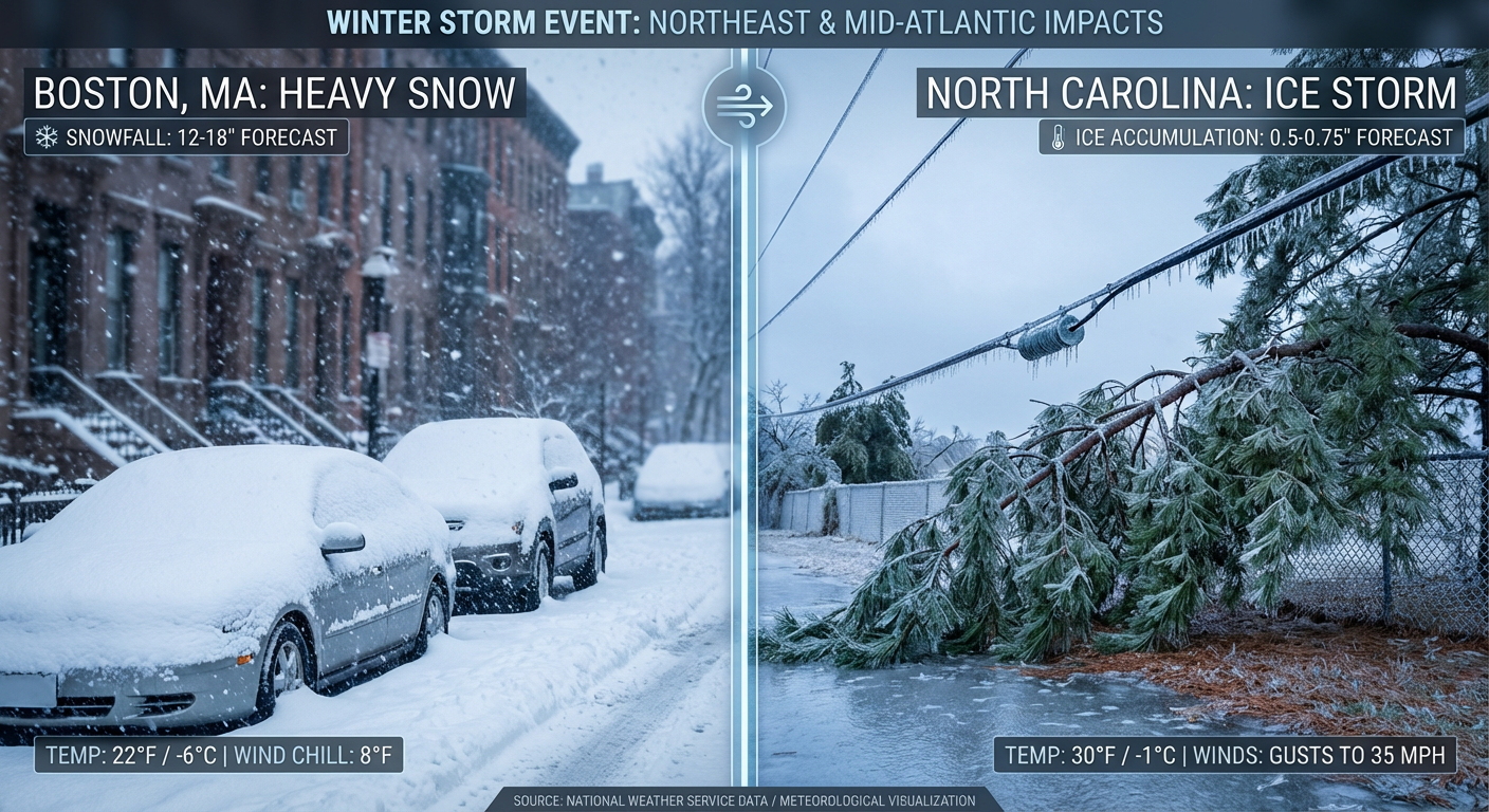
A major winter storm brings 12-18+ inches of snow to the Northeast and dangerous ice to the Carolinas. Plus, tornado risks for the Gulf Coast.
Sunday Scaries: Major Snow for the Northeast & Ice Threat Shifts East
Alright folks, grab your coffee and maybe a warm blanket. If you thought yesterday was wild with thundersnow popping off in NYC and thundersleet rattling windows in Texas, today isn't looking much calmer. We have a massive system stretching across the country, and it is bringing a little bit of everything depending on where you are. Here is the thing, this storm is evolving fast, so let's break down exactly what you need to know for your Sunday.
The Northeast Gets Buried
If you are in the Ohio Valley, Pennsylvania, or New England, get the shovels ready. The WPC is calling for snowfall rates of 2 to 3 inches per hour later today. That is the kind of snow that covers the road as soon as the plow passes.
We are looking at widespread totals of 12 to 18 inches across eastern New York, southern Vermont, and Massachusetts. The I-95 corridor from Philly to Boston is going to be a mess. There is a "warm nose" of air trying to sneak in aloft near the coast, which means you might hear the pinging of sleet mixing in this afternoon. That makes the snow heavy and much harder to move.
The Ice Threat Slides East
Down South, the story is ice. We saw catastrophic icing yesterday in the Ark-La-Miss region, and now that freezing rain line is moving into the Carolinas and Virginia.
We are watching for ice accumulations of 0.25 to 0.50 inches in parts of the Virginia Piedmont and North Carolina today. I know we see "schools closed" trending already, and I expect that to continue into Monday. If you are in this corridor, keep your devices charged. We are already seeing searches for power outages spiking, and ice is notorious for bringing down lines. If you don't have to drive today in this zone, just don't.
Don't Ignore the Warm Side
It is wild to say this while talking about a blizzard, but we have a severe weather threat today too. Down along the Gulf Coast—specifically the Florida Panhandle, southern Alabama, and southern Georgia—there is a Slight Risk (Level 2 out of 5) for severe storms.
The Storm Prediction Center says damaging winds and a few tornadoes are possible. So if you are in Mobile, Tallahassee, or Albany, don't let your guard down just because everyone else is talking about snow. Have a way to get warnings.
The Deep Freeze & Football Impact
Behind this storm, it is just brutally cold. We have wind chills dropping to -20F or -30F in the Plains. This cold air is dense and it is sticking around.
For the sports fans out there:
- Patriots at Broncos: If you are heading to the game in Denver tonight, bundle up. It is going to be frigid with some light upslope snow showers possible. That 2014 forecast of "cold" doesn't compare to this Arctic blast.
- Rams at Seahawks: Seattle is looking wet with rain likely, but the Cascades are getting hammered with snow. Travel over the passes is going to be tough.
Bottom Line
- Northeast: Heavy snow is the main story. Travel will be difficult to impossible later today. Monday morning commute looks rough.
- Carolinas/VA: The ice threat is real. Prepare for power outages and slick roads.
- Gulf Coast: Keep an eye on the sky for storms and potential tornadoes today.
- Everyone Else: The cold is the big story. Protect your pipes, pets, and plants.
Stay safe out there, y'all. We will keep watching the radar.
https://ryanhallyall.com/blog/sunday-scaries-major-snow-for-the-northeast-ice-threat-shifts-east