Blog Article
Sunday Weather Forecast: Severe Storms, Snow, and Fire Danger
A massive weather system splits the US this Sunday. Track the severe storm risk in the Ohio Valley, heavy snow in New England, and critical fire danger out West.
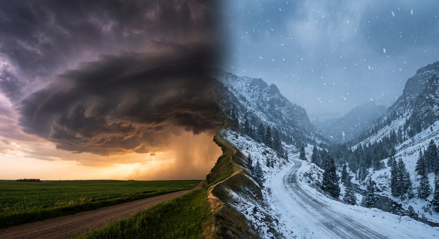
Alright folks, as we talked about yesterday, we have been tracking some absolute madness in the atmosphere. The situation in Hawaii with the flash flooding and that dam scare was intense, and our thoughts are with everyone cleaning up out there. But as we get into the rest of the weekend, we are looking at a massive split-screen of weather across the lower 48.
We have a classic spring tug-of-war setting up for your Sunday. Let's break down exactly what you need to know and how this is going to impact your weekend plans.
Serious Storms Brewing in the Ohio Valley
Heading into Sunday, we are watching an amplifying trough moving quickly across the north-central US. What does that mean for you? Well, it is pulling up a ton of moisture and instability right into a cold front.
The Storm Prediction Center has outlined a Slight Risk (that is a level 2 out of 5) for severe thunderstorms across parts of the Ohio Valley for Sunday afternoon and evening. We are talking about a large area including Columbus, Pittsburgh, Cincinnati, and Louisville. Further east, places like Philadelphia and Baltimore are in a Marginal Risk.
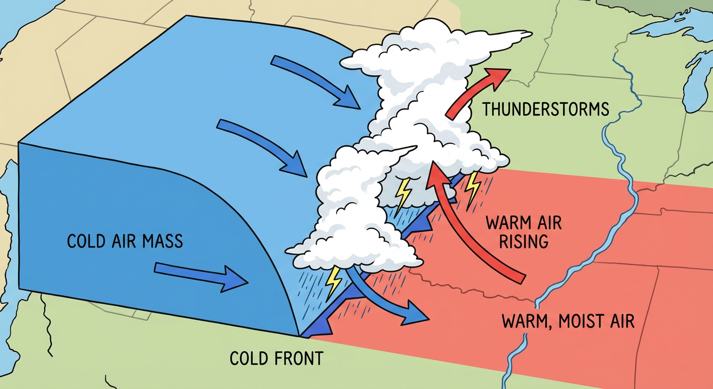
The main things we are watching for are large hail and damaging wind gusts. The data shows a 15 percent probability for both of those hazards in the Slight Risk area, along with a small 2 percent risk for an isolated tornado. If you are having a Sunday barbecue or traveling back from a weekend trip, keep a very close eye on the sky. It might start off as a nice, warm afternoon, but things are going to change fast once that front arrives.
Winter's Last Gasp in New England
False fall? More like winter's last gasp! While the Ohio Valley is dealing with severe thunderstorms, the exact same system is pulling down cold air on its northern side.
We have a Slight Risk of winter storm impacts for northern New England on Sunday into Monday morning. Folks in northern New York, Vermont, New Hampshire, and Maine are looking at a solid 4 to 8 inches of accumulating snow, particularly in the higher elevations of the Adirondacks and Green Mountains.
You are going to be swinging from light jackets right back to heavy hoodies and snow boots. If you live up there, you will definitely want to leave early for your Monday morning commute. It is going to be a slick and messy drive.
Wind and Fire Threat Out West
Now, let us shift gears and talk about the High Plains and the South. The wind out there is no joke right now.
Today, we have a Critical Fire Weather area for parts of Wyoming, Colorado, South Dakota, and the Nebraska Panhandle. By Sunday, that Critical Fire threat shifts south into the Texas Panhandle and southwest Oklahoma. It has been incredibly hot and dry out there, with places in the Southwest shattering heat records over the last couple of days.
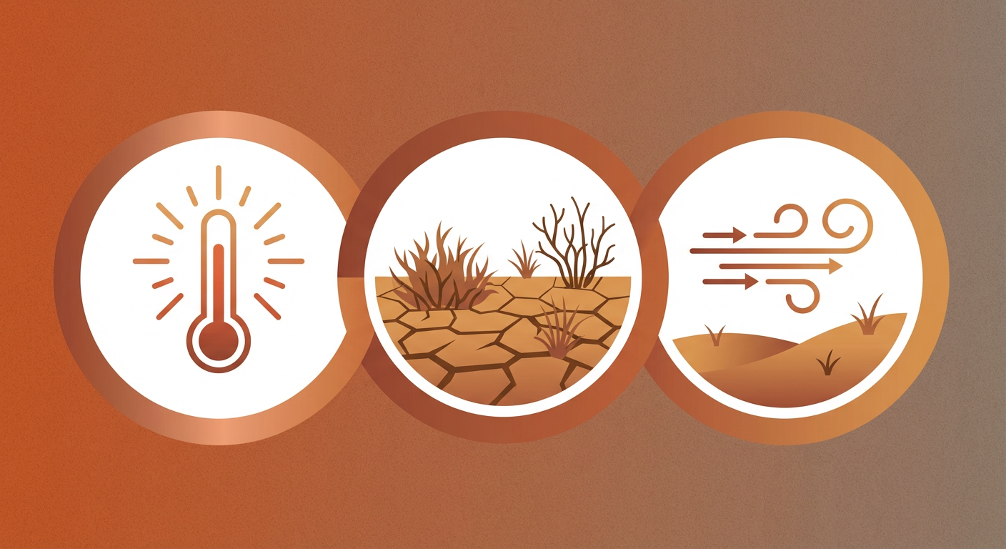
If you are heading out to the Dallas Soul Food Festival on Sunday, you might not see the flames, but you will definitely feel the gusty winds driving that fire risk just to your northwest. Please, absolutely no outdoor burning if you are anywhere near these critical zones. One spark in this dry brush, and the wind will take care of the rest.
The Bottom Line
Here is the thing, y'all. Spring weather transitions are always messy, and this weekend is a perfect example.
- Ohio Valley: Have multiple ways to receive severe weather alerts on Sunday afternoon and evening. Do not rely just on outdoor sirens.
- New England: Get the snow shovels back out and prepare for a slow, slick Monday morning commute.
- High Plains & Texas: Respect the wind and keep those sparks put away.
Stay safe out there, keep your weather apps handy, and I will keep you updated as this massive system develops.