Blog Article
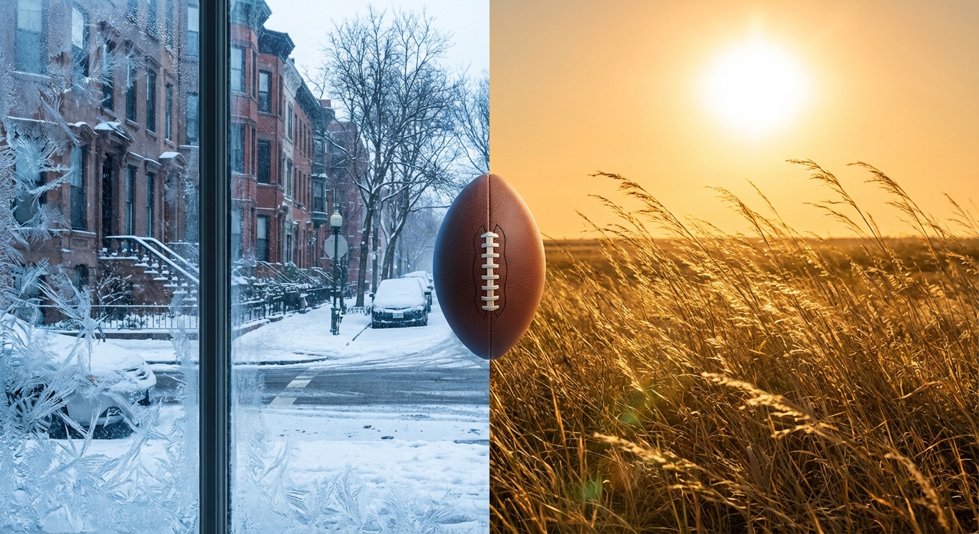
Super Bowl Weather: Arctic Cold East vs False Spring Central US
Current weather forecast for Feb 8, 2026: Dangerous cold in the Northeast, record warmth in the Plains, and rain for the West Coast.
Super Bowl Sunday: From Deep Freeze to False Spring
Good morning y'all! Happy Super Bowl Sunday. I hope you have got your snacks ready and your TV set up. We have got a massive day of sports ahead with the Patriots taking on the Seahawks, but if you look out your window this morning, what you see depends entirely on where you live.
We are looking at a weather map that can't seem to make up its mind. It is a classic case of "weather whiplash" across the country today. Let's break down what is happening right now and what is coming down the pike for the start of your week.
The East Coast: One More Day in the Freezer
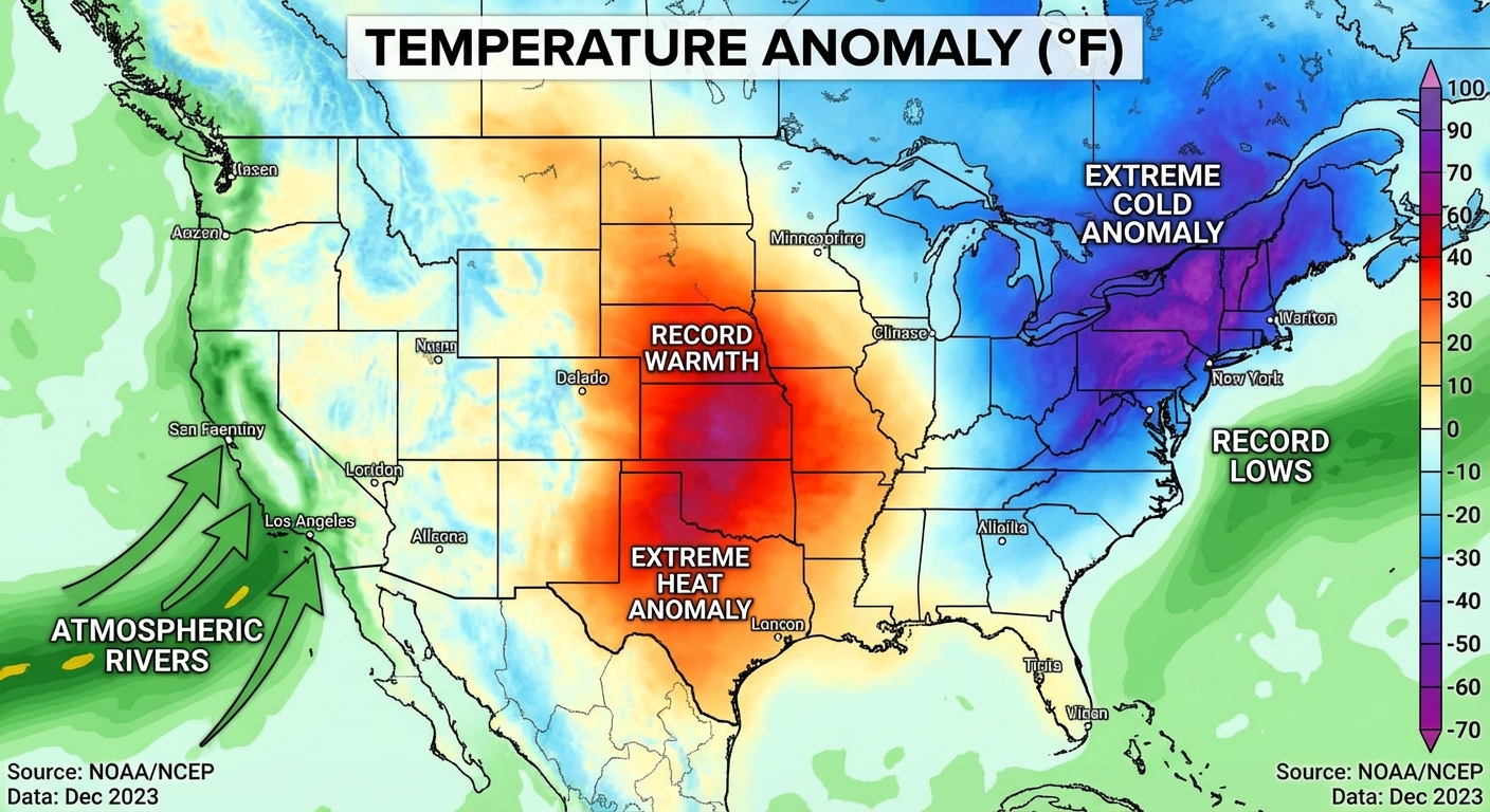
If you are waking up anywhere from the Ohio Valley to New England, I don't have to tell you it is cold. That Arctic airmass we have been tracking is parked right over y'all. We are talking about high temperatures struggling to get out of the single digits and teens for the interior Northeast today.
The wind chills are the real kicker here. In parts of the interior Northeast and New England, it feels like 30 degrees below zero this morning. That is dangerous cold, folks. If you are heading out to a Super Bowl party later, double-check your car battery and bundle up.
The good news? This is the bottom of the barrel. The data shows conditions moderating starting tomorrow. We could see temps jump up about 10 degrees on Monday and another 10 degrees on Tuesday. So hang in there, the thaw is coming.
The Central Plains: A Massive "False Spring"
Now, look at the middle of the country. It is a completely different world. While the East is freezing, the Central and Northern Plains are about to roast.
We are forecasting highs in the 60s and 70s across the Plains. That is 35 to 40 degrees above average for early February! It is going to feel like late April out there. If you are in Nebraska, Kansas, or the Dakotas, you might be tempted to grill out for the game today.
But here is the catch: With that heat comes wind and dry air. The Storm Prediction Center has highlighted a Critical Fire Weather area for the Southern High Plains (parts of Texas, New Mexico, and Oklahoma) for Monday. We are looking at winds gusting over 25 mph and humidity dropping to 10-15%. Please be careful with any outdoor sparks or grills. It wouldn't take much to start a wildfire in these conditions.
The West Coast & The Big Game Forecast
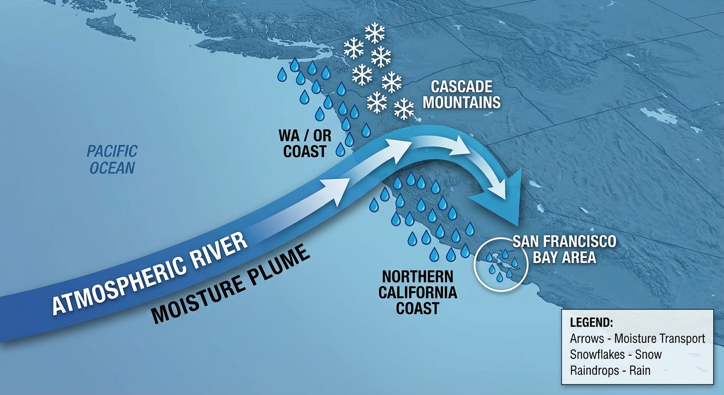
Out West, the atmospheric river is still doing its thing, but it is shifting south. The heaviest rain is moving from Washington down into Oregon and far northern California today. The Cascades and Northern Rockies are getting hammered with heavy snow, which is great for the snowpack but tough for travel.
For the Super Bowl in Santa Clara:
If you are lucky enough to be at Levi's Stadium or just watching on TV, the weather looks decent but potentially a bit damp nearby. That moisture feed is sagging south, bringing light to moderate rain showers to lower elevations in Northern California. It shouldn't be a washout for the game, but don't be surprised if you see some sprinkles or clouds lingering around the stadium. Temps will be in the 50s and 60s, so much more comfortable than what the Patriots fans back home are dealing with.
Space Weather: Still Active
Quick update on the sun: That solar activity we talked about yesterday is arriving. The Space Weather Prediction Center says G1 (Minor) geomagnetic storming is likely today, February 8th.
What does this mean for you? Probably nothing major, but there is a chance for some radio fluctuations. If the broadcast glitches during the halftime show, you can blame the sun! And for folks in the northern tier (where it isn't cloudy), keep an eye on the sky tonight for auroras.
Bottom Line
- Northeast: Stay warm. It is dangerously cold one last day before the thaw begins.
- Plains: Enjoy the warmth but be extremely careful with fire tomorrow.
- West: Rain is moving south; watch for snow in the high elevations.
- Super Bowl: Looks like a classic California winter day—cool and maybe a little damp, but ready for football.
Enjoy the game, stay safe, and I'll catch y'all tomorrow!
https://ryanhallyall.com/blog/super-bowl-sunday-from-deep-freeze-to-false-spring