Blog Article
Texas Severe Weather: 2-Inch Hail and Flash Flood Threat
A Level 2 severe weather risk brings large hail to West Texas on Tuesday, followed by a nocturnal flash flood threat for San Antonio and the I-35 corridor.
Texas Baseball, Hen-Egg Hail, and a Midnight Flood Threat
The Houston Astros and Texas Rangers are playing a three-game series up in Arlington this week. That stadium has a retractable roof. Fans sitting inside will be perfectly comfortable. But if you are driving in from West Texas or the Hill Country to catch a game, the drive home is going to be a headache. We have a serious weather setup taking shape across the Lone Star State for Tuesday and Wednesday.
While the holiday weekend brought some perfect patio weather to the Great Lakes, the atmosphere down south is reloading. We are tracking a potent combination of large hail and heavy nighttime rain.
The Permian Basin Hail Threat
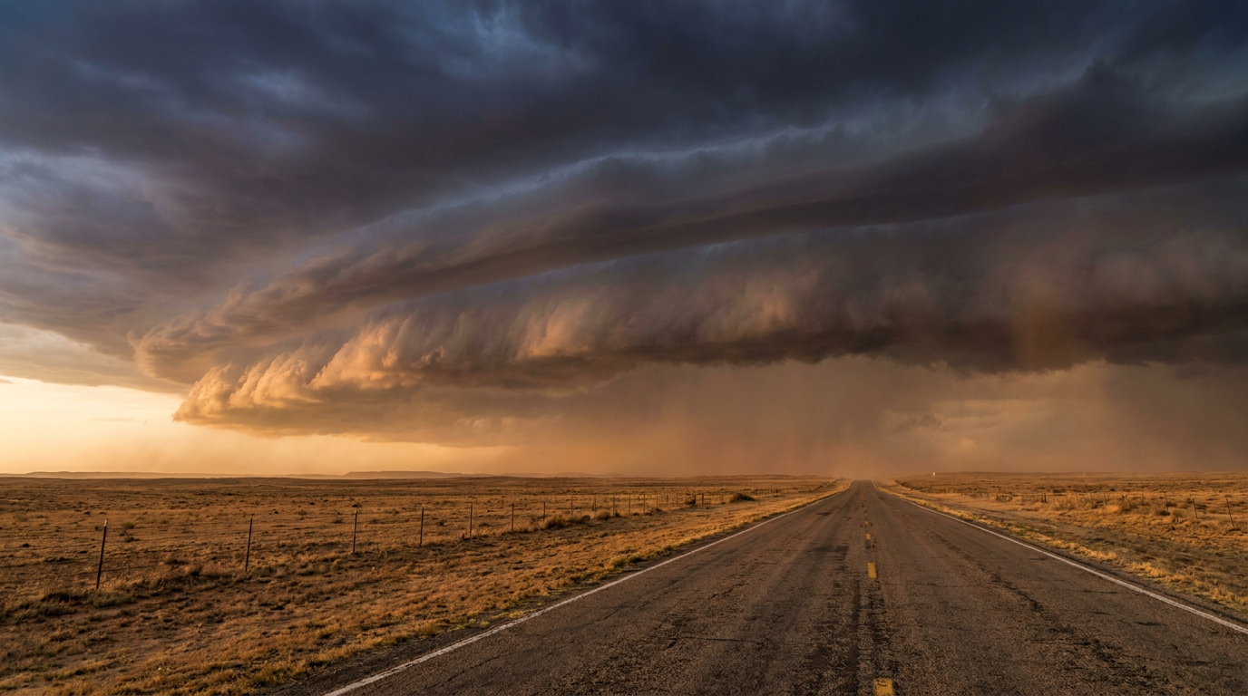
The Storm Prediction Center has upgraded West and Southwest Texas to a Level 2 Slight Risk for severe weather on Tuesday. This includes Midland, Odessa, and San Angelo. Forcing from an upper-level trough will arrive Tuesday afternoon, and that is going to fire off scattered severe storms.
The main hazard here is large hail. The data shows a hatched area for significant hail right over the Permian Basin. Inside that zone, hailstones could reach two inches in diameter. That is hen-egg size. If you live out that way, you need to park your vehicles under a sturdy roof by Tuesday afternoon.
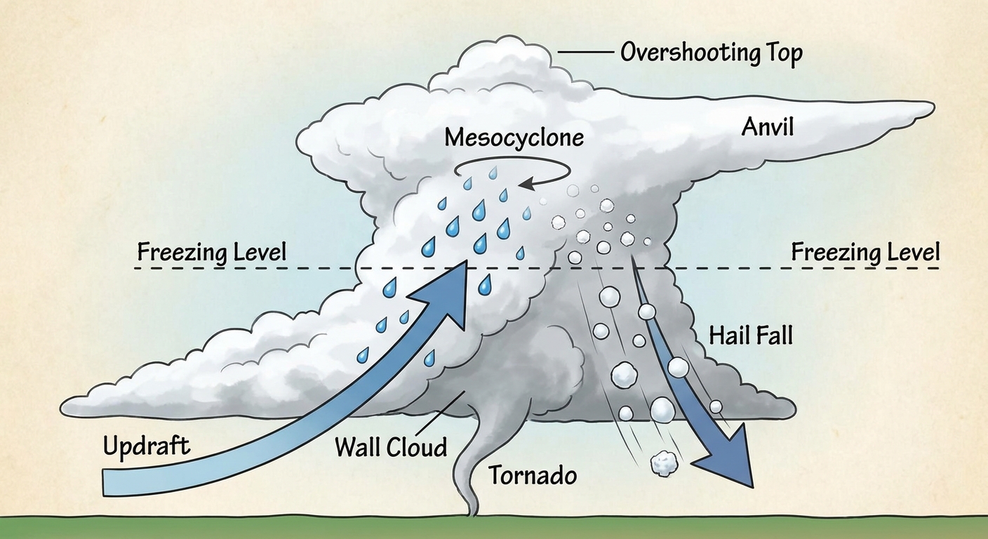
We also have a 5 percent chance for a few tornadoes in this specific area. The wind profile supports rotating storms, so keep a close eye on the sky if you are traveling along I-20.
Midnight Rain on the I-35 Corridor
Later on Tuesday night, the focus shifts east toward the Hill Country and the I-35 corridor. San Antonio and Austin are looking at a nocturnal flash flood threat. The Weather Prediction Center has placed Central and West Texas in a Slight Risk for excessive rainfall for Tuesday into Wednesday.
A slow-moving system is going to pull deep moisture out of Mexico and direct it right into Central Texas. We are expecting heavy rain to fall while people are sleeping. The ground in Texas is already soaked from the relentless weather we saw this past weekend. It will not take much additional rain to get water flowing over the roads.
By Wednesday, that heavy rain threat shifts slightly east. The Weather Prediction Center highlights the eastern half of Texas and the ArkLaTex region for continued flash flood potential.
A Hundred Degrees in Montana
Meanwhile, the weather up north is acting completely out of character. We are tracking extreme early-season heat in northeastern Montana. Temperatures could approach 100 degrees on Tuesday. For context, the average high in late May for a northern city like Minneapolis is around 69 degrees. Hitting 100 in Montana right now is exceptional.
At the exact same time, an unusual upper-level low is diving from the Pacific Northwest into the Rockies. That system is pulling record moisture into the mountains. The Weather Prediction Center has actually introduced a Marginal Risk for excessive rainfall in the Northern Rockies. That means we could see flash flooding near old burn scars in Montana and Idaho.
The weather is clearly not taking a break after the holiday weekend. Make sure your phone alerts are turned on, especially if you live in a flood-prone area of Central Texas.
https://ryanhallyall.com/blog/texas-baseball-hen-egg-hail-and-a-midnight-flood-threat