Blog Article
Texas Flash Flooding & Hail Threat, Northeast Cooldown
Severe storms threaten West Texas with hen-egg size hail and flash flooding today, while a strong cold front brings flight delays and a chill to the Northeast.
Texas Faces Big Hail and Flash Flooding While the Northeast Cools Down
Yesterday was one for the record books, y'all. We saw 92 mph wind gusts in Kansas and 22 inches of snow in Wyoming. Yes, 22 inches of snow in late May. That massive storm system is finally breaking down, but we still have a lot of active weather to get through today.
The severe threat is splitting into two main areas. We have a serious flood and hail setup in Texas, and a messy travel day unfolding on the East Coast.
The Texas Hail and Flood Threat
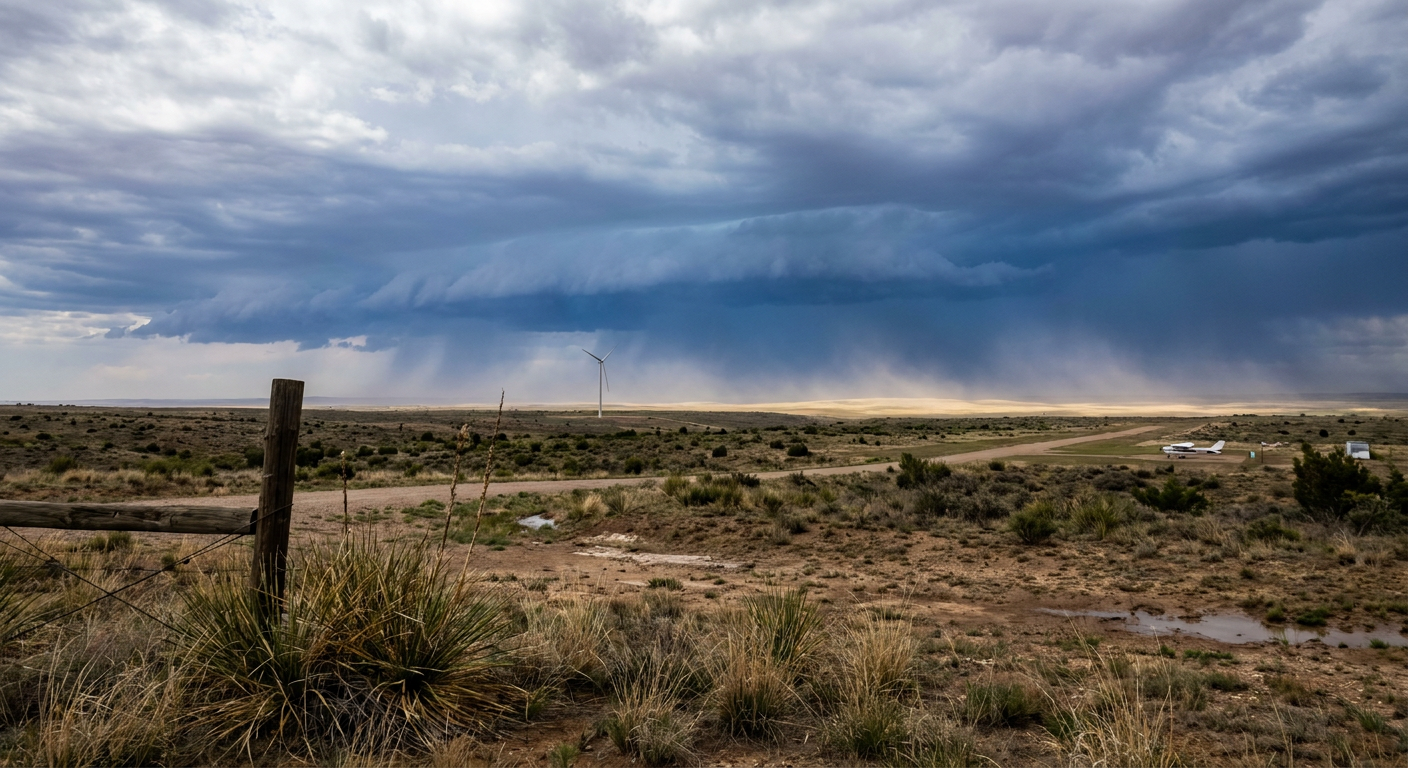
If you live in West or Southwest Texas, you need to pay attention today. The Storm Prediction Center has a Level 2 Slight Risk for severe storms covering Midland, Odessa, and down toward Del Rio. The main hazards are 60 mph wind gusts and large hail.
There is a specific hatched area for significant hail in this outlook. That means if a storm gets going, it could drop hailstones two inches in diameter or larger. That is hen-egg size. It will absolutely total a windshield and damage your roof.
But the wind and hail are only half the story. The Weather Prediction Center has a Slight Risk for excessive rainfall over the Edwards Plateau and Southwest Texas. We are looking at an atmosphere loaded with moisture. Slow-moving storms could easily dump over 5 inches of rain in some localized spots.
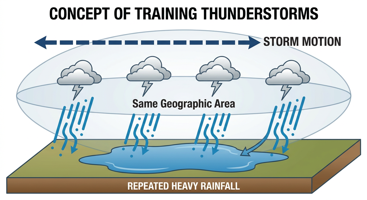
Flash flooding is a serious threat here. When storms "train" or move over the exact same area over and over, the ground simply cannot absorb the water fast enough. Do not try to drive through water covering the road. It takes very little moving water to sweep a vehicle away.
Northeast Changes and Travel Headaches
That strong cold front that caused yesterday's mess is pushing through the Eastern US today. We have a Level 1 Marginal Risk for severe storms stretching from Washington DC up through Philadelphia and New York. You might see some isolated damaging wind gusts or quarter-size hail this afternoon.
This front is going to cause some major travel headaches. If you are flying through JFK or other major Northeast hubs today, expect delays. The low clouds and heavy rain are going to slow everything down and cause a ripple effect across the airspace.
We also have a lot of baseball happening on the East Coast tonight. The Mets are in DC, the Blue Jays are in the Bronx, and the Reds are in Philly. You will want a poncho and a jacket. Temperatures are going to drop sharply behind this front. New York usually hits about 72 degrees this time of year. By tomorrow morning, you will be feeling a chill that is a good 10 to 20 degrees below normal.
- West Texas: Have a plan for hen-egg size hail. Park your car in a garage or under a sturdy carport if you can.
- Southwest Texas: Watch out for rapid water rises on local roads, especially around the Edwards Plateau.
- Northeast: Pack your patience at the airport and bring a jacket for those evening outdoor plans.
The Bottom Line
Make sure you have a way to get warnings today, especially if you are in the Texas risk areas. If you encounter a flooded road on your commute home, turn around and find another route. For folks on the East Coast, keep an eye on the radar before heading out to the ballpark tonight, and get ready to turn the heat back on for a couple of days.
https://ryanhallyall.com/blog/texas-faces-big-hail-and-flash-flooding-while-the-northeast-cools-down