Blog Article
Texas Flash Flood Threat and Mid-Atlantic Severe Weather
Heavy rain targets saturated ground in Texas and the Gulf Coast today. Read the latest on the flash flood risk and a Mid-Atlantic severe wind threat.
Texas Ground is Full, But the Rain Keeps Coming
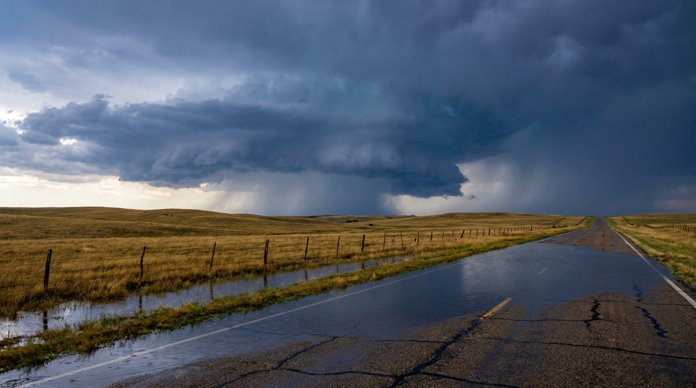
Alright y'all, yesterday was a rough one. We saw a Flash Flood Emergency down in Mississippi, six inches of rain washing out roads in North Carolina, and a 79 mph wind gust near Batesville, Texas. The atmosphere was working overtime.
Today, we are dealing with the hangover from that system. The severe weather threat is shifting east, but the water problem is staying right where it is.
The Sponge is Full in Texas
Here is the thing about flash flooding. It is not just about how much rain falls today. It is about how much water the ground can actually hold. Right now, the ground across Texas and the Deep South is acting like a kitchen sponge that has already been soaked.
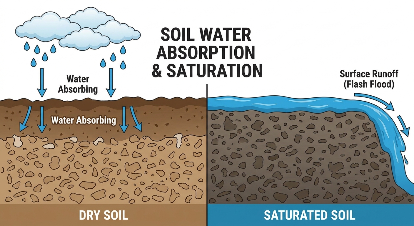
The Weather Prediction Center has a Slight Risk for excessive rainfall posted today for Southeast Texas, the Central Gulf Coast, and parts of the Ohio Valley. We already have a complex of storms moving out of the Hill Country and into the I-35 corridor. Because the soil is already saturated from yesterday's storms, any new rain is going to run right off into the creeks and streets.
If you live in Houston, Dallas, or anywhere along that Gulf Coast stretch, you need to be highly aware of your commute today. Water is going to pool up fast on the roadways.
Mid-Atlantic Wind Threat
While the South deals with water, the Mid-Atlantic has a different problem. The Storm Prediction Center has outlined a Slight Risk for severe weather today covering Washington DC, Richmond, Norfolk, and Virginia Beach.
We have an upper-level trough moving southeast across the Great Lakes. As that system pushes into the warm May air ahead of it, thunderstorms are going to fire up. The main hazard here is going to be straight-line wind. We are looking at a 15 percent probability for damaging gusts of 60 mph or higher.
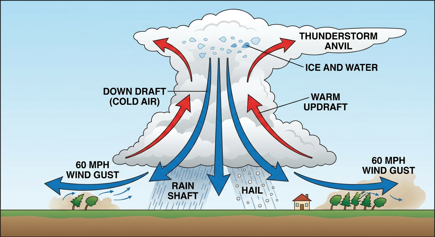
If you are heading up to Baltimore tonight to watch the Rays take on the Orioles, you are sitting right on the edge of that risk area in a Level 1 Marginal zone. Keep a radar app handy. Those 60 mph winds are plenty strong enough to snap tree branches and cause localized power outages.
A Strange Setup Out West
We also need to talk about the West Coast. We have a vigorous upper-level low parked over Nevada right now. That is pulling some strong, dry winds across the Desert Southwest. We have elevated fire weather conditions today for eastern Nevada, western Utah, and northwest Arizona. Wind gusts up to 25 mph combined with humidity dropping down to 15 percent means any spark could start a wildfire.
Tomorrow, that same system is going to trigger a Marginal Risk for severe storms up in the Pacific Northwest. It is not every day we talk about severe hail and wind in central Oregon and eastern Washington, but the mid-level winds are going to be strong enough to support a few feisty storms by Thursday afternoon.
Key Factors We Are Watching
- Texas I-35 Corridor: Ongoing storms are moving over ground that cannot take any more water. Flash flooding is a highly probable outcome today.
- Virginia and DC: Scattered storms this afternoon could pack a serious punch. Have a way to get warnings if you are outdoors or commuting.
- Southwest Fire Danger: Keep the chains from dragging and avoid outdoor burning in Arizona and Utah today.
Bottom Line
If you live in Texas or the Gulf Coast, treat every low-water crossing like it is already flooded. Turn around and find another route. For folks in the Mid-Atlantic, secure your patio furniture and trash cans before you leave for work today. Those afternoon wind gusts will send loose items flying.
https://ryanhallyall.com/blog/texas-ground-is-full-but-the-rain-keeps-coming