Blog Article
Texas Faces 6-8 Inches of Rain as Flood Risk Climbs
WPC posts a Moderate Risk of excessive rainfall for the Texas Hill Country Tuesday and Wednesday, while an Enhanced severe risk targets northern New England.
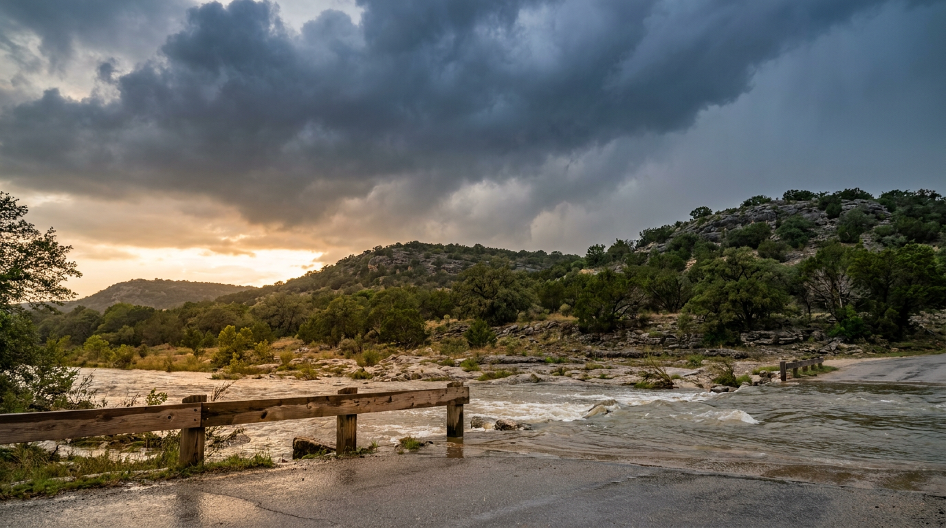
Texas Is Staring Down 6 to 8 Inches of Rain, and the Water Has Nowhere to Go
Alright y'all, we need to talk about Texas. Not today, exactly, but starting tomorrow and running hard into Wednesday. The Weather Prediction Center has a Moderate Risk of excessive rainfall posted for the Edwards Plateau, the Hill Country, the Rio Grande Valley, and the Lower Trans Pecos. That's a level 3 out of 4 on the flood scale, and it's the highest-priority story on the board this morning.
Here's why I'm leading with it. This July has already been brutal on the flooding front. We watched a Flash Flood Emergency near Oates, Missouri with over 12 inches of rain. We saw 13.5 inches in Polk City, Iowa on the Fourth. Kelleys Island, Ohio picked up a 14-inch report. The ground across a lot of the country is already loaded up, and now the machine is pointing at south-central Texas.
What's Actually Happening Up There
Think of it like this. A mid-level disturbance is going to park itself over the region and just meander. It's not in a hurry to leave. When you get a slow-moving feature like that sitting over deep tropical moisture, you get storms that form, rain themselves out, and then get replaced by new storms over the same ground. Meteorologists call that training and backbuilding. Same spot, over and over, like railcars passing one point on the track.
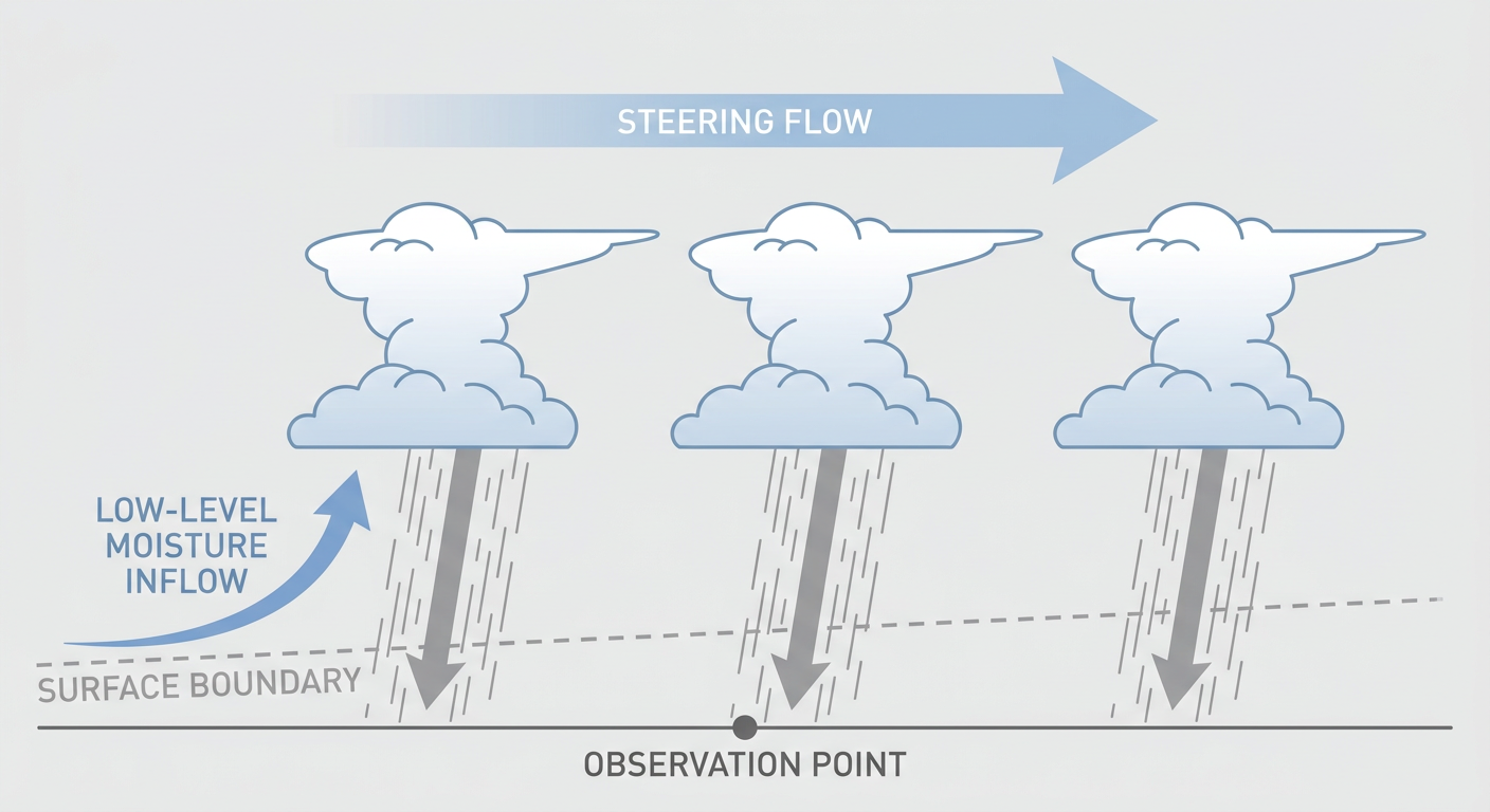
WPC put it plainly in their discussion. That mid-level disturbance from Tuesday is likely to hang around for at least one more day into Wednesday, keeping the low-level convergence pattern locked over the same areas. The models are consistent on the signal for repeated rounds of heavy rain.
Our forecast team is talking multi-day totals of 6 to 8 inches or more, with precipitable water values over 2.25 inches feeding the central Gulf Coast side of this. When the atmosphere is that juiced up, rainfall rates can spike fast, and the Hill Country is notorious for how quickly its creeks and rivers respond. Steep terrain, thin soil, and water that runs off in a hurry. That's the whole reason this region has a nickname you don't want to earn.
The Timeline
- Tuesday (Day 2): Slight Risk of excessive rainfall over Texas into the central Gulf Coast, with a Moderate Risk taking shape across the Hill Country and Rio Grande Valley. This is when the heavy stuff gets organized.
- Wednesday (Day 3): The Moderate Risk holds over the Lower Trans Pecos, Edwards Plateau, Rio Grande Valley, and Hill Country as that disturbance refuses to move on. Round two over saturated ground is the bigger concern.
If you live in San Antonio or anywhere along the I-10 and Hill Country corridor, this is a two-day story, not a one-and-done. San Antonio normally runs a high near 96 this time of year. Rain and cloud cover will knock temperatures down, but the real issue is water, not heat.
Meanwhile, Up in New England
The severe weather headline for Tuesday sits way up north. SPC has an Enhanced Risk (level 3 of 5) posted for northern New England, covering Burlington, Plattsburgh, and a good chunk of northern Maine. A strong shortwave trough drives clusters of storms out of the St. Lawrence Valley into Vermont, New Hampshire, and western Maine through the afternoon and overnight.
Damaging wind is the main player here. SPC is carrying a 30 percent wind probability in the core zone, with gusts to 75 mph possible inside the hatched area. There's also a 5 percent tornado risk with a note that any tornado that forms could reach EF2 strength, plus large hail up to 2 inches. Dewpoints over 70 and MUCAPE topping 2000 J/kg tell you the air up there is plenty unstable.
For today, Monday, the severe threat is small. A Marginal Risk covers parts of the southern Atlantic Seaboard, including Charleston, Savannah, and Columbia, plus a separate area in western Montana. Isolated damaging wind gusts are the concern, and that lines up with the tree-down reports we saw across the Carolinas and Georgia yesterday.
A Quick Note on the Rest of the Map
The tropics are quiet. There's one weak invest out in the central Pacific near 10.5 north, but it's far from land and nothing to lose sleep over. Space weather is calm too, with only a slim chance of a brief G1 minor geomagnetic bump late tonight into tomorrow. Nothing that changes your day.
Out west, the northern High Plains keep dealing with elevated fire weather as a surface low develops over eastern Montana and drags dry, breezy air across the region. And that heat dome we keep mentioning is still anchored over the Upper Midwest and Great Lakes. If you're near the Twin Cities, you've probably already seen the headlines about a stretch of 90-degree days piling up.
What I'm Watching
- Whether that Texas disturbance stalls exactly where the models say. A small shift changes which creeks flood first.
- Rainfall rates in the Hill Country. This is flashy terrain, and short bursts matter more than storm totals in the first hour.
- The northern New England line and how fast it organizes Tuesday afternoon. Wind is the threat to plan around.
- Fire weather in the northern High Plains, where dry thunderstorm lightning could spark new starts.
Bottom Line
If you're in south-central Texas, from the Hill Country down through the Rio Grande Valley, get your plan ready now for Tuesday and Wednesday. Know your low-water crossings and don't drive into them, because most flood deaths happen in vehicles. Six to eight inches of rain on ground that responds fast is a serious setup, and this is a two-day event.
If you're in northern New England, Tuesday afternoon and evening is your window for damaging wind, hail, and an isolated tornado. Charge your phone, keep a way to get warnings, and bring in anything loose in the yard before the storms arrive.
Everybody else, today is mostly quiet outside a marginal storm risk along the Southeast coast. Enjoy it.