Blog Article
Atlantic Tropical Wave Watch & Ohio Valley Storm Risk Today
NHC gives a central Atlantic tropical wave 70% development odds while the Ohio Valley faces another Slight Risk severe weather and flash flood day after Monday's damaging MCS.

The Atlantic Wakes Up: A Tropical Wave to Watch While the Ohio Valley Digs Out Again
Alright y'all, two stories today. One's brewing way out over open water, and one's still cleaning up after itself back home in the Ohio Valley. Let's get into both.
Invest 92AL: The Season's First Real Tropical Signal
The National Hurricane Center is tracking a tropical wave sitting about 800 miles southwest of the Cabo Verde Islands, way out in the central Atlantic. NHC has tagged it Invest 92AL, and here's the number that matters: 70% chance of development into a tropical depression within the next two days, climbing to 80% over seven days. That's a HIGH confidence call from NHC, not a maybe.
The wave is forecast to keep moving west to west-northwest over the next several days, and NHC says the environment ahead of it is "conducive for development." In plain terms, that means warm water, low wind shear, and enough moisture for this thing to organize into our next depression, and likely our next named storm, probably within the week.
There are two other areas NHC is watching in the Atlantic behind this one. One's sitting at 50% development odds (medium confidence) and another way back at just 10% (low confidence, more of a long-shot). Neither of those is an immediate concern, but it tells you the Atlantic's finally getting its engine running after a slow stretch.
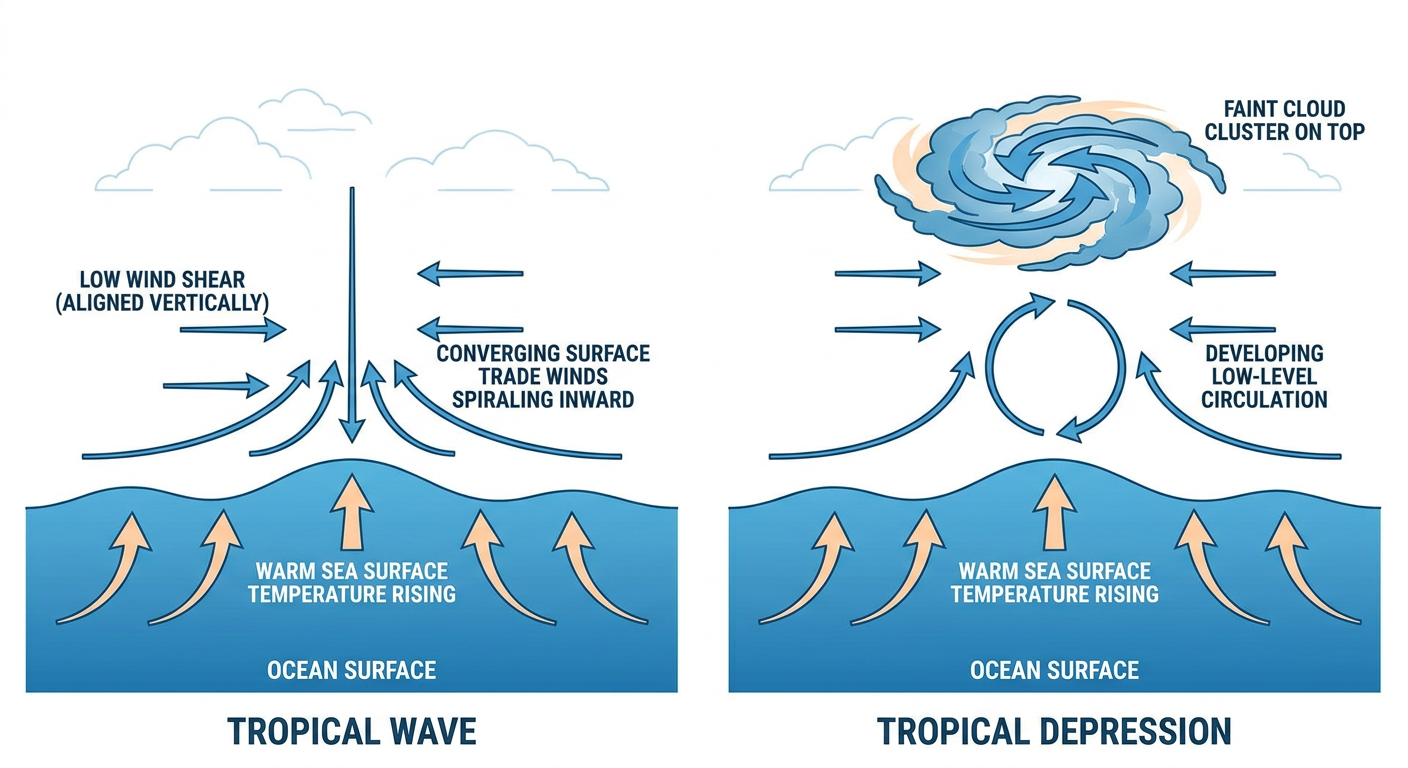
For now, this system is thousands of miles from any US coastline, and it's way too early to talk about tracks or impacts. But we'll be watching it closely over the next few days, because a system with a 70% development chance this early in its life usually doesn't fizzle out. If it does become Tropical Depression or Tropical Storm status, we'll have a name and a track cone to talk about soon.
Meanwhile, Back Home: The Midwest MCS Train Keeps Rolling
If you were anywhere from Illinois to West Virginia yesterday, you know exactly what we're talking about. That bowing MCS put down gusts of 80 to 96 mph in Illinois, 82 mph in Columbus, and even later spun up extreme supercells out in western South Dakota with 4.5-inch hail and a 111 mph gust near Newell. Lake County, Indiana, lost power to over 192,000 customers. It was a rough 24 hours, and the ground across the Ohio Valley is still soaked from it.
Today, SPC has a Slight Risk of severe thunderstorms up from a corridor running through the northern/central Plains into the lower Ohio Valley, with Indianapolis, Louisville, Omaha, Des Moines, and Cedar Rapids all sitting inside that zone. A broader Marginal Risk stretches out to Chicago, Philadelphia, Charlotte, and Denver. The setup: one or more MCS clusters riding northwesterly flow aloft through a very moist, unstable airmass. Damaging gusts and isolated hail are the headline threats, with only a 2% isolated tornado chance, so today's not shaping up to be another derecho-level day, but it's not nothing either.
On top of that, WPC has a Slight Risk of excessive rainfall painted from the central Plains through the Tennessee Valley today, describing an active "ring of fire" pattern where repeated rounds of storms keep training over the same soaked ground. That's a real concern given how saturated soils already are in Ohio, West Virginia, and Indiana after this week's rain.
Regionally, it's peak mid-August, so a normal high in Indianapolis or Louisville runs upper 80s, and Des Moines and Chicago average right around the low to mid 80s this time of year. That heat and humidity ahead of the storms is exactly what's fueling the instability keeping this pattern active.
What This Means for Fair Season and Weekend Plans
The Iowa State Fair and Illinois State Fair both kick off Thursday, August 13, right inside that Day 2 Marginal Risk zone that covers Des Moines and the wider Midwest corridor. Nothing alarming yet, but fairgoers should keep an eye on the sky for afternoon pop-up storms. The Chicago Air and Water Show on Saturday sits in a region that's held at NICE-to-FAIR tier through the week per the outdoor conditions outlook, with the Midwest corridor still fighting cloud cover and shower chances into the weekend.
Key Factors We're Watching
- Invest 92AL's development into a tropical depression, likely within the next couple of days
- Continued Slight Risk severe weather from the central Plains into the Ohio Valley today, with damaging wind gusts the main threat
- Slight Risk of excessive rainfall over already-saturated ground from the Plains through the Tennessee Valley
- Marginal severe risk expanding into Denver, Kansas City, and the Front Range by Thursday and Friday
- A minor G1 geomagnetic storm already passed yesterday; SWPC now calls for quiet-to-unsettled space weather through midweek, with another slight uptick possible around August 14 and 19
Bottom Line
Keep half an eye on the Atlantic. Invest 92AL is the real deal, a system NHC gives 70% odds of becoming a depression inside 48 hours, and it's the first tropical story of real substance this season. It's too far out to affect anyone stateside right now, but it's worth bookmarking.
Closer to home, if you're anywhere from Omaha to Louisville to Indianapolis today, don't let yesterday's damage lull you into thinking the pattern's done. It's a Slight Risk day again, mainly for damaging wind gusts and isolated hail, layered on top of ground that's already full from the last 48 hours of rain. Have a way to get warnings today, know where you'd go if a storm rolls through, and if you're headed to the Iowa or Illinois State Fair this week, keep the weather app handy.