Blog Article
Severe Storms and a Pneumonia Front Target the Midwest
A potent cold front will bring severe storms to the Midwest, a massive temperature drop to the Great Lakes, and critical fire weather to the Southwest.
The Big Temperature Crash: Severe Storms and a 'Pneumonia Front' on the Way
Alright y'all, we talked yesterday about the severe weather threat brewing for the Midwest. That is still very much on the table for Thursday. But today, I want to talk about the bulldozer driving those storms. We have a massive cold front sweeping across the country, and it is bringing some extreme changes.
We have been dealing with record heat across a huge chunk of the country. Now, a potent cold front is going to transition that heat into a significant severe weather and fire weather event.
The Great Lakes Pneumonia Front
If you live near Lake Michigan, get ready for a shock. Forecasters are watching the potential for a 'pneumonia front' to push through. That is a weather term for a cold front that drops temperatures by 16 degrees or more in just one hour.
We could see temps crash over 30 degrees in a matter of hours behind this boundary. For context, the normal high for Chicago in late March is about 47 degrees. We have been running way above that, so this sudden freeze is going to feel like a brick wall.
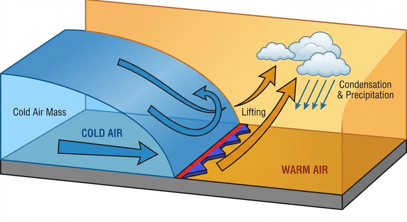
Thursday's Severe Storm Threat
Ahead of that cold air, the atmosphere is incredibly juicy. The Storm Prediction Center has a Slight Risk posted for Thursday afternoon and evening. This covers a huge chunk of real estate including Chicago, Detroit, Indianapolis, Columbus, and Cleveland.
I noticed a lot of folks searching for Cincinnati weather this morning. You will probably see some rain first thing Thursday morning, but the main severe event arrives later in the day.
Here is what we are watching for Thursday:
- Timing: Discrete supercells are expected to form by late afternoon.
- The Hazards: The primary threats are going to be very large hail up to 2 inches and damaging winds over 60 mph.
- Tornado Threat: An isolated tornado or two is also possible before these storms congeal into a messy line overnight.
- Flash Flooding: There is a Marginal Risk for excessive rainfall across northern Indiana and Ohio. We could see some training showers and storms Thursday night that might cause localized flooding.
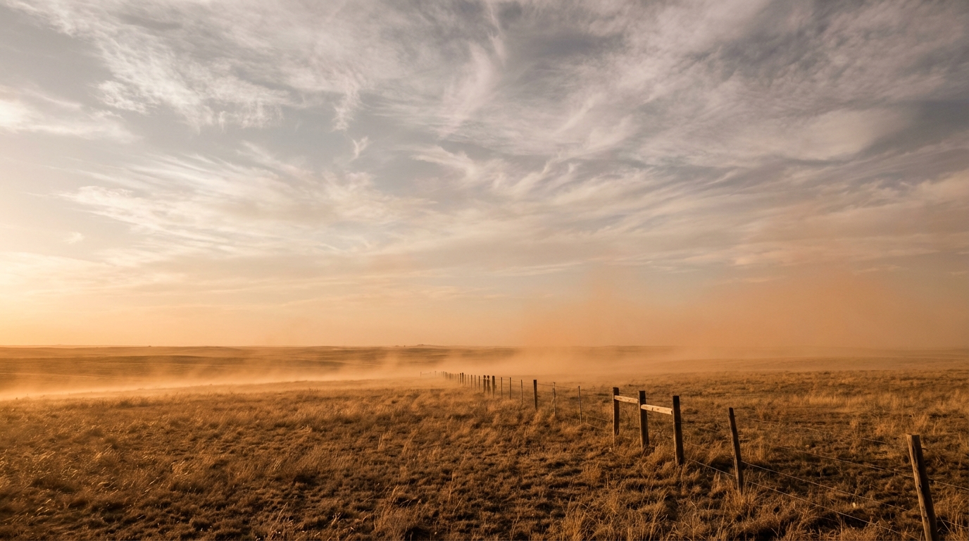
Critical Fire Danger Out West
While the Midwest gets storms, the Southwest is baking. We have a Critical Fire Weather area highlighted for central New Mexico through the Texas and Oklahoma Panhandles on Thursday. Cities like Albuquerque and Amarillo are right in the middle of this.
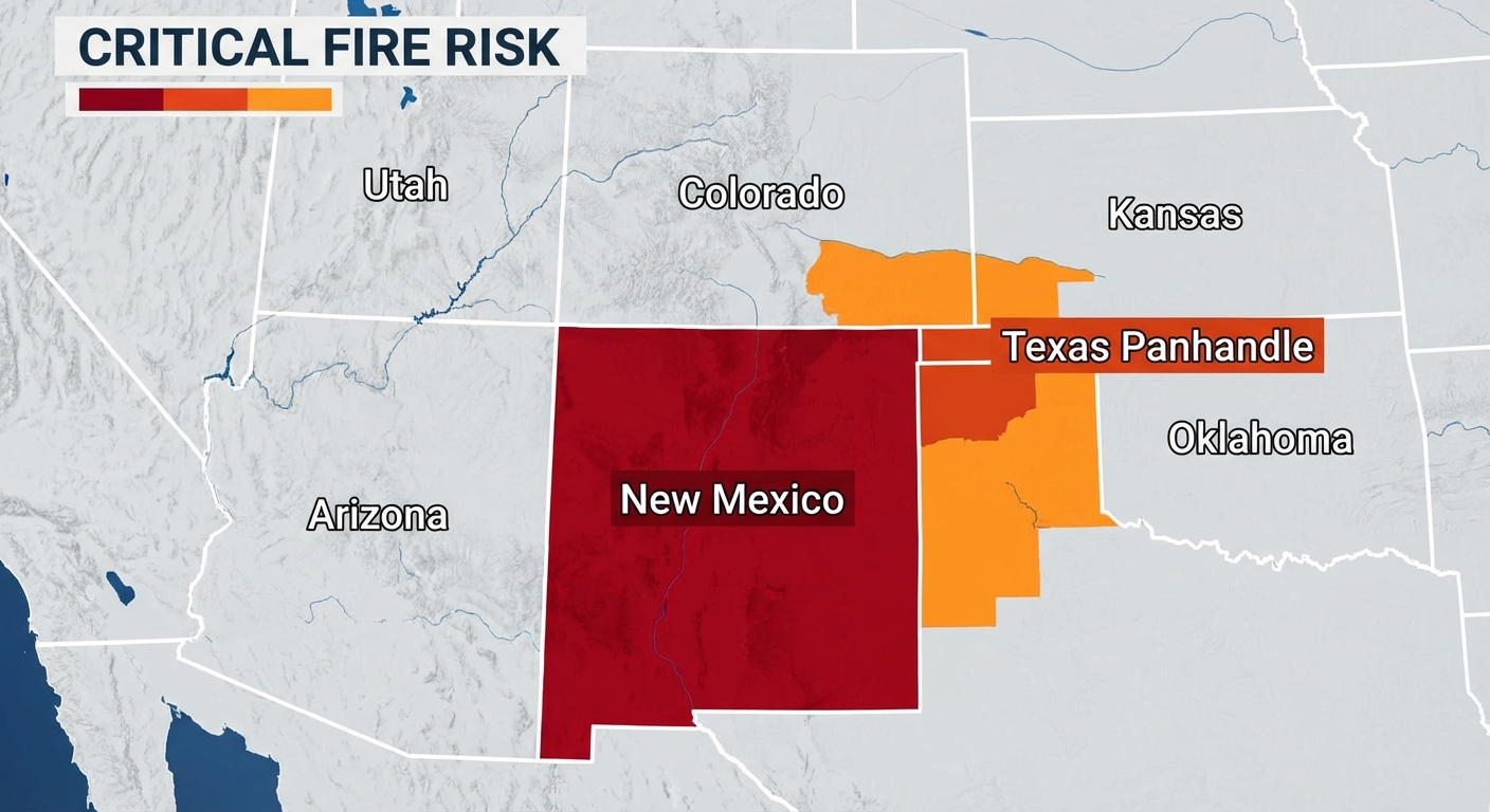
We are talking about near-record heat, humidity dropping into the single digits, and strong wind gusts. It is a dangerous setup for wildfires. The dryline is going to shift east, and the winds behind it will be fierce.
The Bottom Line
Here is what you need to do. If you are in the Midwest or Great Lakes, keep the AC running today but have your winter coat ready for Friday. Make sure you have multiple ways to get weather warnings on Thursday evening, especially if you are commuting home from work or heading out to an evening event.
If you live out in the High Plains or Southwest, absolutely no outdoor burning. One spark is all it takes in those conditions. Have a plan ready in case an evacuation order is issued for your area.