Blog Article
Oshkosh AirVenture Under Enhanced Severe Weather Risk Tonight
EAA AirVenture Oshkosh sits inside tonight's SPC Enhanced Risk zone for tornadoes and 75 mph gusts. Plus updates on Tropical Depression Two in the Gulf.
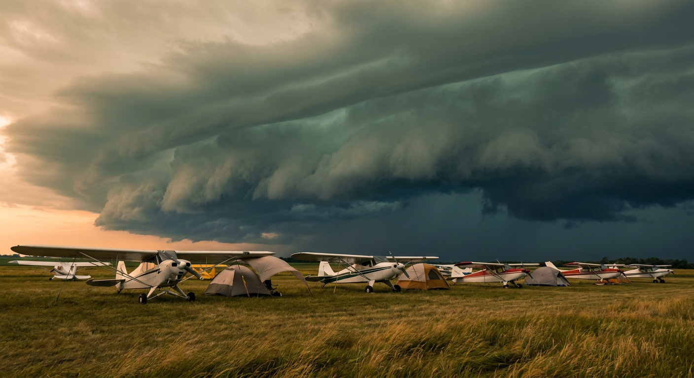
The Biggest Fly-In on Earth Just Landed Right in Tonight's Severe Weather Bullseye
Alright folks, here's the thing about EAA AirVenture Oshkosh. It's the largest aviation gathering on the planet. Hundreds of thousands of people, thousands of small aircraft parked wingtip to wingtip on open grass, tents everywhere. It kicked off today in Oshkosh, Wisconsin. And tonight, that whole scene sits inside an Enhanced Risk for severe thunderstorms.
That's not a coincidence I can wave off. Milwaukee, Madison, Rockford, Cedar Rapids, and Green Bay are all named in today's Storm Prediction Center outlook as the core of the threat. Oshkosh sits right in the middle of that corridor. If you've been seeing "tornado watch" trending in your searches tonight, that's because one is already up for eastern Iowa as storms move in, just to the southwest of the AirVenture grounds. That's the same broader system we're talking about here.
Why Tonight Looks Like Trouble
The SPC isn't hedging on this one. Inside the Enhanced Risk area, forecasters have painted a hatched zone where any tornado that forms could reach EF2 or stronger, and a separate hatched zone where wind gusts could top 75 mph. Hail chances run as high as 15 percent for quarter-size stones, with a pocket capable of producing hail the size of a hen's egg, over two inches across.
For context, that 75 mph gust threshold isn't garden variety outflow. That's enough to flip an unsecured light aircraft or collapse a vendor tent in seconds. If you know somebody camping under a wing at Oshkosh tonight, this is the night to make sure they've got a plan and a way to get info fast.
The setup driving this is a classic mid-July upper Midwest severe day. Strong daytime heating, a plume of deeper moisture, and a disturbance sliding through aloft are all lining up to fire off supercells this afternoon that can grow into a bowing line of storms by tonight. That's the stage where the wind threat usually peaks, right as folks are packing up lawn chairs and heading back to their tents or RVs.

The Gulf's Slow-Mover Keeps Grinding Along
Meanwhile, Tropical Depression Two is still doing its thing in the Gulf, about 195 miles southeast of Mobile as of this afternoon. It's a sluggish system, drifting northwest at just 3 mph with 35 mph winds, and reconnaissance aircraft have been flying through it most of the day trying to pin down exactly how strong it really is.
The track keeps pointing toward the northern Gulf Coast, with our impact model flagging Pensacola in an "action" tier as the closest approach comes within about 54 miles in a day and a half. Sabine Pass, Houma, and southwest Louisiana are all in a "prepare" tier as the system's projected path continues toward landfall near New Orleans late Wednesday into early Thursday. This one likely won't be a wind story so much as a rain and storm surge story for the coast, so if you've got plans along the Gulf this week, keep an eye on it rather than writing it off because the wind numbers look modest.
And while we're on the Gulf region, don't sleep on the heat either. Heat indices are running 110 to 115 degrees from the Northern Plains down into the Lower Mississippi Valley right now. For a city like Jackson, Mississippi, where the July average high sits at 92, a heat index reading in that 110 to 115 range is a real jump above what late July normally feels like, even accounting for typical humidity.
Tuesday Moves the Target East
Here's where it gets interesting for anybody with weekend travel through the mid-Atlantic. Tuesday's outlook already has an Enhanced Risk drawn from the Upper Ohio Valley into Washington, Baltimore, and Philadelphia, an area covering close to 36 million people. Deep-layer winds aloft are forecast in the 40 to 60 knot range, which tends to organize storms into long-lived, damaging wind producers rather than short-lived pop-up cells.
Our analog data points to the June 29, 2012 derecho as a rough historical comparison for the corridor, though nobody's saying Tuesday repeats that exact outcome. What we can say is the wind threat, a 45 percent chance of widespread damaging gusts, is the highest tier probability anywhere in either day's outlook. If you've got a Phillies game, an Orioles game, or anything outdoors planned in that stretch Tuesday evening, keep half an eye on the sky.
The Takeaway
Big outdoor gatherings and severe weather season don't check each other's calendars. Oshkosh drew a rough night to kick off AirVenture, the Gulf still has a slow-moving system to watch, and the mid-Atlantic gets its turn tomorrow. None of that means panic. It means knowing where you fall on tonight's map and having a way to get updates if the sky starts looking like business.