Blog Article
New SPC Severe Weather Maps & Multi-Day Storm Threat
The SPC just changed how we read severe weather maps. Learn what the new Conditional Intensity levels mean before the big Texas and Oklahoma tornado threat.
The Blood Moon, A Massive Map Change, and Your Weekend Severe Threat
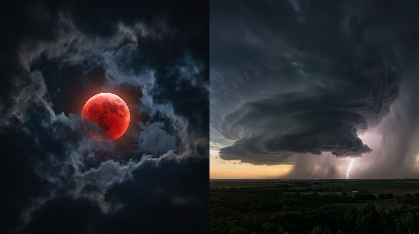
Alright folks, if you are scrolling through your feeds tonight, assuming Instagram hasn't crashed on you again, you are probably seeing a million blurry pictures of the moon. We have a total lunar eclipse happening right now. It is the first Blood Moon visible across the whole US since 2022, and it is an incredible sight if you actually have clear skies to see it.
But here is the thing. While we are all looking up at the sky, the way we track dangerous weather down here on the ground just changed forever.
Today, the Storm Prediction Center officially rolled out a brand new way to read severe weather maps, and we need to talk about it before a major multi-day storm setup kicks off tomorrow.
The Old Maps Are Gone
Y'all know I love a good weather map. For years, when we had a major threat for tornadoes or giant hail, meteorologists would show you a map with a "hatched" area. It looked like a bunch of diagonal lines drawn over the map. Well, throw that out the window.
Starting today, we are using a new Conditional Intensity system. It is a three-tiered setup that makes things way easier to understand.
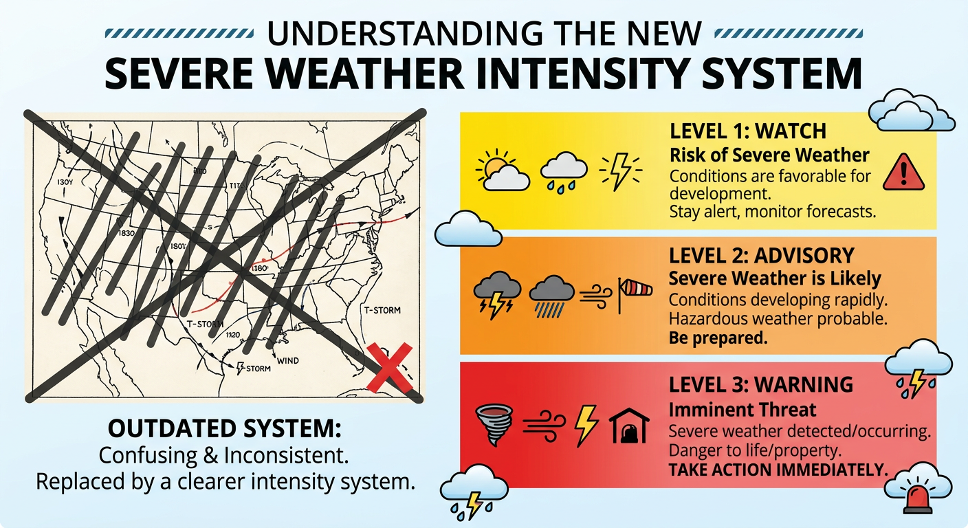
Instead of trying to figure out if you live inside the zebra stripes, you will now see clear Level 1, Level 2, and Level 3 intensity zones for tornadoes, wind, and hail. This is huge for your safety, folks. When you see a Level 3 for tornadoes on your screen this spring, you will know exactly how serious the situation is without needing a meteorology degree.
And get this. We are going to have to test drive these new maps almost immediately.
A Multi-Day Severe Outbreak is Brewing
We have a very active pattern setting up right now. If you missed the Blood Moon tonight because of clouds in the Plains or the Midwest, you are already seeing the moisture returning to the area. We have a Marginal Risk for some isolated hail tonight from the Southern Plains up into Missouri and western Illinois.
But things really start to escalate as we go through the week:
- Wednesday: We have a Slight Risk (Level 2 out of 5) stretching from North Texas right up through the Ozarks and into southern Illinois. We are talking about places like Dallas, St. Louis, and Cincinnati. The main threats here are large hail and damaging winds up to 70 mph, but we also have a 2 percent tornado risk on the board.
- Thursday: The target moves a bit west. We have another Slight Risk from West Texas up into Kansas. If you live near Lubbock or Amarillo, be on the lookout for large hail and a couple of isolated tornadoes as a dryline fires up.
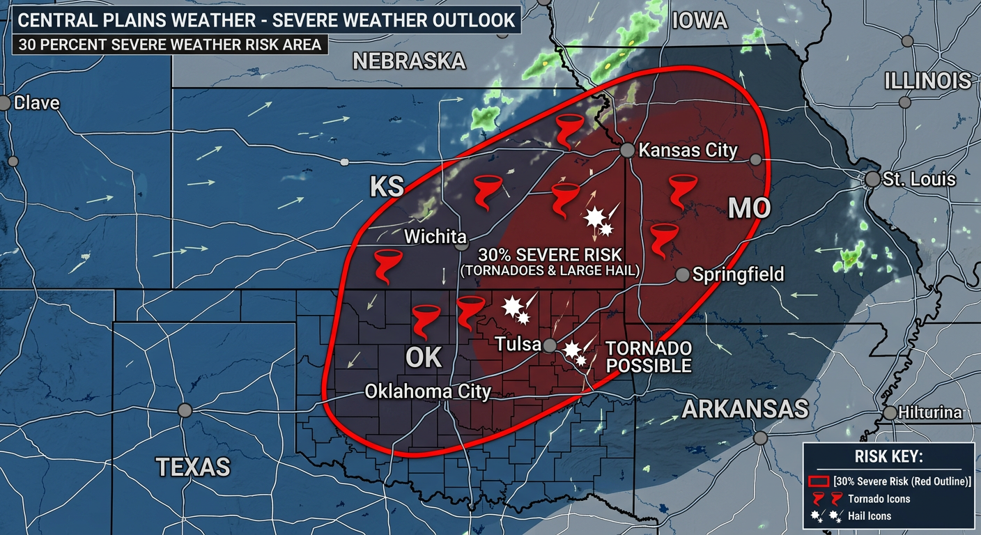
- Friday: This is the day I am watching the absolute closest. The Storm Prediction Center has already slapped a 30 percent risk area over eastern Oklahoma, eastern Kansas, and western Missouri. We are talking about the potential for supercells, large hail, and tornadoes.
We also have a Marginal Risk for flash flooding from North Texas up into the Ohio Valley. Some localized spots in the Ozarks could see over 3 inches of rain by Thursday morning. If you come across a flooded road, turn around. It is never worth the risk.
What About the Rest of Y'all?
While the middle of the country prepares for storms, we have two completely different extremes happening on the coasts.
Down in Florida, the situation is getting dire. The state is dealing with its worst drought in 25 years. It is so dry right now that wildfires have literally shut down I-75 along Alligator Alley. The state of emergency is very real. If you are heading down there for a spring training game, be extremely careful with anything that could spark a fire.
Meanwhile, the Pacific Northwest is about to get slammed with winter weather. A potent cold front is crashing into the coast, bringing 4 to 12 inches of heavy snow to the Cascades through tomorrow morning. Snow levels are dropping fast, so mountain passes are going to be a mess.
There is a lot going on right now, y'all. Take a few minutes tonight to learn those new SPC map levels. Share the info with your family in Texas, Oklahoma, and Missouri so they know what to look for on their weather apps this week.
I will be tracking this massive storm system every step of the way. Stay safe out there.
https://ryanhallyall.com/blog/the-blood-moon-a-massive-map-change-and-your-weekend-severe-threat