Blog Article
Ohio Valley Severe Weather Forecast: Cold Front Pushes East
A strong cold front brings a Slight Risk of severe thunderstorms and flash flooding to Michigan, Ohio, and Pennsylvania today. Get the latest forecast here.

The Cold Front Pushes East: Tracking Today's Severe Threat in the Ohio Valley
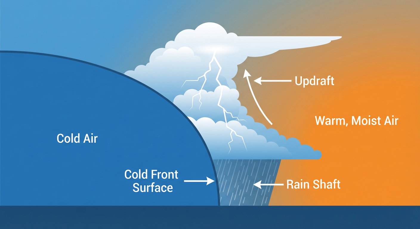
Alright y'all, it has been a long, exhausting week. From the crippling ice up in Wisconsin to the devastating tornadoes across the Midwest and Southern Plains, this storm system has tested a lot of folks. Today, that main cold front is finally pushing east, but we are not quite done yet.
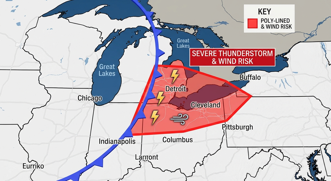
As we talked about yesterday, this sprawling system is still packing a punch. The Storm Prediction Center has a Slight Risk posted from southeast Michigan through Ohio and into western Pennsylvania and New York. If you live in Detroit, Columbus, Cleveland, or Pittsburgh, you need to keep your guard up this afternoon. The main hazard is going to be damaging wind gusts as this cold front sweeps through.
Heavy Rain and Temperature Swings
We also have a Slight Risk for excessive rainfall in the same general area, plus another Slight Risk down in the ArkLaTex region. The ground is already saturated in places like Ohio from earlier flash flooding. It will not take much extra water to cause issues on the roads today. If you encounter water covering a roadway, turn around.
Ahead of the front, things are feeling pretty juicy. Once that boundary passes, temperatures are going to drop noticeably. Detroit normally sees highs around 59 degrees this time of year. You will be reaching for a jacket tonight as that colder Canadian air settles in behind the storms.
Looking Ahead to Sunday
By Sunday, the severe threat shifts to the Mid-Atlantic coast. We have a Marginal Risk from the eastern Carolinas up through Virginia Beach and Norfolk. It is a lower-end threat, mostly just isolated wind gusts, but still something to watch if you are out and about.
Meanwhile, if you are out on the West Coast catching the Mariners or Astros games in California tonight, you have absolutely perfect weather. High pressure is keeping things quiet and dry out there.
Key Factors We Are Watching
- Ohio Valley Winds: Damaging wind gusts are the primary severe threat today from Michigan to Pennsylvania.
- Flash Flooding: Heavy rainfall rates could cause localized flooding in the Great Lakes and the ArkLaTex region.
- Fire Weather: By Sunday, a tightened pressure gradient will bring elevated fire weather conditions to the Southern High Plains. Keep the outdoor burning to a minimum.
Bottom Line
The severe threat today is not at the catastrophic levels we saw earlier this week, but a 60 mph wind gust will still knock down a tree or take out power lines. Have a way to receive warnings today if you are in the path of this cold front, and take it easy on the roads if you get caught in a heavy downpour.