Blog Article
Weather Whiplash: False Spring Heat vs Sierra Snowstorm
Record heat and fire risk hit the Plains today while California braces for 2 feet of snow. Plus, a clipper system brings snow to the Northeast.
The "False Spring" Trap & California's Next Big Soak
Alright folks, the confetti has settled in Santa Clara and the Seahawks constitute the new champions of the world. But while the football season is officially over, the weather season never stops. And let me tell you, the atmosphere is acting a little confused this Monday morning.
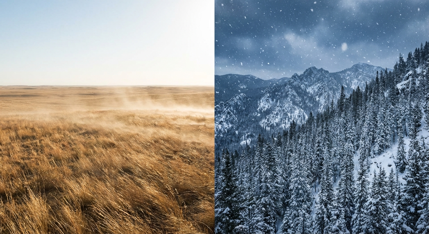
We are looking at a classic case of weather whiplash today. If you are in the Central Plains, you might be thinking winter is over. If you are in the Sierras, you are about to get buried. And if you are in the Northeast, well, you are just trying to thaw out from that brutal weekend freeze. Let's break down exactly what is happening and what you need to prepare for this week.
The Central US: Don't Be Fooled by the "False Spring"
Here is the thing. If you stepped outside in Nebraska, Kansas, or the Texas Panhandle today, it probably felt amazing. We are talking high temperatures in the 60s, 70s, and even 80s. That is nearly 40 degrees above average for early February. It feels like May out there.
But this warmth comes with a catch. The air is bone dry, the winds are howling, and we have a Critical Fire Weather Risk in place for parts of the High Plains today. With humidity dropping as low as 10-15%, any spark could spread fast. So please, be careful with anything that could start a fire. No outdoor burning today.
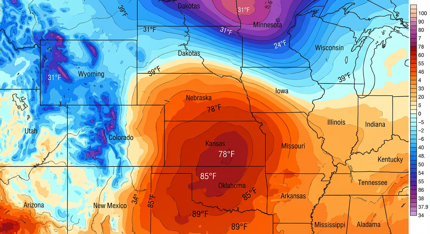
And get this... it's a trap. A cold front is already sliding down the Rockies. By tonight and tomorrow, those temps are going to crash back to reality. It is going to be a shock to the system, so don't pack away the heavy coats just yet.
California: The Snow Machine Returns
While the Plains are baking, the West Coast is getting active again. A new Pacific system is knocking on the door and it is going to push into California starting Tuesday.
This isn't just a few showers. We are looking at a solid moisture plume hitting the Sierra Nevada. The Weather Prediction Center is calling for a near-certainty of at least 8 inches of snow, with the higher peaks likely seeing 1 to 2 feet of fresh powder by Wednesday.
If you are planning to travel through the passes like Donner Summit, you need to be prepared. This is great news for the snowpack, but it is going to make travel treacherous. Lower elevations and the coast will see moderate rain, so watch out for slick roads during your commute Tuesday.
Northeast: A Quick Clipper
For my friends up in New England and the Great Lakes, we are finally shaking off that deep freeze from the weekend. But as the temperatures moderate, we have a "Clipper" system racing across the border.
This is a fast-moving system that will bring a swath of snow and wintry mix from the Upper Great Lakes today into Upstate New York and New England by Tuesday. We aren't looking at a blizzard here, generally 1 to 3 inches for most folks, but the Tug Hill Plateau could squeeze out localized amounts up to 8 inches thanks to some lake enhancement.
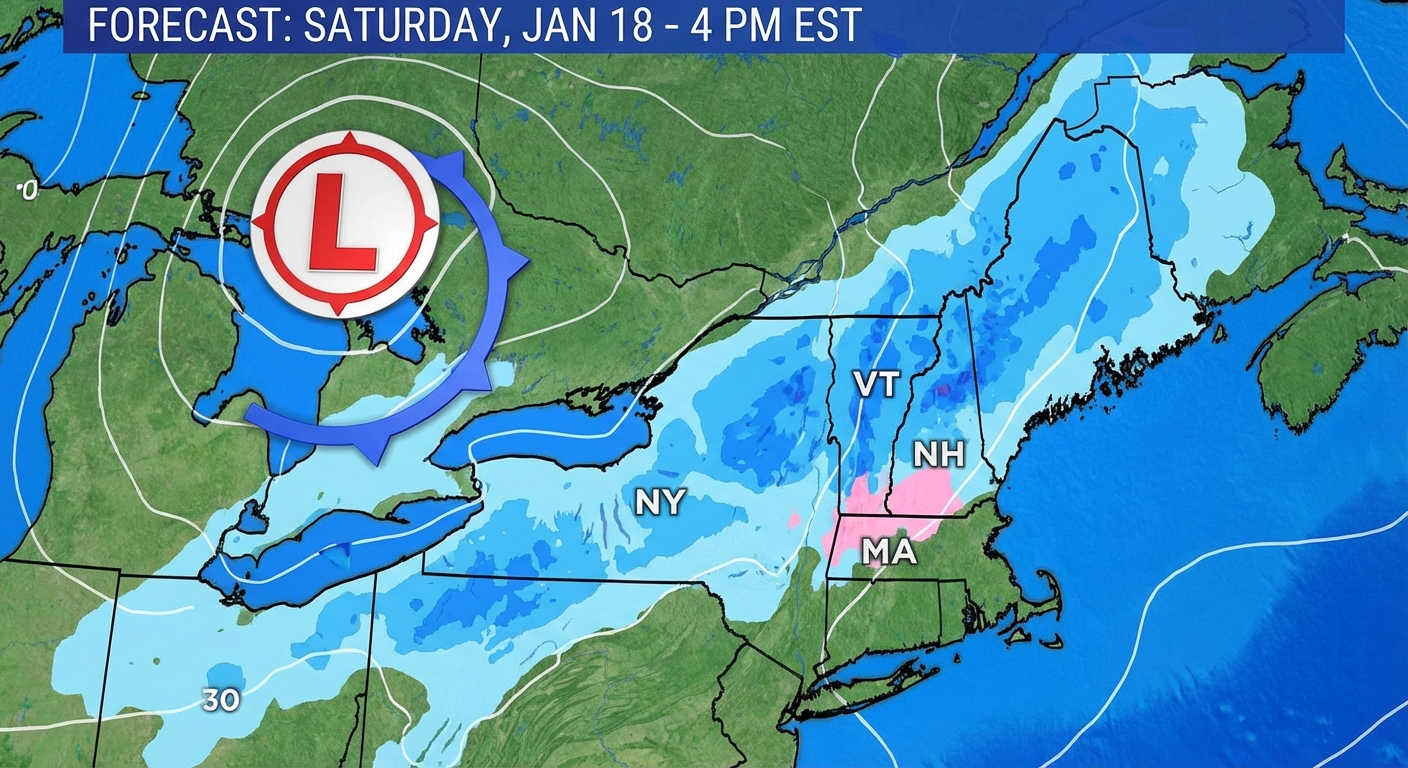
It is going to be enough to grease up the roads, so give yourself extra time getting to work or school tomorrow morning.
Bottom Line
- Central Plains: Enjoy the warmth today but be extremely careful with fire. The cold returns tomorrow.
- California: Prepare for heavy mountain snow starting Tuesday. If you don't have to drive through the mountains mid-week, don't.
- Northeast: Watch for slick spots Tuesday as light snow moves through.
- Space Weather: That solar storm we talked about is still lingering with G1 (Minor) conditions likely today.
Stay safe out there, y'all!
https://ryanhallyall.com/blog/the-false-spring-trap-californias-next-big-soak