Blog Article
Severe Storms & Flash Flood Risk: AZ to Missouri Aug 4-5
SPC Marginal severe risk hits the Carolinas and SE Arizona today, with a Slight excessive rainfall threat over burn scars. Missouri and Illinois are next.
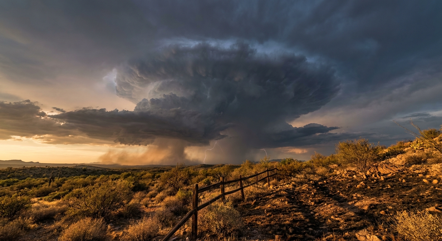
The Flood Threat Rotates: From the I-95 Corridor to the Desert Southwest and Central Plains
Alright y'all, let's talk about what happened yesterday for a second because it was a lot. New Jersey, New York, Pennsylvania, and Connecticut got hammered with training thunderstorms that dumped close to 5 inches of rain in spots like Maple Shade, NJ. We had water rescues in Hawthorne, cars stuck up to their windows in Agawam, Massachusetts, and Route 130 in New Jersey closed in both directions. That system finally pushed offshore, but it left behind a real mess along the I-95 corridor.
Today, the pattern is turning the page. The flood and severe weather threat has rotated west and south, and it's not done moving yet.
Today: A Marginal Risk from the Carolinas to the Desert
SPC has a Marginal Risk of severe thunderstorms posted in two separate spots today: the western Carolinas (Charlotte, Greenville, Columbia) and the southern Rockies into southeast Arizona (Tucson, Benson). These aren't connected systems. Think of it as two smaller stories happening under one umbrella.
In the western Carolinas, storms firing late this afternoon into evening could produce severe wind gusts. Nothing widespread, just an isolated damaging gust threat (SPC has that pegged at 5%, Level 1). If you're headed to a Wyndham Championship practice round or just mowing the lawn in the Piedmont this evening, keep half an eye on the sky.
Out in the southern Rockies and southeast Arizona, moderate instability is building today, and that's where things get more interesting.
Southeast Arizona: Monsoon With Teeth
Here's the thing about yesterday in Arizona: it wasn't a warm-up act. Tucson International Airport measured a 71 mph thunderstorm wind gust, and a personal weather station 18 miles southeast of Willcox clocked an 88 mph gust. That's not garden-variety monsoon. That's a legitimate downburst event.
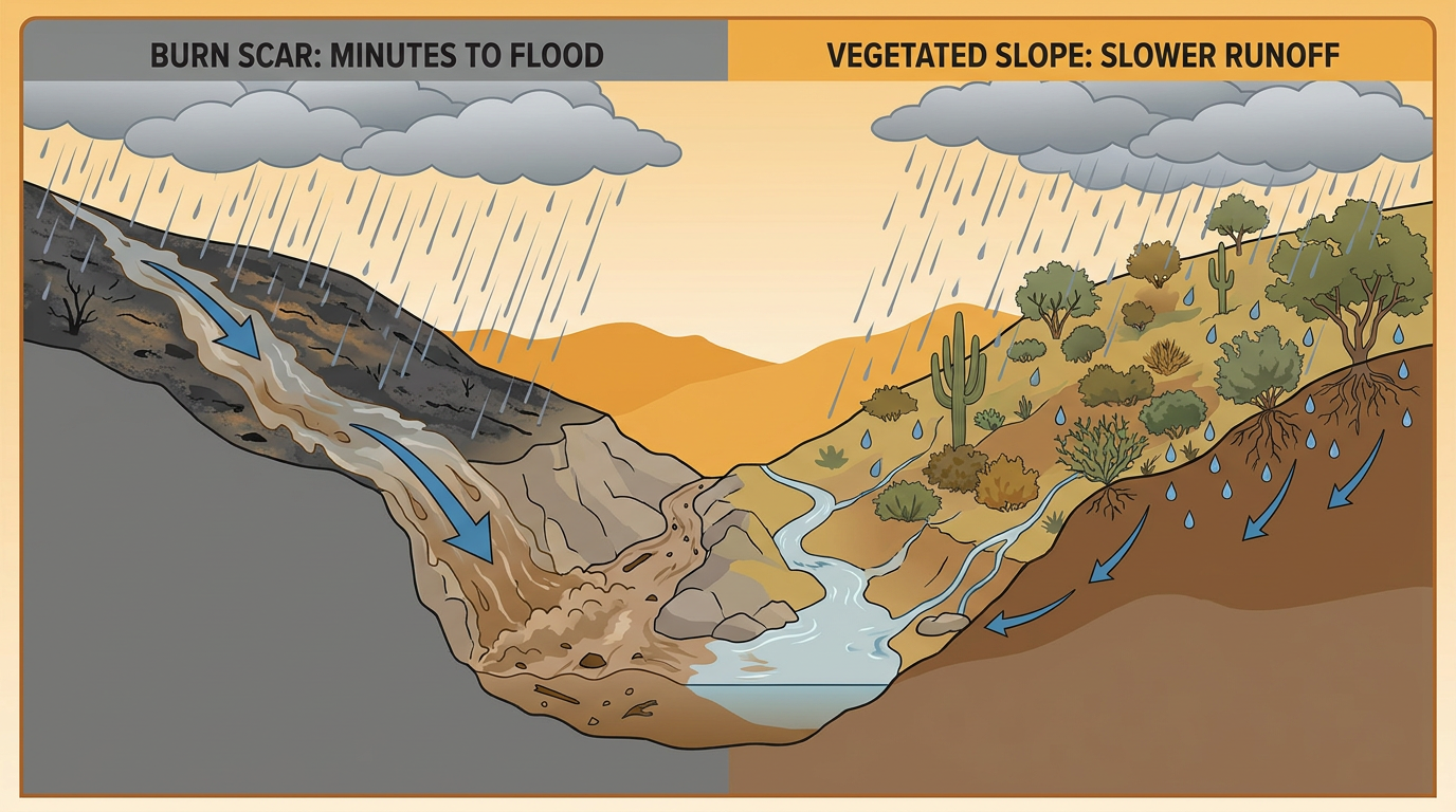
Today, WPC has a Slight Risk of excessive rainfall over southern and southeast Arizona, tucked inside a broader Marginal Risk. The setup: weak energy aloft undercutting the Southwest ridge, giving storms just enough lift to organize and dump heavy rain fast. The National Weather Service is flagging burn scars specifically, because scorched terrain sheds water almost instantly and turns a heavy downpour into a flash flood in minutes, not hours.
Same story continues for southeast Arizona on Day 2 with another Marginal severe risk layered on top, mainly hail and wind if storms fire again.
Wednesday: The Baton Passes to Missouri and Illinois
By Wednesday afternoon and evening, SPC shifts its Marginal Risk to a corridor from Missouri into central Illinois, plus a separate area from northeast New Mexico into the Oklahoma and Texas Panhandles. A shortwave trough dropping out of the Upper Midwest will run into dewpoints in the upper 60s to low 70s and around 1,500 J/kg of instability. Add 35 knots of deep layer shear and you've got the ingredients for scattered strong to severe storms, mainly clusters that congeal and produce damaging outflow winds. SPC has even penciled in a 2% isolated tornado chance for that Missouri/Illinois zone, which is worth knowing about if you're headed to Wrigley Field or a Cardinals-adjacent event in the region Wednesday evening, though the primary threat there is wind and hail, not spin-up tornadoes.
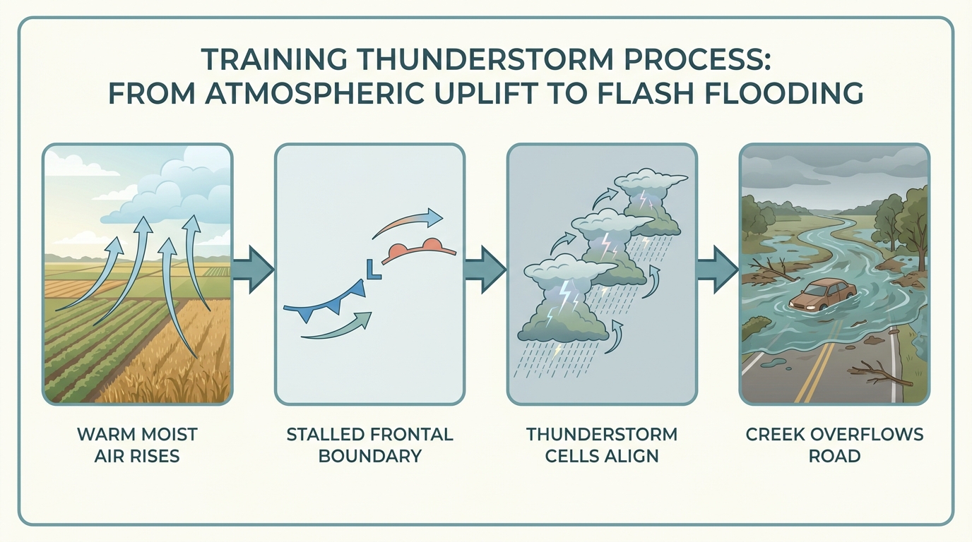
Right behind that severe threat comes a Slight Risk of excessive rainfall from the Central Plains into the middle Mississippi Valley on Day 2. WPC's concern is training convection, storms repeatedly rolling over the same corridor as a stalled front acts like a runway for thunderstorm cells. That's the same mechanism that soaked the Northeast yesterday, just relocated to a new stretch of real estate.
What We're Watching
- Southeast Arizona burn scars: fastest path to flash flooding today and tomorrow, watch for Flash Flood Warnings if storms train over the same drainages
- Missouri/central Illinois Wednesday: damaging wind gusts most likely threat, isolated tornado can't be ruled out
- OK/TX Panhandle and NE New Mexico Wednesday: upslope flow into higher terrain, hail and wind the main concerns
- Fire weather: Red Flag conditions continue across the Great Basin and interior West, unrelated to the monsoon storms but running concurrently
- The bigger pattern: a stubborn ridge is set to build over the Plains, Midwest, and South through the extended period, keeping places like Kansas City, St. Louis, Oklahoma City, and Dallas hot and increasingly humid into next week. Dallas normally sits around 97°F for early August, and confidence is growing that ridge holds those readings at or above normal through the weekend
Quick Hits
Space weather had its moment yesterday with a G1 (Minor) geomagnetic storm from lingering CME effects, peaking at Kp 5 on August 3. That's calming down today and should be quiet by tomorrow. Nothing here that affects your forecast, but aurora chasers up north got a decent show overnight.
Bottom Line
If you're in the western Carolinas or southeast Arizona today, keep the umbrella and the weather app handy this afternoon and evening. Southeast Arizona in particular needs to take the flash flood risk seriously, especially near burn scars and low-water crossings; that monsoon has already proven it can throw 70 to 88 mph gusts around. Missouri and Illinois, your turn comes Wednesday, with both a severe storm threat and a rain-flooding threat stacking on the same day. And if you're anywhere from Dallas to Kansas City to St. Louis, get ready for the heat and humidity to build back in as a ridge takes hold through the extended period. This is shaping up to be a busy midweek, not a repeat of yesterday's Northeast disaster, but a legitimate multi-region pattern worth tracking.