Blog Article
Plains Fire Weather Threat & Weekend Freeze Forecast
A strong cold front brings a weekend freeze to the East and Southeast, while critical fire weather and high winds threaten the Southern Plains today.
The Front Clears the East, But the Plains Fire Threat Burns On
Well y'all, yesterday was a textbook definition of weather whiplash. We tracked an 85 mph squall line moving through the Ohio Valley dropping tornadoes, while folks in Texas were sweating through 106-degree heat. That massive cold front is finally sweeping off the East Coast today. It is leaving a totally different map in its wake.
Red Flags in the Plains
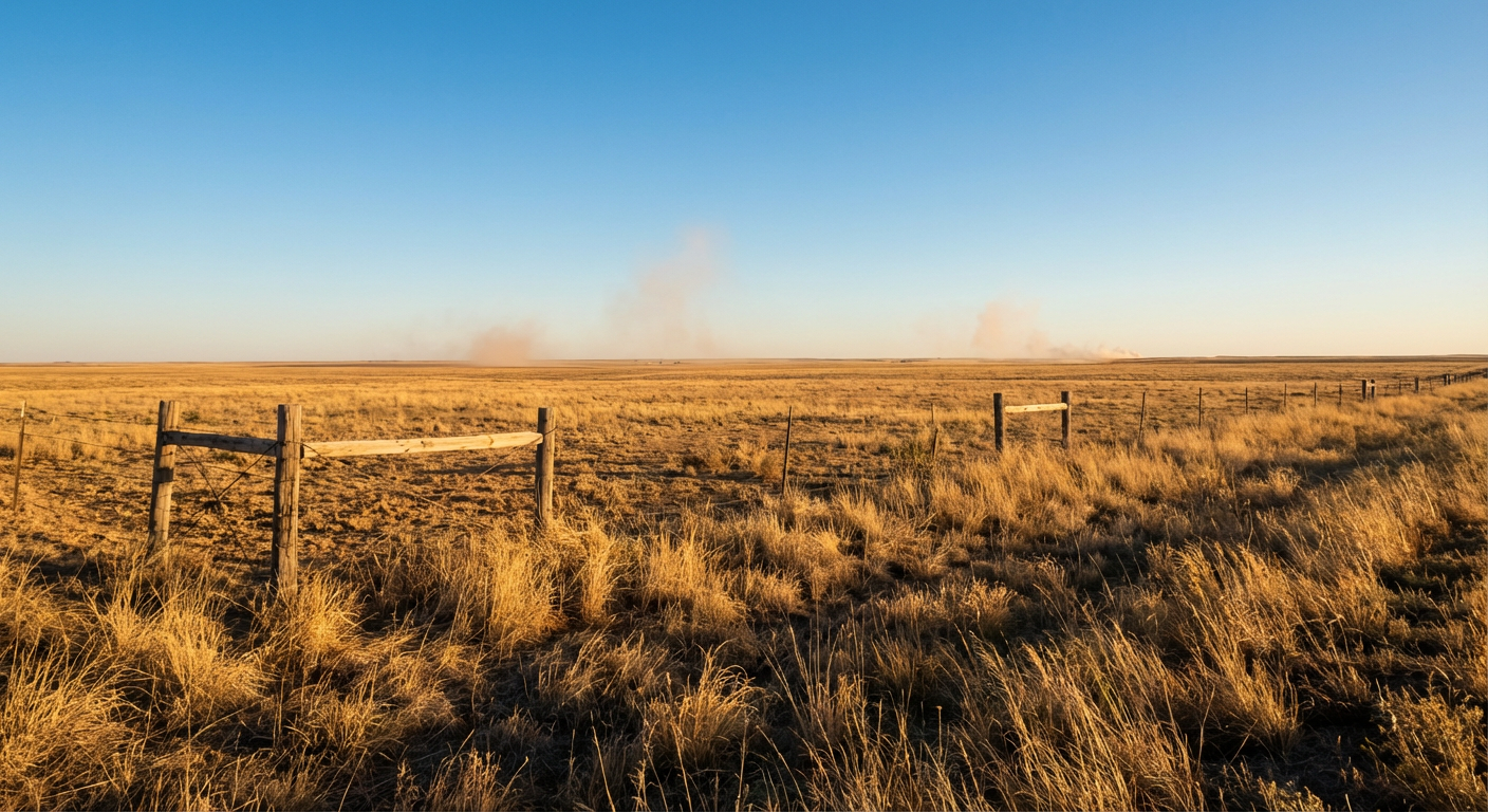
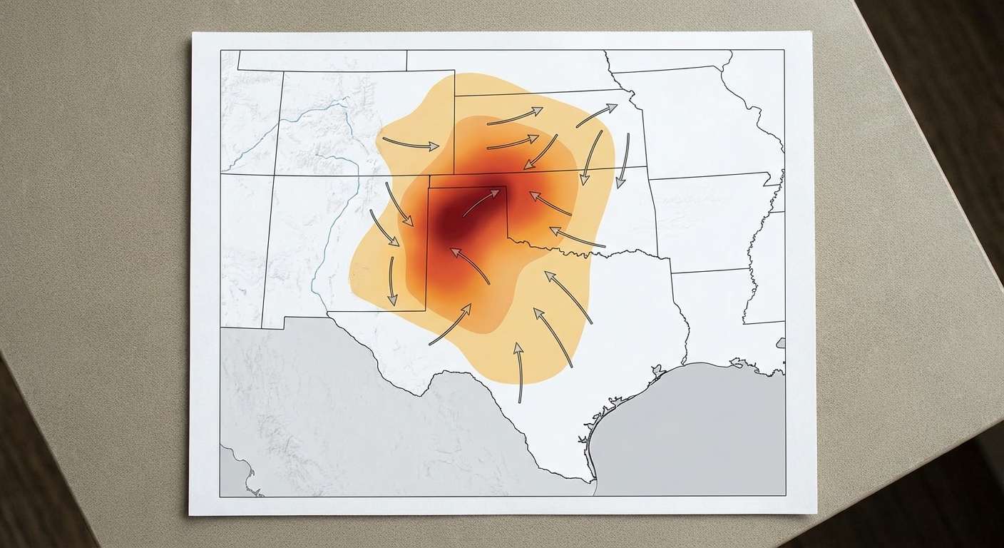
The storms are gone, but the danger in the Southern Plains is not. The Storm Prediction Center has a Critical Fire Weather outlook posted for the Texas and Oklahoma Panhandles, western Oklahoma, and south-central Kansas.
Here is the setup. That cold front pushed through, but it left behind incredibly dry air. We are talking relative humidity dropping down to the single digits. Combine that with high pressure building in and kicking up wind gusts of 35 to 45 mph, and you have a recipe for fast-moving wildfires.
If a spark catches in the dry grass out by Woodward or Amarillo today, the wind will carry it for miles. Do not burn brush today. Do not drag trailer chains. Be careful where you park your truck.
Grab a Jacket for the Weekend
For the eastern half of the country, this front is bringing a sharp dose of reality. A sprawling high pressure system is settling over the Ohio Valley and the Southeast. This is going to wipe out the humidity and clear the skies, but it is also pulling down some very chilly Canadian air.
We are looking at a widespread freeze and frost threat for Saturday morning from the Ohio Valley all the way down into the Southeast. For context, Atlanta normally sees morning lows around 43 degrees in late March. You will be waking up quite a bit colder than that this weekend.
If you are heading out to the Cherry Blossom Festival in Philadelphia on Saturday, pack a heavy coat. Philly normally tops out around 53 degrees this time of year, and the morning air will be crisp. The good news is the skies will be absolutely beautiful. It is perfect weather for hiking or outdoor sports, as long as you layer up.
A Quick Look at Next Week
Enjoy the quiet weekend while it lasts. The Storm Prediction Center is already highlighting an uptick in severe thunderstorm potential for next week.
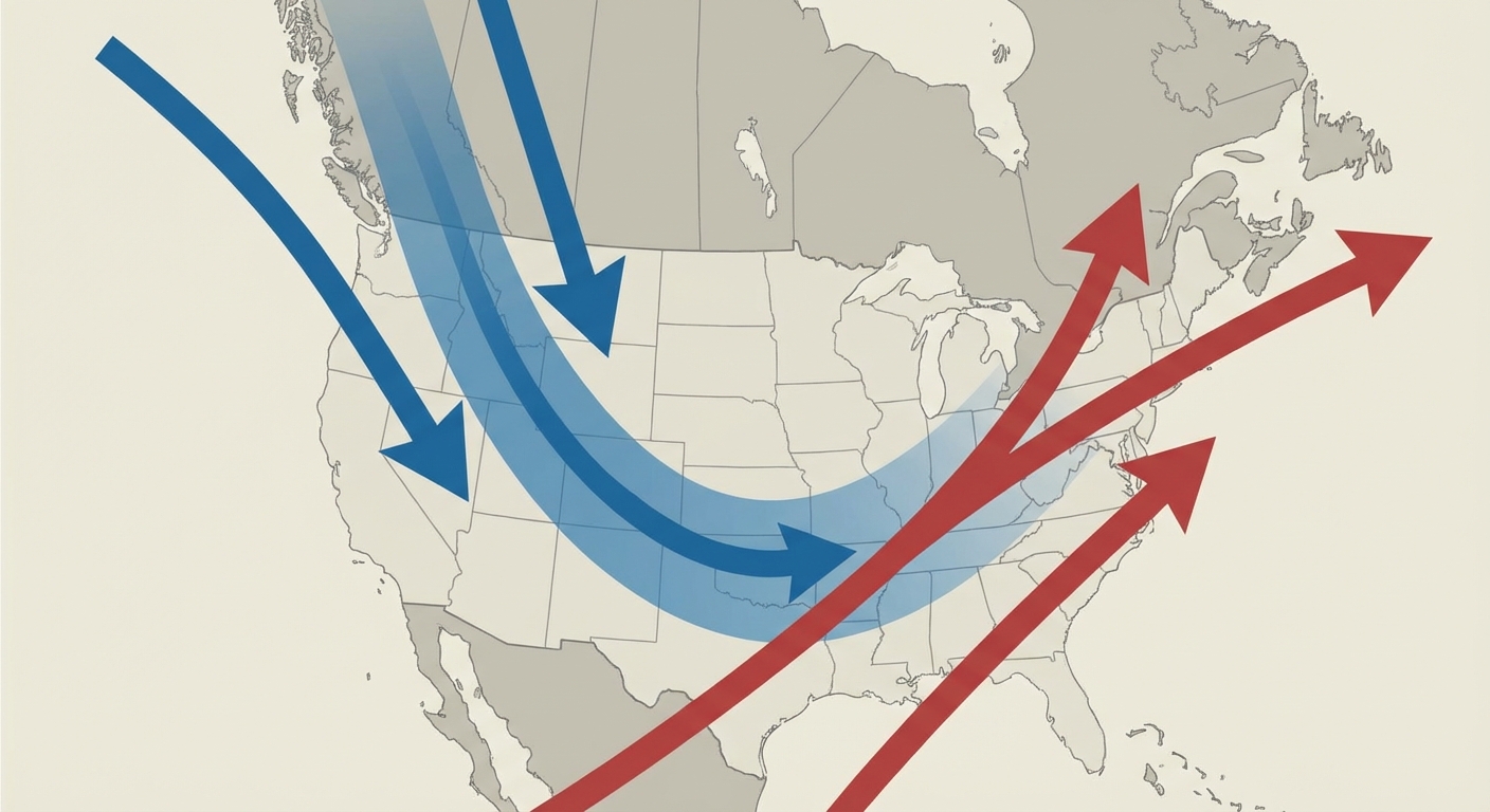
A new upper-level trough is going to dig into the western United States. That will set up a steady stream of low pressure systems coming off the Rockies. We will start to see moisture returning to the Plains, which means the severe weather machine will likely wake back up by the middle of next week.
Bottom Line: The East gets a beautiful but chilly weekend, so protect your sensitive plants and grab a coat. The Southern Plains remain in a critical fire threat today, so practice extreme fire safety. Have a great Friday, and we will talk again tomorrow.
https://ryanhallyall.com/blog/the-front-clears-the-east-but-the-plains-fire-threat-burns-on