Blog Article
Major Ice Storm Forecast: South & East Coast Impact This Weekend
A crippling ice storm targets Texas and Arkansas, while heavy snow aims for the Northeast. dangerous cold continues in the Plains. Full forecast details.
The Ice Storm Cometh: Crippling Impacts for the South & Heavy Snow for the East
Alright folks, pull up a chair and let's get down to business. If you've been following along this week, you know it has been absolutely wild. We've had historic solar storms, earthquakes, and wind chills that would make a polar bear shiver. But as we talked about yesterday, the main event for the lower 48 is knocking on the door, and the data is painting a picture that has me genuinely concerned for a few specific spots.
Here is the thing. The models have stopped waffling and started agreeing. We are looking at a high-impact, long-duration winter storm that is going to mess up travel from the Red River all the way to Boston.
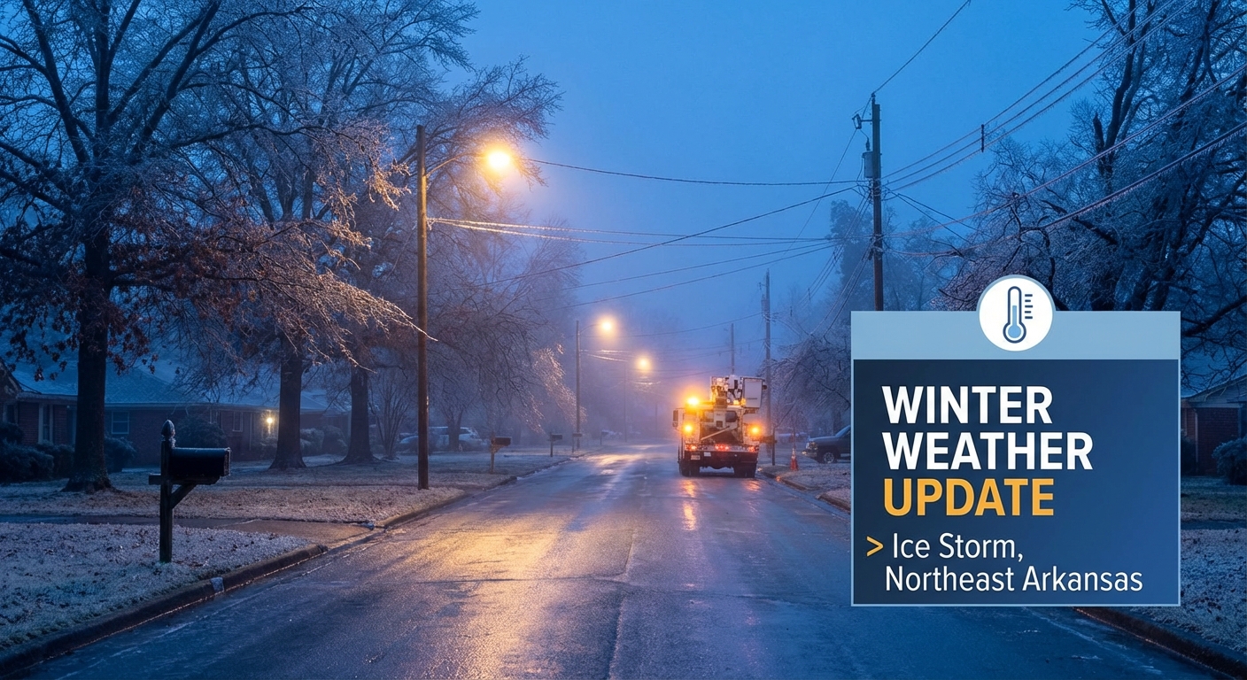
The "Crippling" Ice Threat
I don't use the word "crippling" lightly. I only use it when the folks at the Weather Prediction Center use it, and they have that wording in their discussion for Friday and Saturday.
We have a shallow, dense layer of Arctic air sinking south, and warm, moist air from the Gulf riding right over the top of it. That is the classic recipe for freezing rain.
Who needs to worry:
- Northeast Texas & Arkansas: This is the bullseye. Areas like Round Rock and the DFW Metroplex are going to see a messy transition, but from Texarkana into Central Arkansas, we could see ice accumulations over half an inch. Some spots might even get near an inch. That is enough to snap trees and bring down power lines.
- The Deep South: By Saturday, this mess spreads into northern Mississippi, northern Alabama, and Tennessee. If you are in Memphis or Nashville, you need to be ready for slick roads and power flickers.
If you have plans for the KidsLinked Children's Festival in Round Rock or you're just commuting home Friday evening, please take it slow. This ice is no joke.
The Heavy Snow Corridor
While the South deals with ice, the cold air is deep enough further north for a major snow event.
- Oklahoma & Kansas: Get those shovels ready. We are looking at a solid 6 to 12 inches of snow starting Friday night. If you are searching for "okc weather" right now, the answer is: stay home if you can.
- Ohio Valley: By Saturday, this system moves into Kentucky, Ohio, and West Virginia. We could see snowfall rates of 1 inch per hour here.
- The Northeast: This is the new development. The data is now showing this storm tracking up the coast for Sunday. This puts the I-95 corridor—DC, Philly, NYC, and Boston—in the crosshairs for potentially significant snow.
If you were planning to head to the Philly Chocolate, Wine & Whiskey Festival on Saturday, the weather might hold off until late, but getting home Sunday could be a nightmare. And for folks in Charlotte heading to the Queen City R&B Martini Festival, expect a cold, miserable rain that could end as a wintry mix Saturday night.
The Engine: Dangerous Cold
Behind all this moisture is a 1048mb high pressure dome that is pushing some seriously dangerous air south.
In the Northern Plains (Dakotas and Minnesota), we are still seeing wind chills in the -40°F to -60°F range. That is life-threatening in minutes. Even if you aren't getting snow, this cold is expanding. It's going to keep the AC off and the heaters humming all the way down to the Gulf Coast.
Sports & Weekend Outlook
For the football fans, that Patriots at Broncos game in Denver on Sunday is going to be a cold one. The snow should be winding down there by game time, but temperatures will be frigid. Bundle up.
Bottom Line
Here is what you need to do right now:
- If you are in the Ice Zone (TX, AR, MS, TN): Prepare for power outages. Charge your devices, get some non-perishable food, and know how to stay warm safely if the grid goes down.
- If you are in the Snow Zone (OK to Northeast): Travel is going to be hazardous. If you don't have to drive Saturday or Sunday, don't.
- If you are in the Northern Plains: Stay inside. Frostbite is happening fast out there.
We will keep watching the radar and let you know if anything changes. Stay safe, y'all!