Blog Article
Enhanced Storm Risk Hits DC and Baltimore on July 4th
An Enhanced Risk of damaging-wind storms targets DC and Baltimore this Fourth of July, with 75 mph gusts possible, while heat and Plains flooding round out the day.
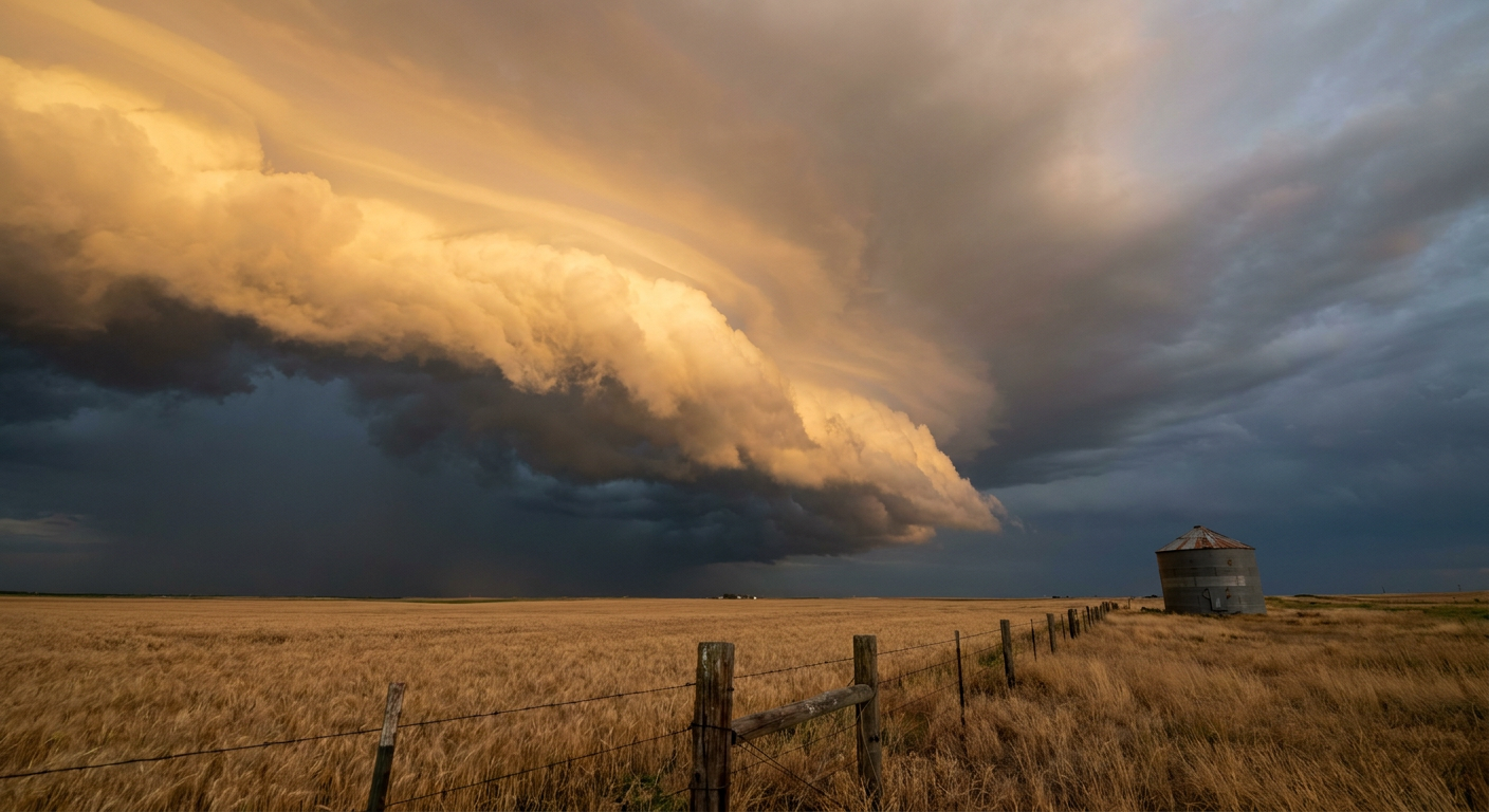
The Mid-Atlantic Gets Round Two: Enhanced Wind Risk Over DC and Baltimore as the Heat Refuses to Break
Alright y'all, yesterday we talked about how the heat was busy rewriting the guest list for America's birthday party. Well, the heat is still here, and now it brought a friend. The Storm Prediction Center has bumped the Mid-Atlantic up to an Enhanced Risk today, which is Level 3 out of 5. That's a step above the Slight Risk zones we've been chewing on all week.
And get this. That Enhanced Risk is sitting right on top of Washington, DC and Baltimore. Same corridor that just watched the National Independence Day Parade get called off over the heat. Now they've got storms to think about too.
Why the Mid-Atlantic, and why today
Here's the setup. You've had days of brutal heat baking the East Coast. That heat is fuel. When storms roll into a warm, humid air mass like that, they've got plenty of energy to work with. The SPC discussion talks about clusters of storms moving across the Allegheny Plateau into the Mid-Atlantic, and the big word in there is "widespread damaging wind."
The numbers back it up. The wind probability in the heart of this thing hits Level 4 of 5, what the SPC calls a widespread damaging wind threat, covering more than 10 million people. Inside that, there's a hatched zone where the strongest gusts could reach 75 mph or more. That's not a hypothetical. Yesterday this same general region saw a 75 mph gust measured at Wilkes-Barre Scranton Airport in Pennsylvania, and trees came down across New Jersey, eastern Pennsylvania, and up into New York.
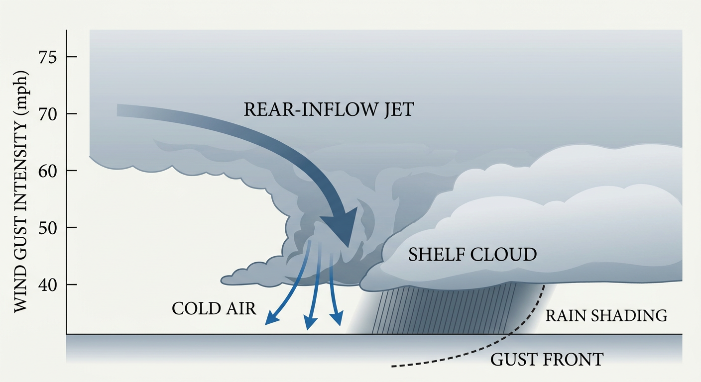
What you're looking at above is why a line of storms can turn nasty in a hurry. When a storm complex bows out, air rushing down from the middle of the atmosphere, called the rear-inflow jet, slams to the surface and spreads out. That's your damaging wind. It's the same mechanism that knocked out power to over 170,000 customers in Wayne County, Michigan yesterday.
There's also a low-end tornado threat, just 2 percent, which the SPC labels an isolated risk. Don't lose sleep over that part. Wind is the story here.
The central Plains have their own thing going
While the East Coast deals with round two, the central and southern Plains are under a Slight Risk. Denver, Tulsa, and Wichita are all inside that zone. Storms are expected to fire Saturday afternoon and evening, and the main concerns are damaging wind gusts and large hail. There's a hatched area where hail could reach 2 inches, hen-egg size.
But the Plains story has a second layer. WPC has a Slight Risk of excessive rainfall across eastern Kansas and Oklahoma. Overnight storms up on the High Plains are expected to grow into an organized complex, an MCS, that drifts southeast into the Lower Mississippi Valley this evening. Tulsa is squarely in the crosshairs for heavy rain, with the local forecast office flagging rainfall rates over an inch an hour.
If you're anywhere near the Phillies at Royals game in Kansas City tonight, or the Cardinals at Cubs in Chicago, keep one eye on the sky. Evening storms are the wildcard.
The heat is still doing heat things
Let's not forget why the Mid-Atlantic is loaded with storm fuel in the first place. The heat wave that shut down the DC parade is still parked over the South and East. AI guidance is flagging heat indices in the 105 to 110 degree range from eastern Texas to the Mid-Atlantic coast. For reference, a normal early-July high in DC is about 89 degrees. Washington already had an interstate buckle from the heat this week. This is dangerous, not just uncomfortable.
The Pirates at Nationals game in DC starts at 3:05 Eastern this afternoon, right in the teeth of both the heat and the eventual storm window. If you're headed there, hydrate early and know where you'll go if the sky turns.
What I'm watching
- Timing of the Mid-Atlantic storms. Peak heating this afternoon into evening is when the storm clusters should get their act together over DC, Baltimore, and the Delaware corridor. That lines up with fireworks and evening events.
- The 75 mph hatched zone. If cells organize into a bowing line, that's where the worst wind damage shows up. Have a way to get indoors fast.
- The Plains MCS and flooding rain. Eastern Kansas and Oklahoma, especially the Tulsa area, could see over an inch an hour tonight. Never drive into water on a road.
- Heat indices past 105. From Texas to the coast, the heat is a health threat all on its own, storms or not.
- Tomorrow's shift. The Slight Risk slides back into the Mid-Atlantic Sunday, so Philadelphia, DC, and Baltimore aren't done with this pattern yet.
Bottom line
If you're in the DC, Baltimore, or Delaware corridor, plan your Fourth around the possibility that storms roll through this afternoon and evening, and treat any that arrive seriously. Damaging wind, not rain, is the main threat, and the strongest gusts could top 75 mph. Keep your phone charged and your weather alerts on. Out on the Plains, watch for evening storms and heavy rain, and don't test flooded roads. And everywhere from Texas to the East Coast, respect the heat. Drink water, find shade, and check on the folks who don't have air conditioning.