Blog Article
Midwest Severe Weather: Level 3 Threat for Chicago & Milwaukee
A Level 3 Enhanced Risk brings 75+ mph winds and strong tornadoes to the Midwest today. See the timeline and impacts for Chicago, Milwaukee, and the East Coast.

The Midwest Reloads for Another Round of Severe Storms
Alright y'all, we need to talk about the Midwest. As we talked about yesterday, a massive line of storms pushed through the Upper Mississippi Valley and brought 94 mph winds to Wisconsin. Hundreds of thousands of folks lost power. If you are out in the yard cleaning up tree branches this morning, you need to keep a very close eye on the sky. The atmosphere is reloading.
The Storm Prediction Center has an Enhanced Risk posted for today. That is a Level 3 out of 5. The target area covers eastern Iowa, northern Illinois, southern Wisconsin, and stretches into Michigan and Indiana. Yes, that includes Chicago and Milwaukee again.
Here is the setup. We have a compact upper-level trough swinging out of the Plains. Ahead of it, a strong low-level jet is pumping a ton of warm, juicy air right into the Midwest. An average June day in Chicago tops out around 80 degrees. Today, that warm sector is going to feel a whole lot heavier and more humid than normal.
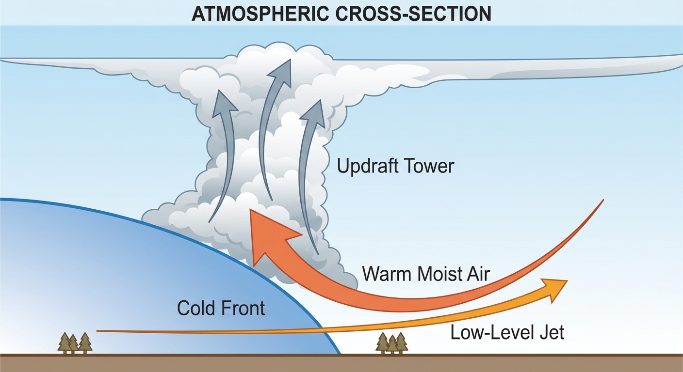
Today's Main Hazards
The data shows a very serious wind threat. We have a 45 percent probability for damaging winds, and there is a hatched area meaning gusts could exceed 75 mph. But that is not the only problem. We also have a 10 percent hatched risk for tornadoes. That hatched label means if a tornado forms, it could reach EF2 intensity or stronger.
- Damaging Winds: 75+ mph gusts can easily take down weakened trees and power lines from yesterday.
- Tornadoes: A few strong tornadoes are possible, especially in Iowa and northern Illinois before the storms merge into a line.
- Large Hail: We are looking at a 15 percent hatched risk for hail up to 2 inches across. That is hen-egg size.
- Flash Flooding: The Weather Prediction Center has a Slight Risk for excessive rainfall. The ground is already saturated from previous storms.
If you are heading to the South Side tonight to watch the Braves play the White Sox, you need a backup plan. Have your radar app open and know where the stadium concourse shelters are located.
The Threat Shifts East on Friday
By tomorrow, this whole system pushes east. The cold front is going to march into a hot, moist environment along the Eastern Seaboard.
The SPC has already outlined a Slight Risk, which is a Level 2 out of 5, from western New England down through the Mid-Atlantic. We are talking about places like New York City, Philadelphia, Baltimore, and Washington DC. The primary hazard tomorrow is going to be damaging wind gusts from outflow-driven storm clusters. If you are planning to catch the Mariners at the Nationals on Friday night, be ready for potential rain delays and gusty winds.
Bottom Line
The Midwest is having a very rough week. Do not let your guard down just because you made it through yesterday. Have multiple ways to receive warnings today that will wake you up if you are asleep. Charge your devices right now. If you live in a mobile home in the Enhanced Risk area, figure out exactly where you will go if a tornado warning is issued.
https://ryanhallyall.com/blog/the-midwest-reloads-for-another-round-of-severe-storms