Blog Article
Plains Severe Weather Forecast: Hail and Wind Threat Continues
A persistent severe weather pattern brings 2-inch hail and 60+ mph winds to the Northern Plains today, with a 75 mph wind threat shifting to the Midwest Friday.
The Plains Severe Weather Setup is Stuck on Repeat
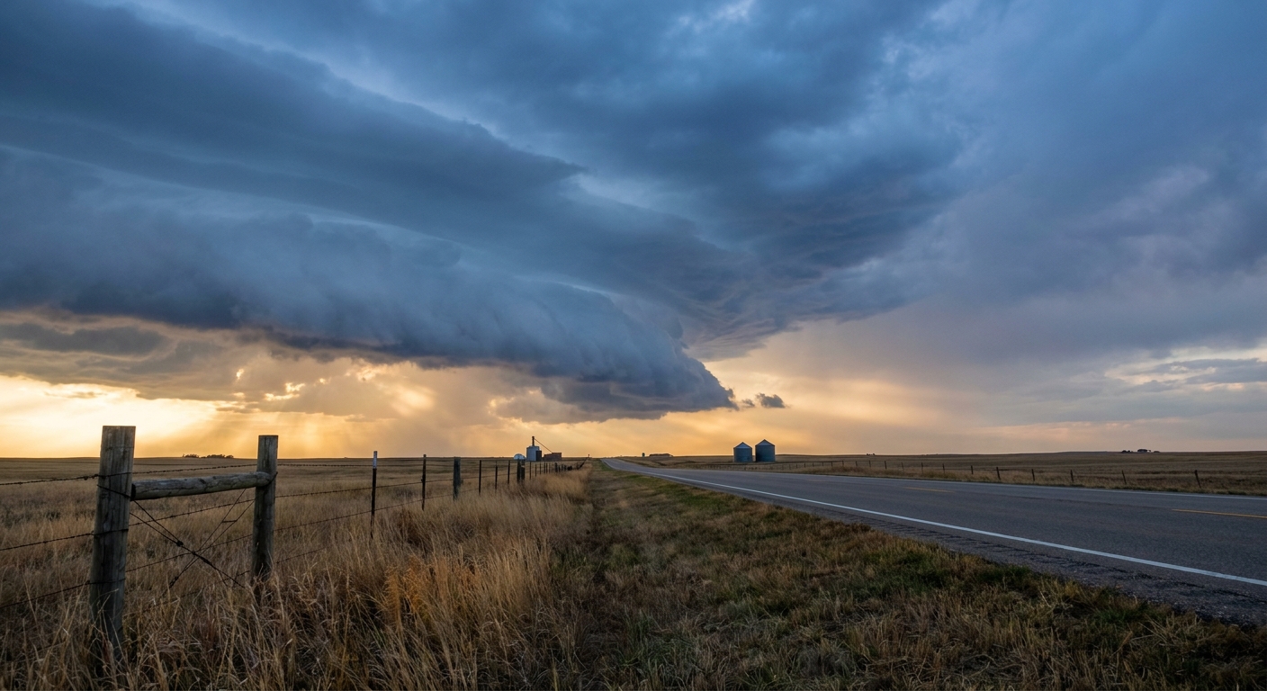
Y'all saw what happened yesterday. We had an 84 mph wind gust tear through Frederick, South Dakota. We had flash flooding wash out roads in Texas and New Mexico. The atmosphere is stuck on repeat right now, and we are looking at another busy couple of days across the middle of the country.
The Storm Prediction Center has a Slight Risk posted today for parts of the Northern Plains, including Rapid City, Aberdeen, and northern Nebraska. The setup is a classic two-part threat.
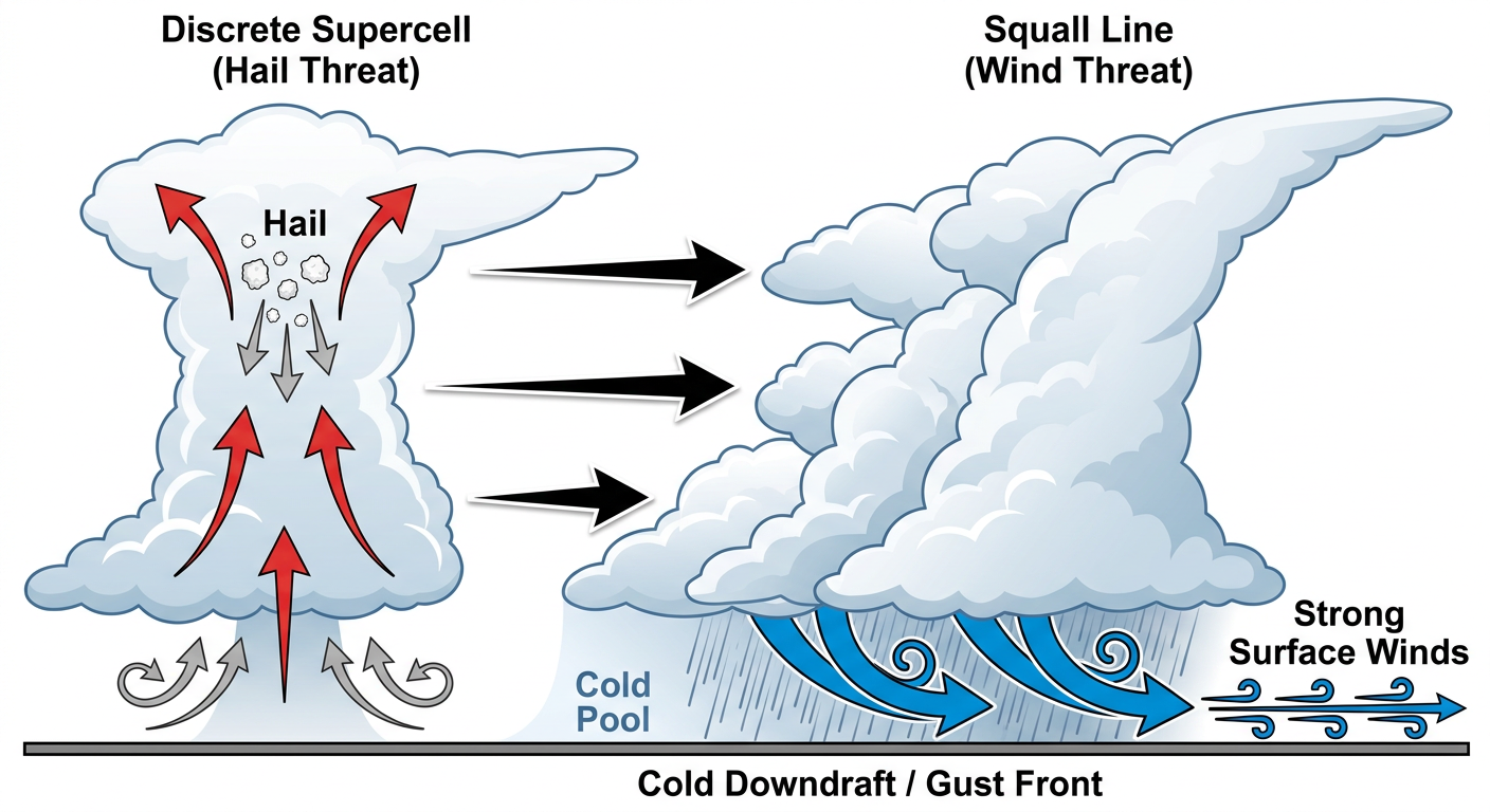
First, we will see individual storms fire off this afternoon. The air ahead of this system is juicy and highly unstable. These initial discrete cells will have plenty of energy to produce large hail. The SPC has a specific hatched area highlighting the risk for hailstones up to 2 inches across. That is hen-egg size. If you live in this zone, you want to make sure your cars are parked under a roof before you sit down for dinner.
The Nighttime Wind and Rain Threat
After the sun goes down, those individual storms are going to congeal into a line. That is when the threat shifts from hail to damaging wind. We could easily see gusts over 60 mph as this complex rolls east.
On top of the wind, the Weather Prediction Center has a Slight Risk for excessive rainfall across the Northern and Southern Plains today. These storms might train, meaning they move over the exact same areas back to back. The ground in a lot of these spots is already soaked from yesterday. It will not take much extra water to cause flash flooding. If you are driving tonight and see water over the road, turn around.
Friday Shifts East
On Friday, this whole setup slides east into the Mid-Missouri Valley and Upper Midwest. Places like Omaha, Des Moines, and Rochester are in a Slight Risk for tomorrow.
The wind threat actually goes up a notch on Friday. The SPC has a hatched area for wind, meaning we could see significant gusts of 75 mph or higher. That is enough wind to bring down large trees and cause power outages. We are also keeping an eye on a continued heavy rain threat for eastern Nebraska and western Iowa, where storms could stall out and dump several inches of water.
Smooth Sailing Out East
It is not all bad news today. High pressure is sitting pretty over the eastern half of the country, bringing some truly pristine weather to the East Coast. If you have tickets to see the Guardians play the Yankees in the Bronx tonight, or the Orioles up in Boston, you are going to have absolutely perfect baseball weather. You can expect clear skies, comfortable humidity, and zero delays.
Bottom Line
- Today: Have your cars parked in the garage if you live in the Dakotas or northern Nebraska. Hen-egg-sized hail is possible this afternoon.
- Tonight: Have a way to get warnings that will wake you up. The wind and flash flood threats will peak after dark.
- Friday: Folks in Iowa, Minnesota, and Wisconsin need to prepare for a significant damaging wind threat by tomorrow evening.
https://ryanhallyall.com/blog/the-plains-severe-weather-setup-is-stuck-on-repeat