Blog Article
Fire Weather in LA, Squall Line in the Mid-Atlantic: Friday Forecast
Critical fire weather threatens LA during the NLCS while a strong squall line targets Mid-Atlantic outdoor events Friday. Here's what both mean for you.
The Same Week Dodgers Fans Fought the Wind and Jersey Poetry Lovers Watched the Sky
Alright folks, two things are trending today that have nothing to do with each other on the surface. Everybody's talking about the Azusa brush fire chewing toward homes, and everybody's got the Brewers-Dodgers NLCS game circled on their calendar. Get this, though. Those two stories are connected by the same weather pattern, and it's worth understanding before you plan your weekend.
When the Dodgers Take the Field, the Santa Anas Take Over
The Storm Prediction Center has a Critical fire weather area stamped right over western L.A. County and southeastern Ventura County today, and it holds again tomorrow. That zone covers Oxnard, Santa Clarita, Thousand Oaks, Simi Valley, and Camarillo, roughly 2.4 million people living under a dry offshore wind pattern.
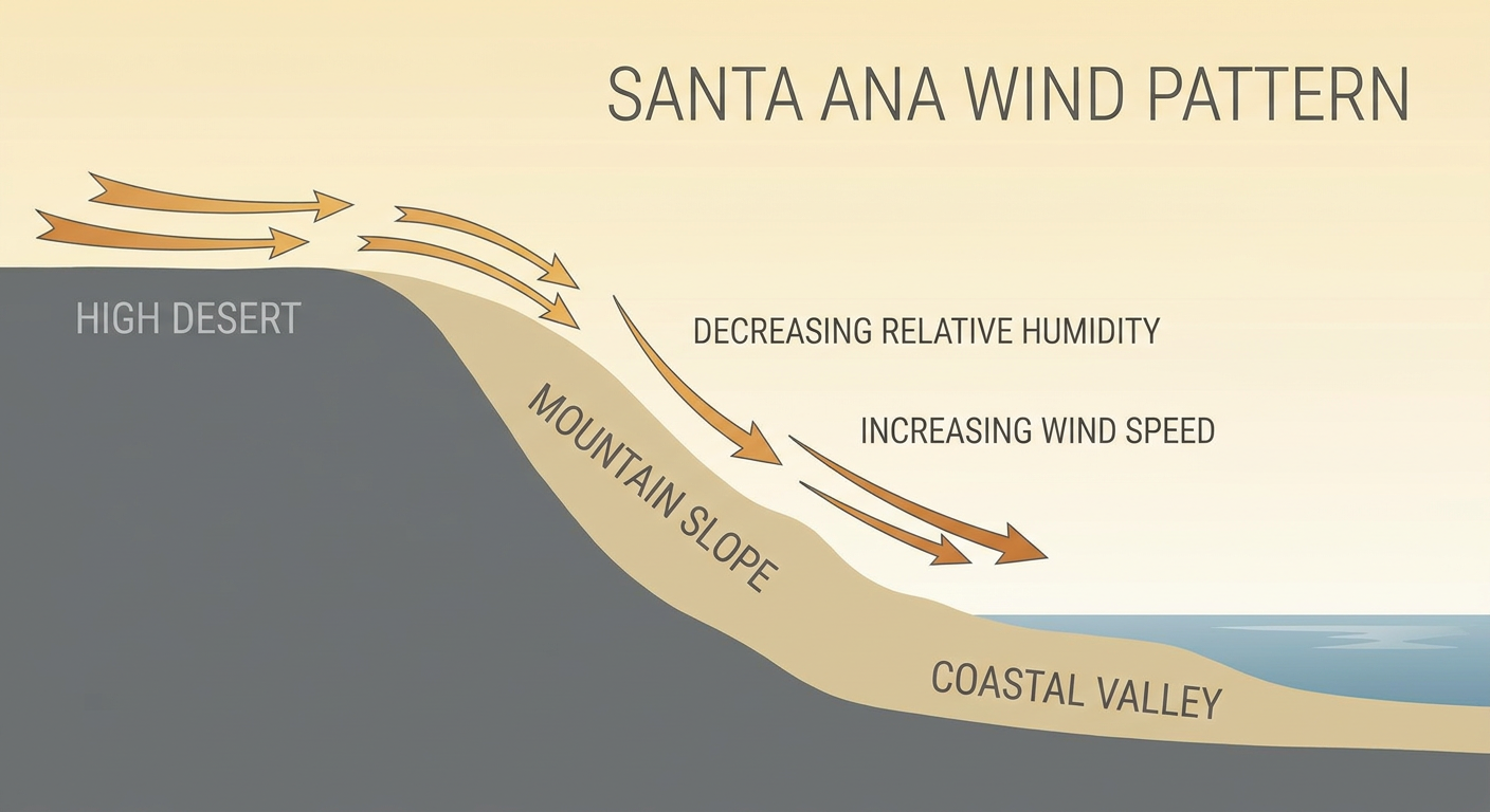
Here's the setup. A mid and upper-level low sitting off the Baja Peninsula, paired with high pressure building into the central U.S., is squeezing out a classic Santa Ana regime. Winds blow from the desert toward the coast instead of the usual onshore flow, and that air dries out fast as it sinks down the mountain slopes. SPC is clocking sustained 20 to 30 mph winds with gusts up to 50 mph across those same hills through Friday. Combine that with low relative humidity and cured fuels from a dry fall, and you've got exactly the ingredients that turned a brush fire near Azusa into evacuation orders this week.
Now, Dodger Stadium itself sits outside that critical zone, so Game 2 of the NLCS isn't getting rained out or smoked out tonight. But the same wind pattern that's making outfielders squint into gusty air over Chavez Ravine is the reason crews are stretched thin fighting fire a few canyons over. If you've got people heading to the game or driving through the foothill communities this weekend, that's the honest trade-off: beautiful, bone-dry October air for baseball, paired with real fire danger just up the road.
Friday's Squall Line Has Its Own Guest List to Crash
Meanwhile, three time zones east, a different kind of trouble is lining up. SPC has a Slight Risk of severe storms stretched from western Pennsylvania and New York down through the Mid-Atlantic and into southern New England for Friday, with a Marginal Risk bracketing that corridor. We're talking about roughly 41.7 million people under that Slight Risk alone, covering New York City, Philadelphia, Washington, Baltimore, and Newark.
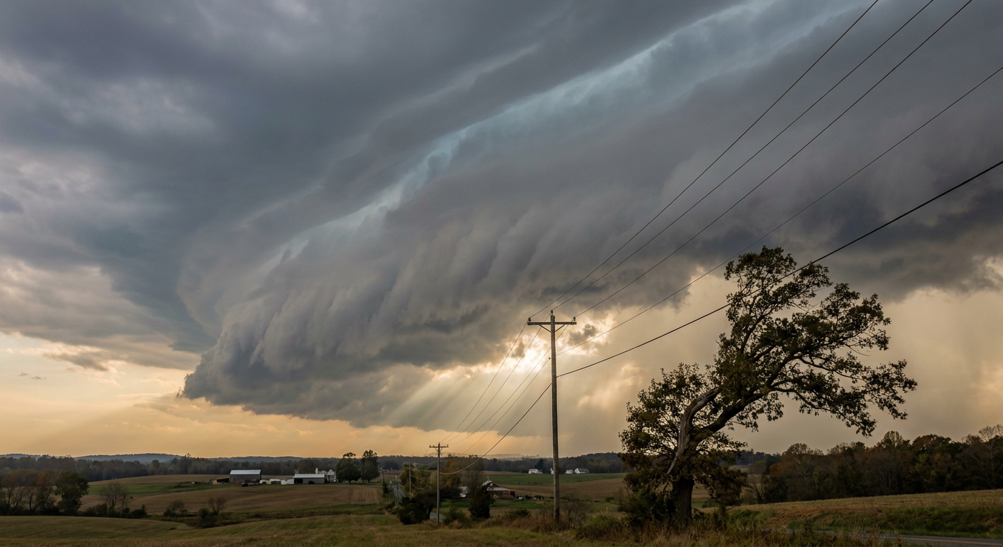
The mechanism here is a strongly forced squall line, the kind that doesn't need a ton of instability to do damage because the dynamics are doing the heavy lifting. A positively tilted upper trough is digging in and racing toward the coast, dragging a surface low and a cold front with it. SPC's own forecast puts frequent 35 to 55 knot gusts inside that line, with locally severe gusts of 60 mph or better possible, plus a brief embedded tornado risk riding along for the ride.
Our analog database flagged something useful here too. Halloween 2019 gets cited as a credible setup match. That event brought a high-shear, strongly forced squall line through the Mid-Atlantic, including an EF2 tornado in southeastern Pennsylvania, confirmed by the damage survey. The comparison isn't exact, the forecasters are careful to say the similarity is dynamical, not a carbon copy. But the shared DNA, strong forcing, limited instability, damaging gusts leading with a secondary tornado threat, means it's a fair comparison for what Friday could look like.
So who's actually standing in the crosshairs? The Dodge Poetry Festival runs its Friday single-day session in Newark, New Jersey, right in that Slight Risk zone. Parking for MJ The Musical in New York and for the Donna Summer Musical in Columbia, Maryland, both sit under the same outlook. BRIC JazzFest in Brooklyn kicks off Friday too. None of these events need to cancel outright, but anybody heading outside for them should watch the timing. SPC expects the line to fire in western Pennsylvania and New York during the late morning or early afternoon, then push through the Mid-Atlantic during the afternoon and into the evening hours. If your Friday night plans involve standing in a parking lot or an open-air venue, build in a plan B for a fast-moving line of wind and rain.
A Quick Word From South of the Border
If you've got a trip to Puerto Vallarta on the books, keep an eye on Hurricane Trudy. It's sitting as a Category 1 hurricane off the southern Mexican coast as of this afternoon, with a Hurricane Watch now up for Manzanillo and forecasters calling for rapid intensification, potentially reaching Category 4 strength near the coast by Saturday morning. The official track keeps the center offshore, but tropical storm conditions are a real possibility for a stretch of the Mexican Pacific coast this weekend. Not a U.S. story, but plenty of American travelers have flights booked down there this time of year.
The Takeaway
Whether it's dry Santa Ana wind feeding fire danger around a baseball stadium or a fast squall line timing itself to crash a poetry festival parking lot, the lesson's the same this week. October weather doesn't check anybody's event calendar. Check the forecast for your specific hour, not just your city, before you head out Friday.