Blog Article
Severe Weather Shifts North: Hail Threat For The Dakotas
A Slight Risk of severe weather targets the Northern Plains today with large hail and damaging winds, while West Texas faces a multi-day flash flood threat.

The Severe Threat Shifts North: Tracking Hail And Wind In The Dakotas
Y'all, yesterday was a mess. We saw an 82-mph wind gust at the Kansas City airport and widespread power outages down in Alabama. That same storm energy is still kicking, but the main severe weather threat is shifting north today.
The Northern Plains Setup
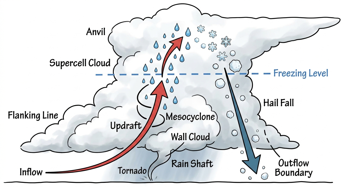
The Storm Prediction Center has a Slight Risk posted for parts of the Northern Plains today, specifically the Dakotas. We are looking at a setup where isolated supercells could fire up this afternoon and eventually merge into a larger line of storms by tonight.
The main things to watch are damaging wind gusts and large hail. And get this, there is a hatched area for hail today and tomorrow. That means if a storm gets going, we could see hailstones two inches in diameter. That is hen-egg size, folks. That will dent your truck and ruin a roof. There is also a 5 percent chance for a few tornadoes today in the Dakotas.
Tomorrow, this system slides east. The Slight Risk covers eastern North Dakota right into western Minnesota. Minneapolis usually sits around 79 degrees for a high this time of year. But the warm, juicy air pulling into this system will keep things feeling a whole lot hotter and more humid, providing plenty of fuel for these storms. If you are heading to Target Field to watch the Twins play the White Sox tonight or tomorrow, you need to keep a close eye on the radar.
West Texas Soaking
Down south, we have a different problem. The Weather Prediction Center has a Slight Risk for excessive rainfall over West Texas and eastern New Mexico today and tomorrow. The moisture is pooling up, and slow-moving storms could dump a lot of water in a short amount of time.
Flash flooding is a real concern here, especially over burn scars or steep terrain. If you commute on I-20 or I-10 out west, do not drive through flooded roads. It only takes a few inches of moving water to float a car.
A Quick Peek At The Tropics
The Pacific is starting to wake up. We have an area of low pressure well southwest of the Baja California Peninsula. The National Hurricane Center gives it a 70 percent chance of becoming a tropical depression in the next two days. It is moving west and away from land, so it is not a threat to the US. But it is a good reminder that hurricane season is officially here.
Key Factors We Are Watching
- Upscale storm growth: Initial discrete supercells in the Dakotas are expected to grow into a larger, wind-producing storm complex tonight.
- Significant hail: The hatched risk means 2-inch hail is possible in the strongest storms across the Northern Plains today and tomorrow.
- Flash flooding: A multi-day heavy rain threat sits over West Texas and eastern New Mexico.
Bottom Line
If you live in the Dakotas or western Minnesota, have your severe weather alerts turned on loud enough to wake you up tonight. For our friends in West Texas, watch out for high water on the roads. Have a plan, and know where your safe room is.
https://ryanhallyall.com/blog/the-severe-threat-shifts-north-tracking-hail-and-wind-in-the-dakotas