Blog Article
Gulf Coast Flooding Threat Continues, Ohio Valley Next
The Deep South faces more heavy rain after catastrophic flooding, while West Texas braces for two-inch hail and the Ohio Valley prepares for flash floods.
The South Can't Catch a Break, Plus a New Threat for the Ohio Valley
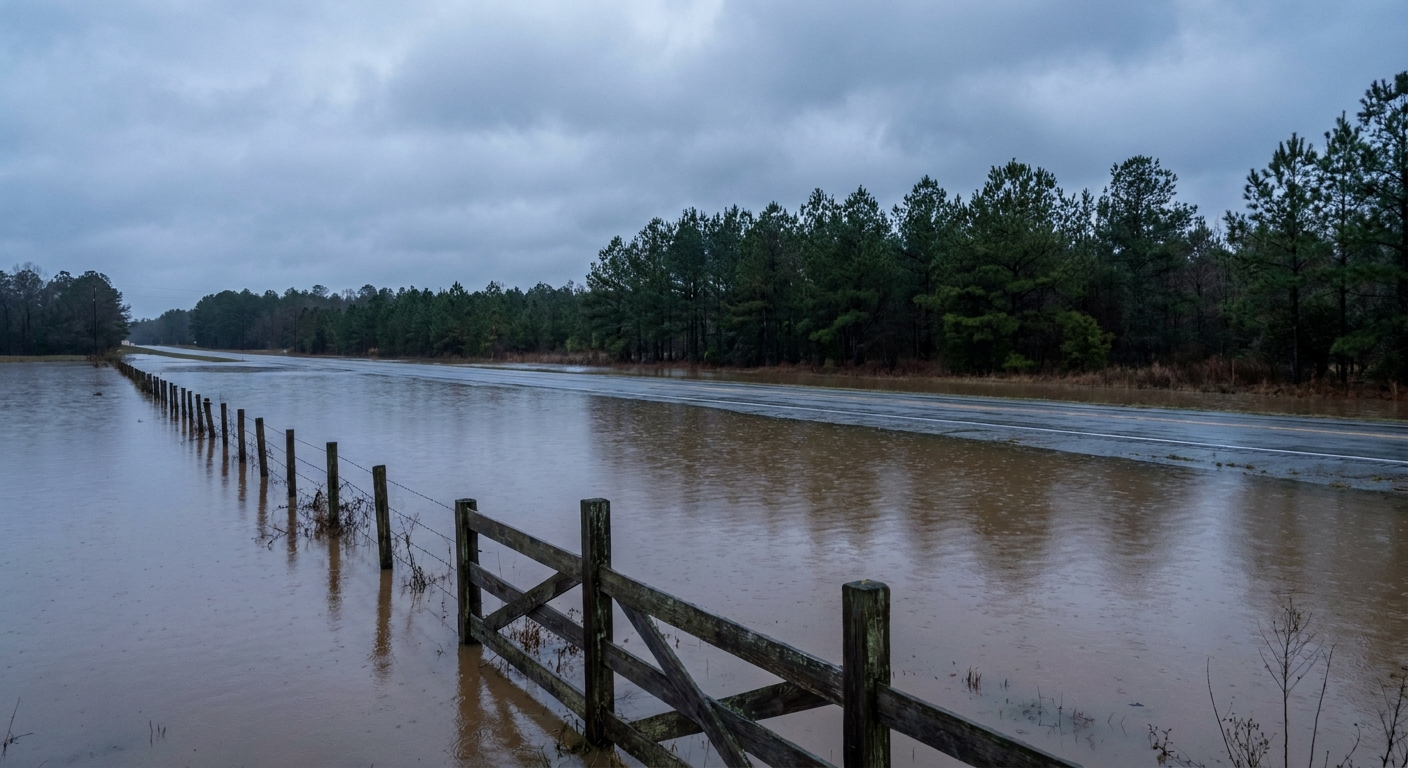
Y'all, yesterday was a heavy one. We watched a catastrophic flash flood situation unfold across southern Mississippi, and my heart goes out to the folks in Petal and Hattiesburg. The ground down there cannot take another drop of water. But the atmosphere is not done with the Deep South just yet.
As we talked about yesterday, we have a very active pattern stuck over the southern half of the country. The severe weather and the heavy rain are both reloading today and tomorrow.
The Rain Just Keeps Coming
The Weather Prediction Center has a Slight Risk for excessive rainfall today right over the central Gulf Coast and back into central and west Texas. Tomorrow, that heavy rain threat shifts into eastern Texas and the Lower Mississippi Valley.
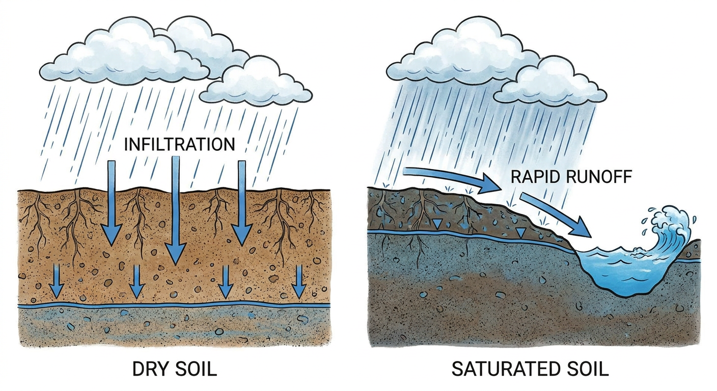
We are looking at the potential for training thunderstorms. That happens when storms line up and move over the exact same areas like train cars on a track. When you drop three to five inches of rain on soils that are already completely saturated, the water has nowhere to go but up. If you live anywhere near the I-10 corridor from Houston over to Mobile, you need to be on high alert for rapidly rising water today and tomorrow.
West Texas Hail and Mid-Atlantic Winds
The severe weather setup in West Texas is still very much in play for today. The Storm Prediction Center has a Level 2 Slight Risk posted for places like Midland, Odessa, and San Angelo. Forcing from an upper-level system will arrive this afternoon and fire off scattered severe storms.
The main hazard out west is large hail. We have a hatched area where hailstones could reach two inches across. That is hen-egg size, and it will absolutely dent your car. There is also a 5 percent chance for a tornado out there this afternoon.
By Wednesday, the severe focus shifts east. A trough is going to swing through the Great Lakes and push into the Mid-Atlantic. That brings a Level 1 Marginal Risk for damaging wind gusts to Virginia, Maryland, and northeast North Carolina for your Wednesday afternoon commute.
Ohio Valley Joins the Flood Watch
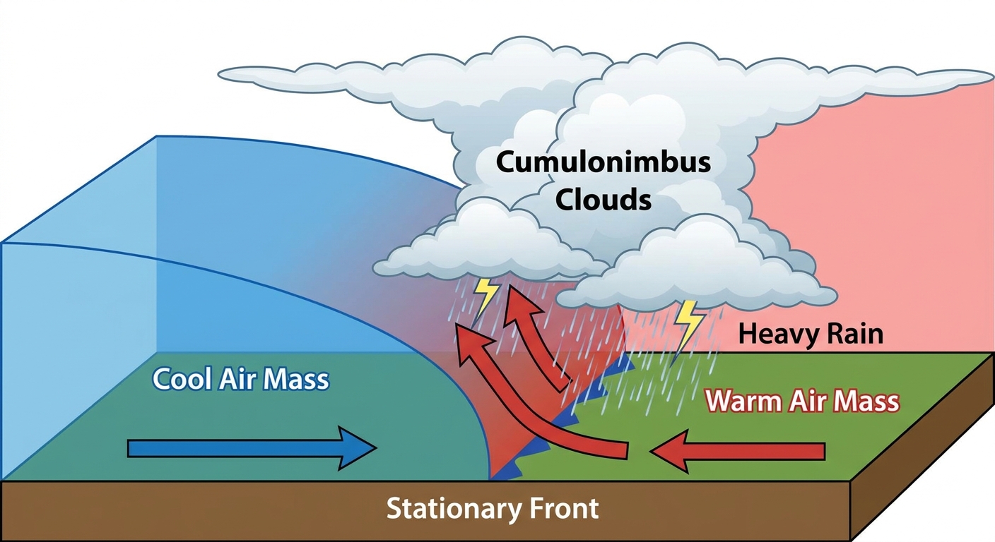
Here is the other big piece of the puzzle for Wednesday. A stalled out front is going to drape itself across the Ohio Valley and Central Appalachians. Deep tropical moisture is going to pool right along that boundary.
The WPC has highlighted a Slight Risk for excessive rainfall stretching through Indiana, Ohio, and West Virginia for Wednesday. If you have tickets to see the Nationals play the Guardians up in Cleveland tomorrow evening, you might want to pack a poncho and prepare for delays. The rain up there could be heavy enough to cause localized flash flooding, especially in the steeper terrain of the Appalachians where water runs off fast.
Key Things I'm Watching
- Gulf Coast saturation: Any new rain in southern Mississippi or Alabama will cause immediate flooding issues.
- Permian Basin hail: That 15 percent hatched area for two-inch hail in West Texas is a serious threat to property this afternoon.
- Appalachian runoff: The flash flood potential in the complex terrain of West Virginia tomorrow requires close monitoring.
Bottom Line: We have a lot of water falling on places that do not need it. Do not drive your car through flooded roadways. It sounds simple, but the vast majority of flood tragedies happen in vehicles. If you live in West Texas, park under a sturdy roof today. Have a way to get warnings that will wake you up, especially if you live near a creek or bayou down south.
https://ryanhallyall.com/blog/the-south-cant-catch-a-break-plus-a-new-threat-for-the-ohio-valley